
CAT | Regions
7
Nikolai Bugrov’s Summer Dacha in Volodarsk
No comments · Posted by Sergei Rzhevsky in Architecture, Regions, Travel
Volodarsk is a small town with a population of about 10 thousand people located in Nizhegorodskaya Oblast, about 60 km west of Nizhny Novgorod. In most cases, the main tourist attraction of small Russian towns is the local museum of local lore and Volodarsk is no exception.
However, the museum in Volodarsk occupies a unique wooden building known as “Nikolai Bugrov’s Summer Dacha” – one of the few surviving houses of similar architecture in the European part of Russia. Photos by: Anna Sukhareva and Yaroslav Gunin.


Tags: Nizhegorodskaya oblast · Nizhny Novgorod city · Russian Empire
8
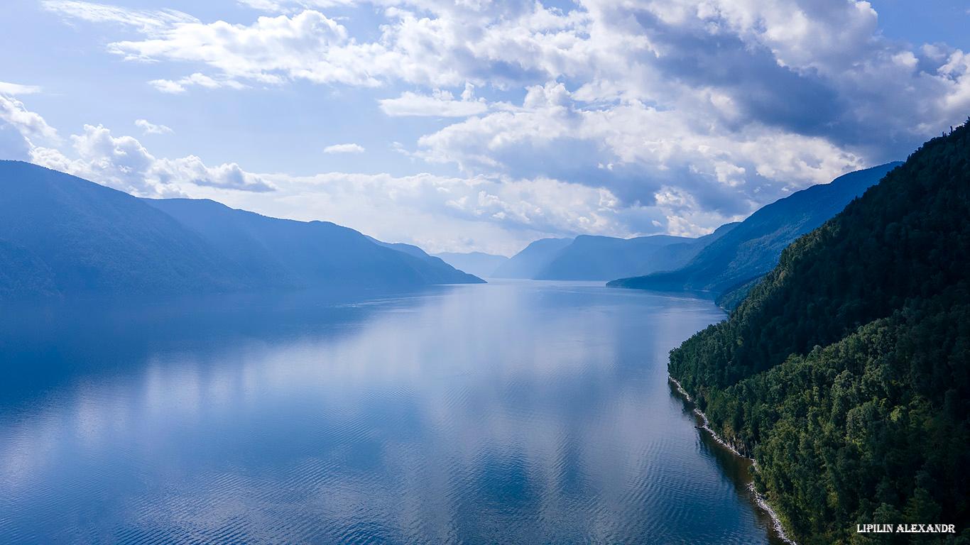
Lake Teletskoye – one of the natural symbols of Russia
No comments · Posted by Sergei Rzhevsky in Nature, Regions, Travel
Lake Teletskoye is a picturesque natural body of water located in the north-east of the Altai Mountains on the territory of the Altai Republic, about 120 km in a straight line from the regional capital Gorno-Altaysk.
One of the most popular natural attractions of Altai, it is included in the UNESCO World Cultural and Natural Heritage List as part of the complex “The Golden Mountains of Altai”. Lake Teletskoye on Google Maps. Photos by: Alexandr Lipilin.
Tags: Altay Republic · Gorno-Altaisk city
27
Gamsutl – a ghost village in the mountains of Dagestan
1 Comment · Posted by Sergei Rzhevsky in History, Regions, Travel
Gamsutl is an abandoned village located at an altitude of about 1.5 thousand meters above sea level in the southern mountainous part of the Republic of Dagestan in the North Caucasus.
Translated from the Avar language, the word “gamsutl” means “at the foot of the khan’s fortress.” It is likely that the khan, the founder of Gamsutl, lived on the top of the mountain, and his troops were stationed on its slopes. The approximate age of the village is 2 thousand years.
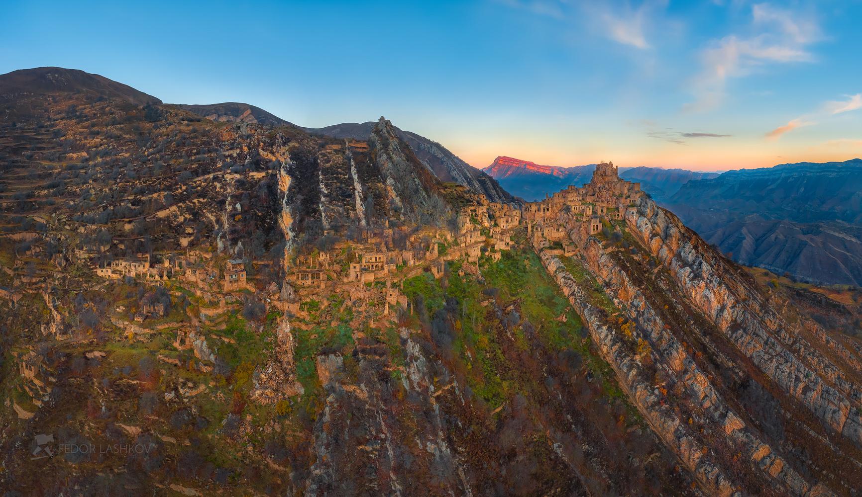
very picturesque abandoned village
Tags: Abandoned · Dagestan Republic
6
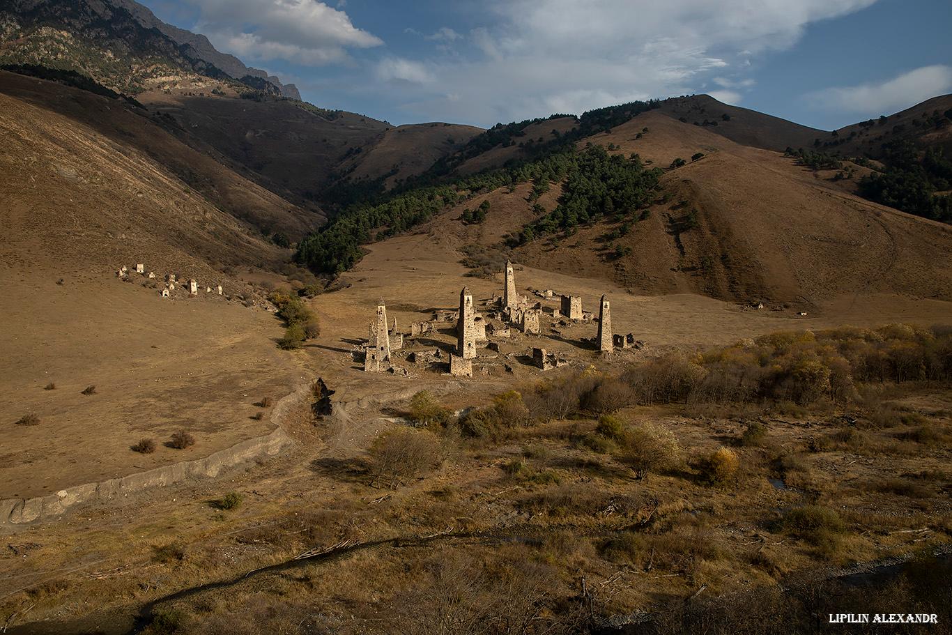
Tower Complex “Targim” in Ingushetia
No comments · Posted by Sergei Rzhevsky in Regions, Travel
Targim is an old abandoned settlement located in the southern part of the Republic of Ingushetia at an altitude of 1,080 meters above sea level.
On its territory there is an architectural complex “Targim” with a number of historical objects: tower-type dwellings, 4 battle towers up to 30 meters high, 4 semi-battle towers, and 16 dilapidated residential towers, as well as 19 crypt burial grounds, 2 mausoleums, and 5 sanctuaries. The tower complex “Targim” on Google Maps. Photos by: Alexandr Lipilin.
Tags: Ingushetia Republic
23
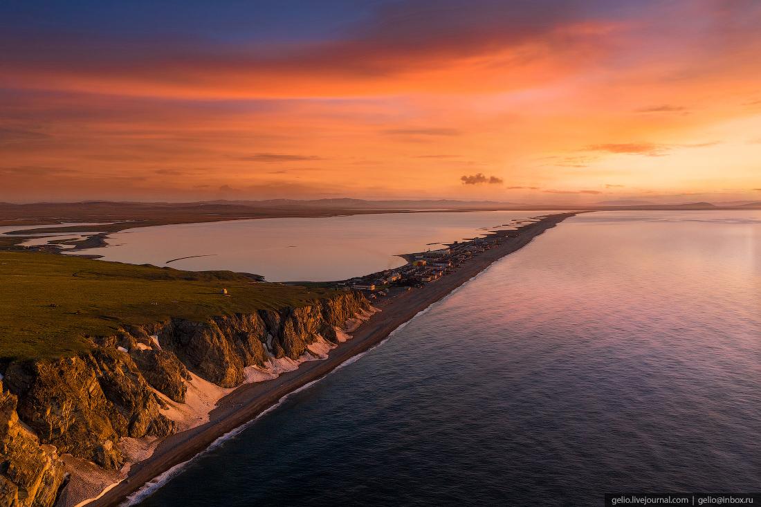
Uelen – the easternmost settlement of Russia and Eurasia
5 Comments · Posted by Sergei Rzhevsky in Regions, Travel
Uelen is a village with a population of 599 people (2021) located in the Chukotka district of the Chukotka Autonomous Okrug in the Russian Far East. This is the easternmost inhabited settlement of Russia and Eurasia. It is only 100 kilometers from this small Chukchi village to the United States (Alaska), and more than 6,000 kilometers to Moscow in a straight line.
The current name of the village probably comes from the Chukchi word “uvelen”, which means “black thawed patches” or “black earth”. Uelen is located at the foot of the hill (sopka), on the slope of which there are black hillocks, which are clearly visible at any time of the year and in the past served as a reference point for travelers coming here. Uelen on Google Maps. Photos by: Slava Stepanov.
Tags: Anadyr city · Chukotka okrug
After a productive working week, you also want to have a productive rest. This article is dedicated to all those who cannot imagine their vacation without the word “active”. Finnish Ninja Sports betting understands not only gambling but also knows how and where to recharge and have a good time offline.
We invite you to familiarize yourself with the fascinating places of the Leningrad Region, where you can spend an informative weekend. We are not talking about the world-famous Peterhof or the Catherine Palace, which of course are recommended for visiting, but less famous, but in spite of this, no less interesting places.
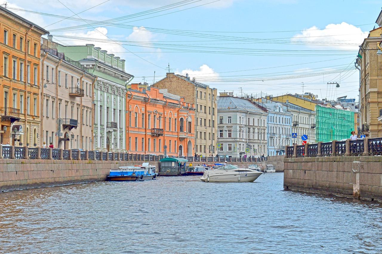
Photo by: Olga Sadrova.
Tags: Leningrad oblast · Saint Petersburg city
12
Church of the Vladimir Icon of the Mother of God in Balovnevo
No comments · Posted by Sergei Rzhevsky in Architecture, Regions, Travel
Balovnevo is a village of about 600 people located in the north of Lipetsk Oblast in the central part of European Russia. In this village you can see a unique monument of architecture of federal significance built in the style of classicism with elements of Gothic – the Church of the Vladimir Icon of the Mother of God (1789-1823).
In November 2015, after two and a half years of restoration, the church reopened its doors to parishioners and tourists. Balovnevo on Google Maps. Photos by: Alexandr Lipilin.
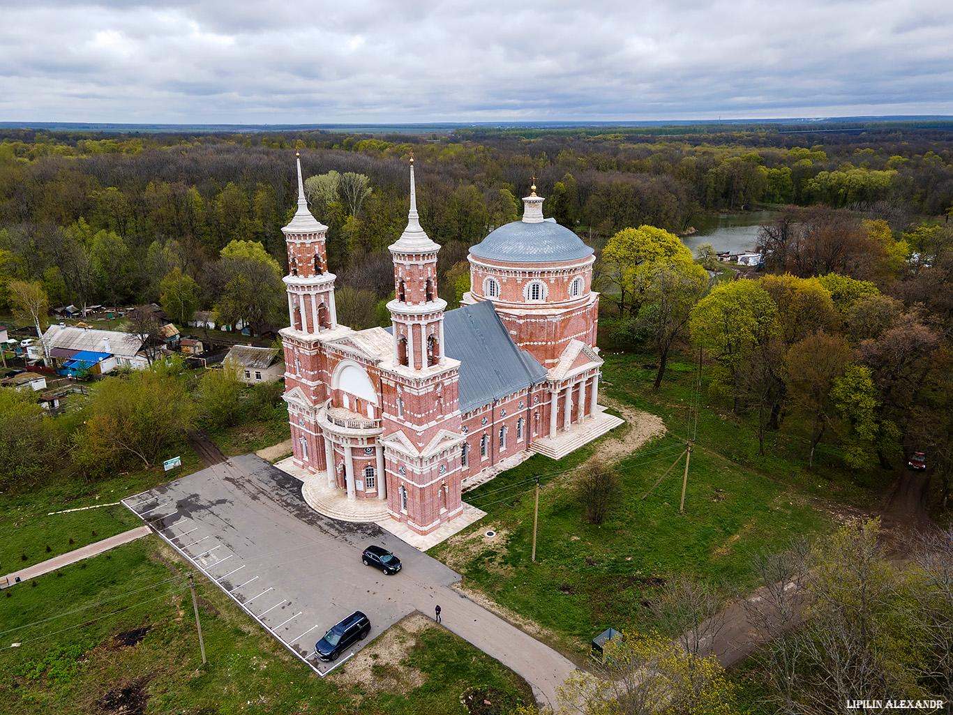
Tags: churches · Lipetsk oblast
6
Ruskeala Express – a unique retro train in Karelia
No comments · Posted by Sergei Rzhevsky in Regions, Travel
“Ruskeala Express” is a tourist retro train running along the route Sortavala – Mountain Park “Ruskeala” – Sortavala in the Republic of Karelia. Today, it is the only daily steam train in Russia.
The average train speed is 40-60 km/h, the travel time is 1 hour. The interior of the train and the uniform of the train employees are made in the style of the late 19th – early 20th centuries. Photos by: Slava Stepanov.
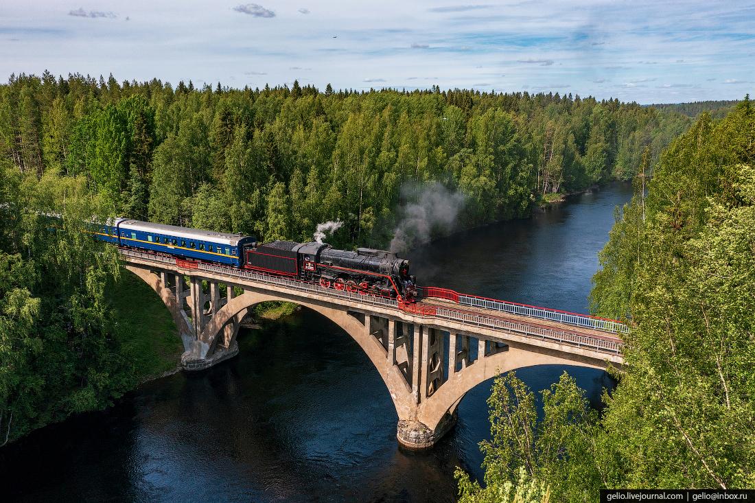
Tags: Karelia Republic
25
Kudykina Gora – the most popular sight of Lipetsk Oblast
No comments · Posted by Sergei Rzhevsky in Entertainment, Regions, Travel
“Kudykina Gora” is a park located on the bank of the Don River near the village of Kamenka, Lipetsk Oblast, about 74 km west of Lipetsk.
This large park of 500 hectares, opened in 2007, is one of the most visited tourist attractions in Lipetsk Oblast offering entertainment for children and adults. “Kudykina Gora” on Google Maps. Photos by: Alexandr Lipilin.
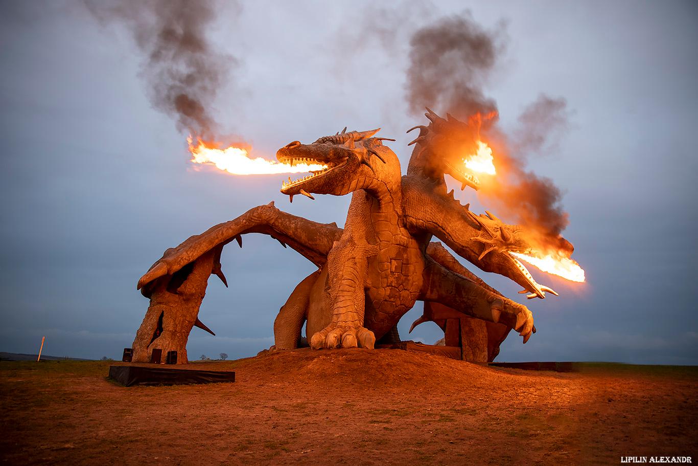
Tags: Lipetsk oblast
10
Snow-covered “Lesnoy Terem” in Astashovo
No comments · Posted by Sergei Rzhevsky in Architecture, Regions, Travel
“Lesnoy Terem” in Astashovo is a former residence of the peasant Martyan Sazonov (1840/2-1914) located in the central part of Kostroma Oblast, about 200 km from Kostroma.
This is quite a unique phenomenon – a country residence built in the middle of a small village in a remote place. This picturesque wooden house was built in the Russian style with rich and varied carved decor. Lesnoy Terem in Astashovo on Google Maps. Photos by: Alexandr Lipilin.

Tags: Kostroma oblast