
CAT | Regions
25
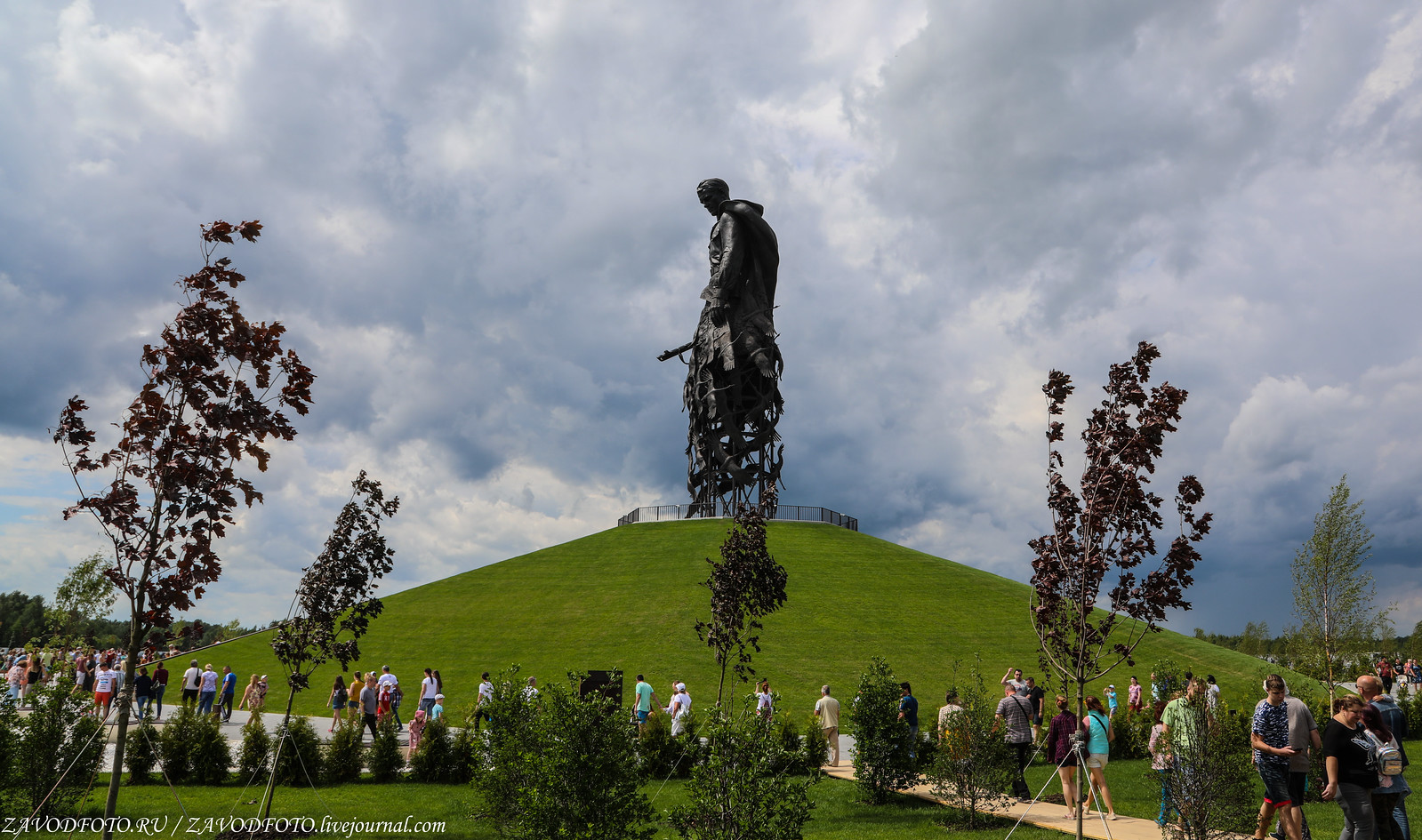
Rzhev Memorial to the Soviet Soldier
3 Comments · Posted by Sergei Rzhevsky in History, Regions, Travel
On June 30, 2020, about 7 km south-west of the city of Rzhev and 200 km north-west of Moscow, the Rzhev Memorial to the Soviet Soldier was opened. It was installed in the place where the Battle of Rzhev took place from January 5, 1942 to March 21, 1943 – one of the bloodiest battles of the Second World War.
The losses of the Soviet side amounted to more than 1 million people killed, wounded and missing, the German side – more than 390 thousand people. The Rzhev Memorial to the Soviet Soldier on Google Maps. Photos by: zavodfoto.

Tags: Tver oblast
6
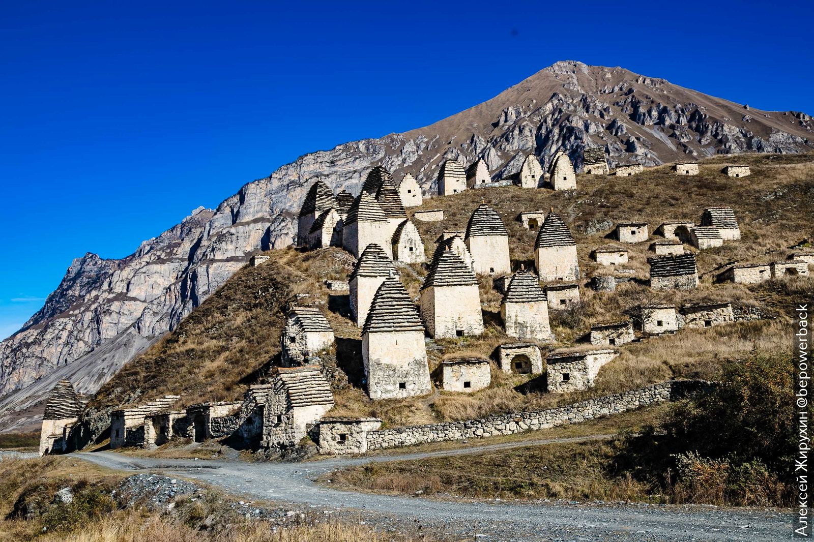
The City of the Dead in Dargavs
No comments · Posted by Sergei Rzhevsky in History, Regions, Travel
Dargavs is a small village located in the Republic of North Ossetia – Alania, about 36 km southwest of Vladikavkaz. The area where the village is located has been inhabited since the Bronze Age. A large number of archaeological sites have been discovered here.
The village is very rich in various architectural monuments. The main one is the so-called “City of the Dead” – an old necropolis consisting of 97 stone memorials, which from afar resemble a small mountain village. It is the largest surviving burial of this type in Russia. Dargavs on Google Maps. Photos by: Alexey Zhirukhin.
Tags: North Ossetia Republic · Vladikavkaz city
27
The Nikolo-Vyazhischi Convent near Veliky Novgorod
No comments · Posted by Sergei Rzhevsky in Architecture, Regions, Travel
The amazingly beautiful complex of buildings of the Nikolo-Vyazhischi Convent of the Russian Orthodox Church is located near the village of Vyazhischi in Novgorod Oblast, about 15 km north-west of Veliky Novgorod.
The architectural structures of the convent are an invaluable cultural monument of the Novgorod land. It is famous for the extraordinary variety of tiles that decorate the buildings of the church complex. The Nikolo-Vyazhischi Convent on Google Maps. Photos by: Alexander Lipilin.

Tags: churches · Novgorod oblast
11
Rybachy Peninsula – one of the most beautiful places in Russia
No comments · Posted by Sergei Rzhevsky in Nature, Regions, Travel
The Rybachy Peninsula is the northernmost part of continental European Russia located in Murmansk Oblast and washed by the Barents Sea. The coastal waters are rich in fish (herring, cod, capelin, etc.), hence its name meaning “Fishing Peninsula”.
Despite its northern location, it is the warmest place in the entire Russian north. Off the coast of the peninsula, the sea doesn’t freeze all year round thanks to the warm North Cape Current. The Rybachy Peninsula on Google Maps. Photos by: Sergey Korolev.

Tags: Murmansk oblast
4
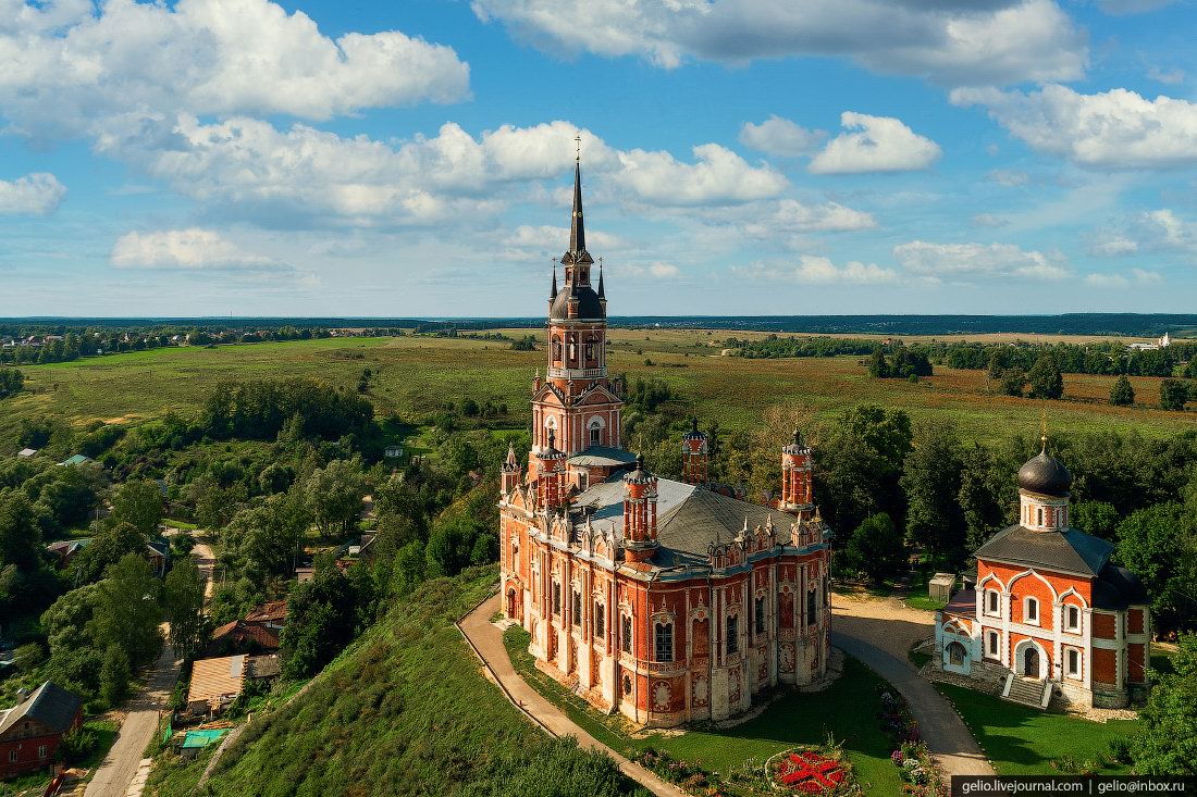
Sights of Moscow Oblast – the heart of Russia
No comments · Posted by Sergei Rzhevsky in Regions, Travel
Moscow Oblast (unofficially – Podmoskovye) is inextricably linked with the capital of Russia, despite its separate administrative status. In terms of population, it surpasses all other subjects of the Russian Federation, second only to Moscow.
This is a region not only with huge economic potential, but also a wonderful place with a rich thousand-year history, attracting travelers from all over Russia and abroad. Photos by: Slava Stepanov.
The pseudo-Gothic St. Nicholas Cathedral. It was built at the beginning of the 19th century on the place where the Mozhaisk Kremlin once stood.
attractions of the Moscow region
Tags: churches · Moscow Oblast · Moskovskaya oblast
1
Church of the Assumption of the Blessed Virgin Mary in Yepifan
No comments · Posted by Sergei Rzhevsky in Architecture, Regions, Travel
Yepifan, founded on the left bank of the Don River in 1566, is a village with a population of about 2,200 people located in the east of Tula Oblast, about 94 km southeast of Tula. This village is included in the list of historical settlements of Russia.
The Church of the Assumption of the Blessed Virgin Mary, built here from 1680 to 1720, is one of the most picturesque churches in the region. Yepifan on Google Maps. Photos by: Vadim Razumov.

Tags: churches · Tula oblast
19
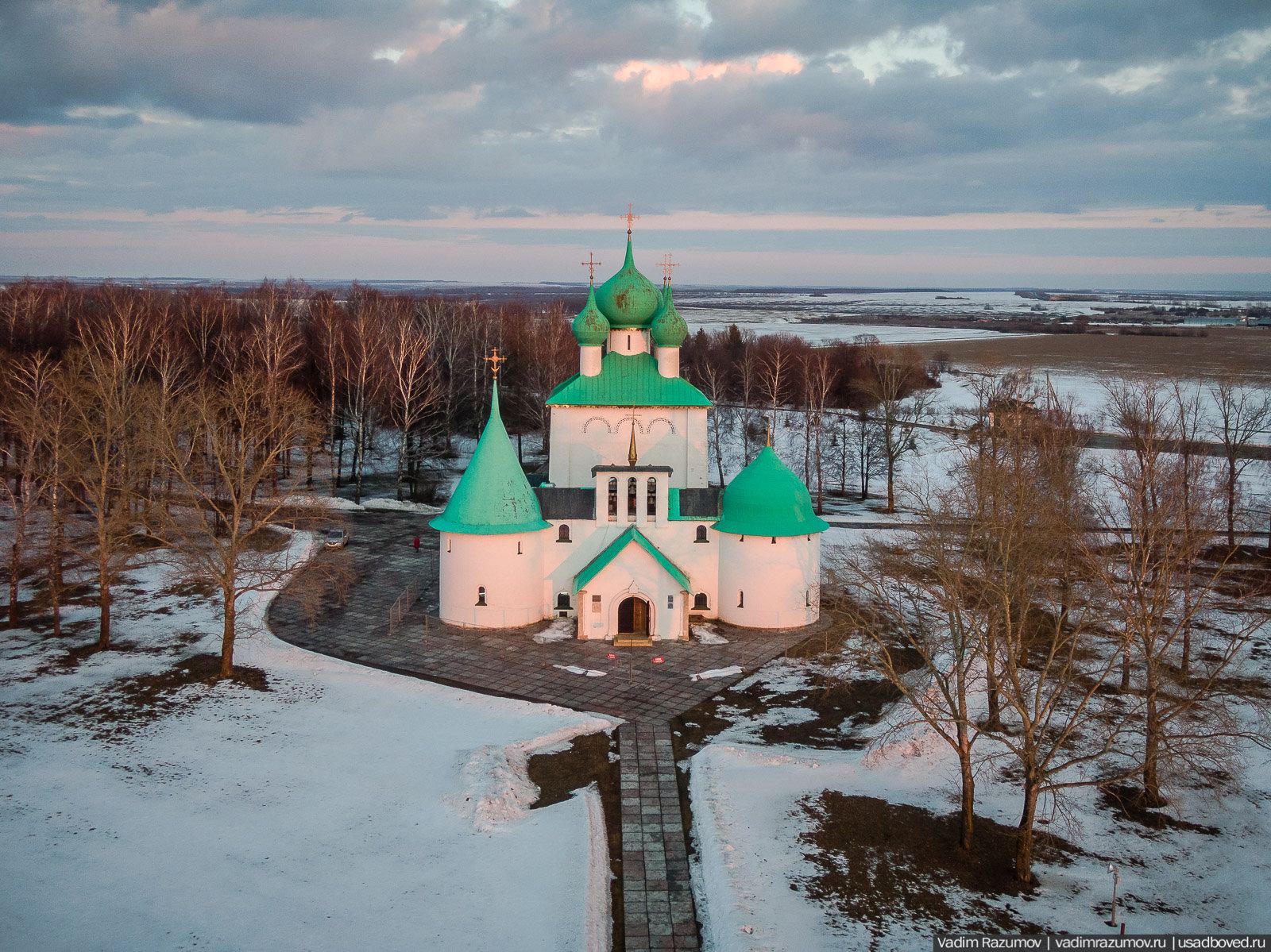
Church of St. Sergius of Radonezh on the Kulikovo Field
No comments · Posted by Sergei Rzhevsky in History, Regions
Church of St. Sergius of Radonezh on the Kulikovo Field, built in 1913-1917, is a monument-church standing on the alleged site of the Battle of Kulikovo (1380) in the southeast of Tula Oblast, about 122 km from Tula.
The architect of the church was Alexey Viktorovich Shchusev. An interesting feature of this church is that one of its towers is crowned by a dome in the shape of a helmet. The Kulikovo Field on Google Maps. Photos by: Vadim Razumov.
Tags: churches · Tula oblast
29
Church of the Icon of Our Lady of Akhtyrka in Moscow Oblast
No comments · Posted by Sergei Rzhevsky in Architecture, Photos, Regions
“Akhtyrka” is a former estate and park complex located on the banks of the Vorya River in Moscow Oblast near the city of Sergiev Posad, about 60 km north-east of Moscow. From 1734 to 1879, it belonged to the princes of the Trubetskoy family.
In 1922, the wooden palace burned down, other structures gradually collapsed. But the Church of the Icon of Our Lady of Akhtyrka (1821-1825) survived. In 1937, it was closed. In 1991, the church was returned to the community of believers, services were resumed. Today, it is a monument of architecture of federal significance. Akhtyrka Church on Google Maps. Photos by: Vadim Razumov.
![]()
Tags: churches · Moscow city · Moskovskaya oblast · Sergiev Posad city
21
The Pokrovsky Khotkov Convent near Moscow
No comments · Posted by Sergei Rzhevsky in Architecture, Regions, Religion
Khotkovo is a town with a population of about 21 thousand people located in Moscow Oblast, about 70 km northeast of the center of Moscow and 14 km southwest of Sergiev Posad.
The town originally appeared as a settlement near the Pokrovsky Khotkov Monastery, first mentioned in 1308. Today, the picturesque ensemble of the Pokrovsky Khotkov Convent is represented by buildings of the 18th-19th centuries. Khotkovo on Google Maps. Photos by: Vadim Razumov.
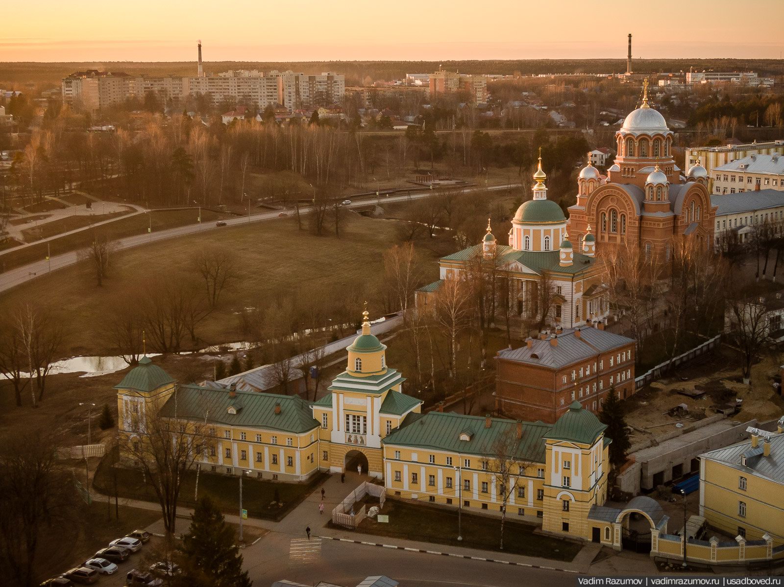
beautiful architectural ensemble
Tags: Moscow city · Moskovskaya oblast · Sergiev Posad city
26
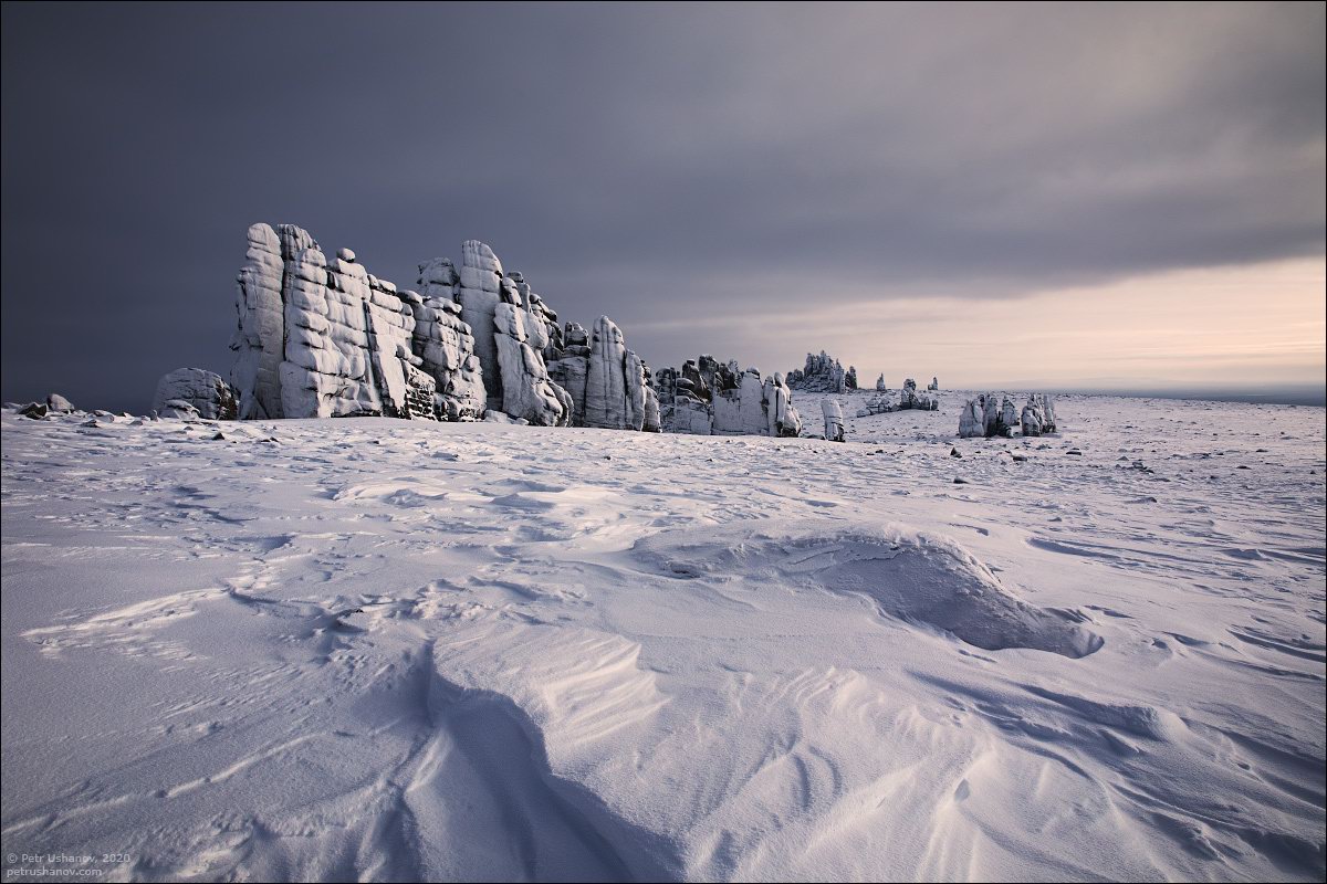
Snow Covered Stone Pillars of Ulakhan-Sis
No comments · Posted by Sergei Rzhevsky in Nature, Regions, Travel
Ulakhan-Sis is a mountain range with a length of about 200 km and a height of up to 754 meters located among the endless swampy forests in the north-east of Yakutia.
Here you can see a large number of various granite pillars 25-30 meters high. This is a very inaccessible place, people don’t live here. The first tourists started visiting it only a few years ago. Ulakhan-Sis on Google Maps. Photos by: Petr Ushanov.
Tags: Sakha Republic · Yakutsk city