
CAT | Nature
18
Colorful summer sunset in the Volga River delta
No comments · Posted by Sergei Rzhevsky in Nature, Photos, Regions
These picturesque photos were taken on one hot summer evening in the Volga River delta somewhere in the Astrakhan region. The delta of the Volga is the largest river delta in Europe and the 8th in the world.
Due to the lowering of the level of the Caspian Sea, the delta area has increased ninefold over the past 130 years. The unique flora and fauna of the delta (sturgeon, lotus, flamingo, Siberian cranes, pelicans) are under state protection as the Astrakhan Nature Reserve. Photos by: Fedor Lashkov.


Tags: Astrakhan oblast
3
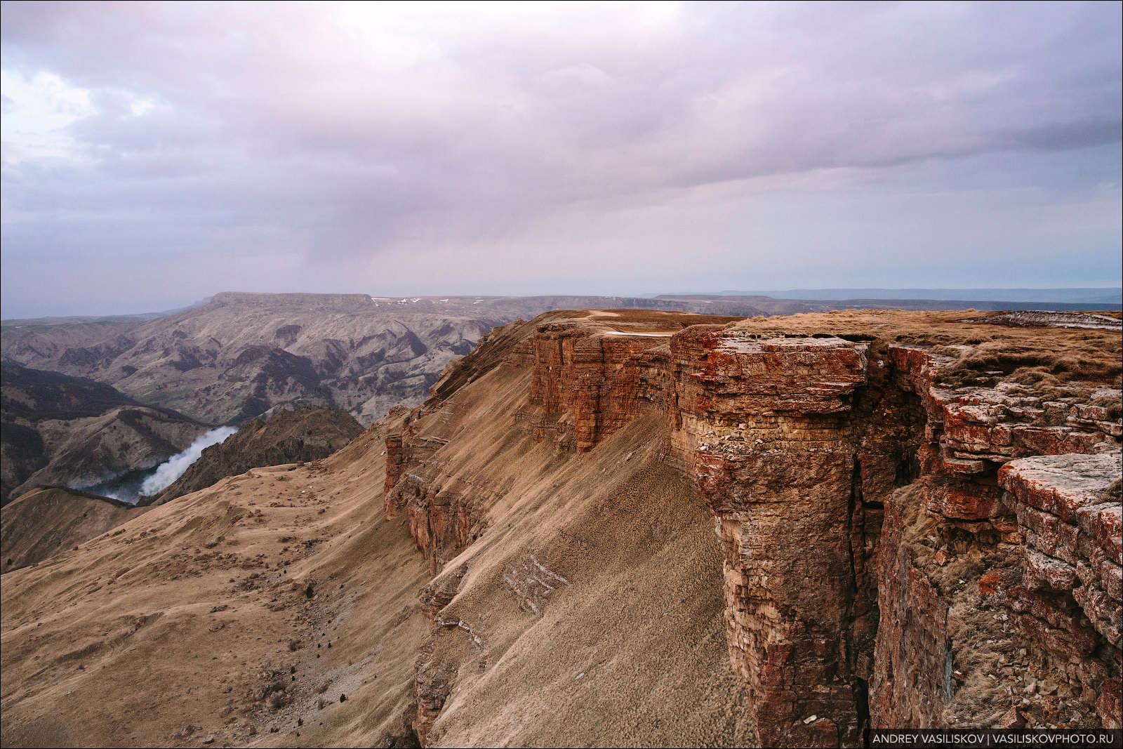
Dawn on the Bermamyt Plateau
No comments · Posted by Sergei Rzhevsky in Nature, Regions, Travel
The Bermamyt Plateau is an amazingly beautiful place, one of the best panoramic sites of the Karachay-Cherkessia Republic. It is located on the northern slope of the Greater Caucasus, about 30 km south-west of Kislovodsk in the Malokarachayevsky district of the republic.
The main part of the plateau – Bolshoy (Big) Bermamyt – reaches a height of 2,591 m. Nearby there is a southern rocky ledge – Malyy (Small) Bermamyt (2,643 m). In clear weather, you can enjoy scenic views of the snow-covered peaks of the Greater Caucasus and Mount Elbrus. The Bermamyt Plateau on Google Maps. Photos by: Andrey Vasiliskov.
Tags: Karachay-Cherkessia Republic
23
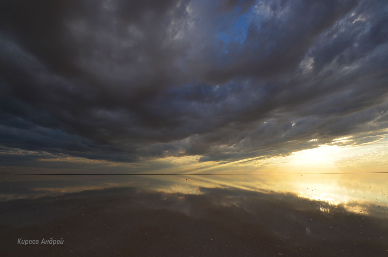
Elton – the Largest Lake of the Volgograd Region
No comments · Posted by Sergei Rzhevsky in Nature, Regions, Travel
Elton is a picturesque salt lake located in the Pallasovskiy district of the Volgograd region, not far from the border with Kazakhstan, 206 km east of Volgograd.
It is not only the largest lake in the Volgograd region, but also the largest mineral lake in Europe and one of the most mineralized lakes in the world. Lake Elton on Google Maps. Photos by: Andrei Kireev.
Tags: Volgograd oblast
18
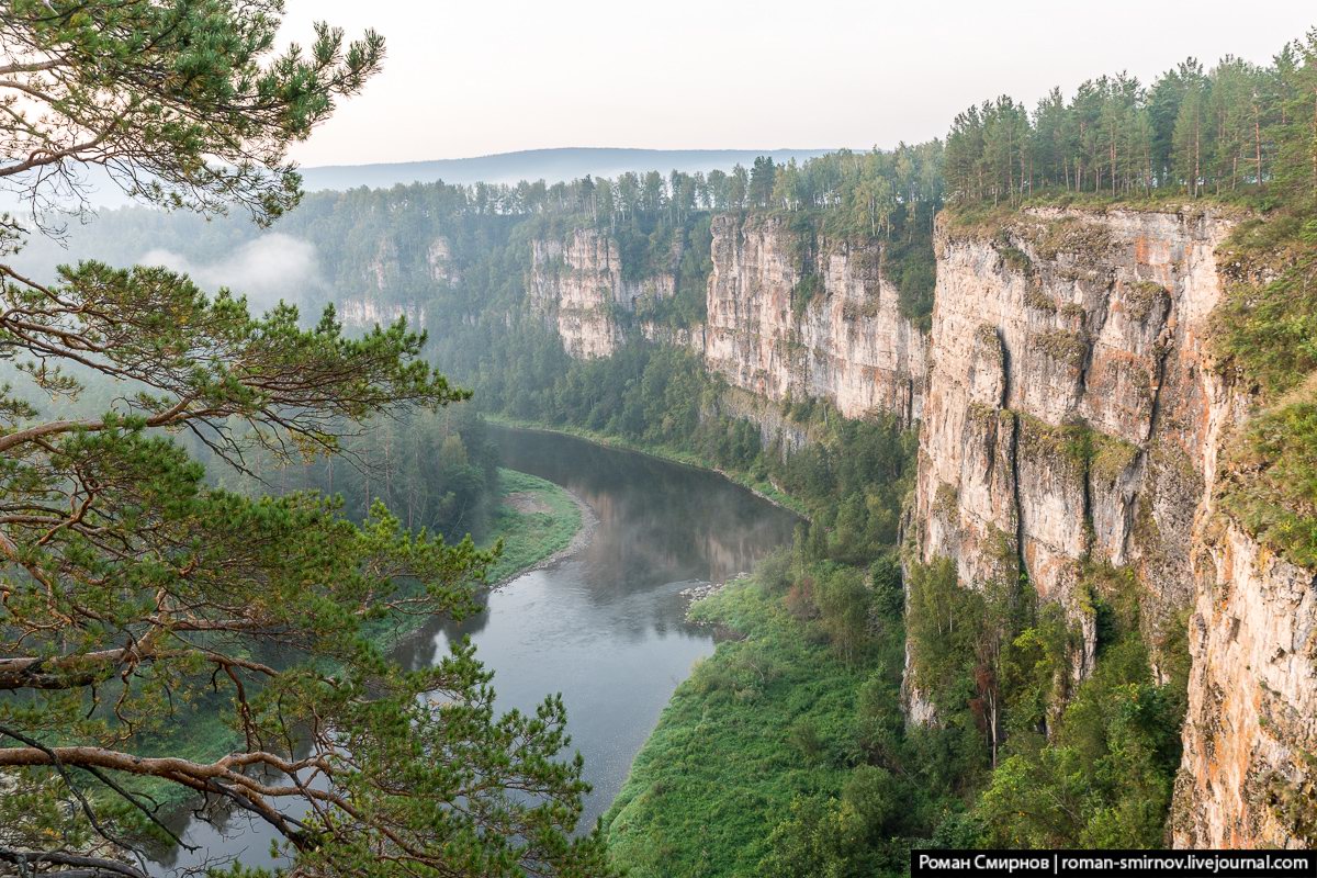
Bolshiye Pritesy Cliff in the Chelyabinsk Region
No comments · Posted by Sergei Rzhevsky in Nature, Regions, Travel
The cliff of Bolshiye Pritesy, located in the west of the Chelyabinsk region, is one of the most famous and popular sights of the Ay River. The height of this steep rocky wall is up to 100 meters.
The Ay River is one of the most beautiful rivers in the Urals. In the Bashkir language its name means “Moon” or “Moon River”. It flows through the territory of the Chelyabinsk region and the Republic of Bashkiria. The length of the river is 549 kilometers. It has a lot of picturesque cliffs, rocks, caves.
Tags: Chelyabinsk oblast
26
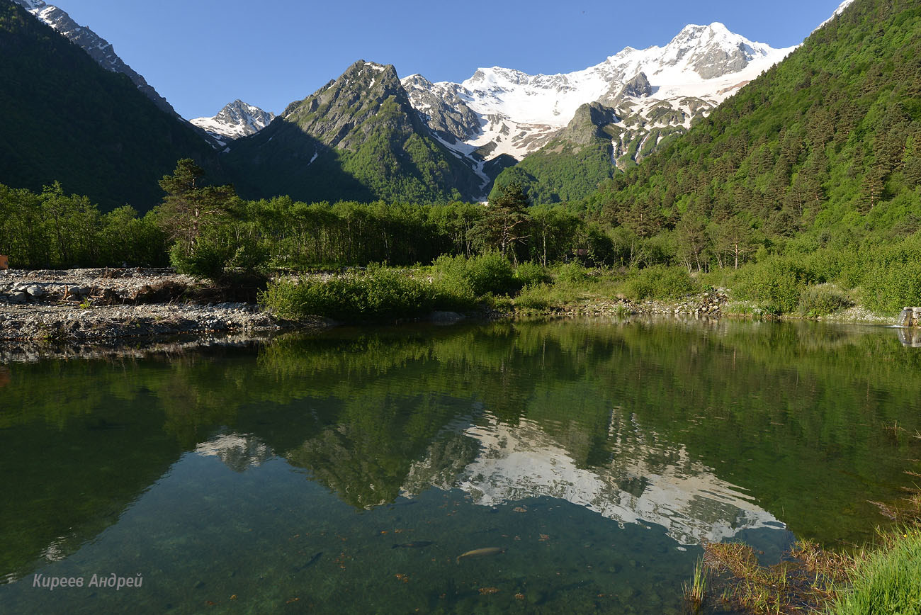
Beauty of Mountainous Digoria in North Ossetia
No comments · Posted by Sergei Rzhevsky in Nature, Regions, Travel
In the Caucasus there are a lot of interesting and beautiful places and one of them is Digoria located in the western part of the Republic of North Ossetia – Alania, on the northern slope of the Main Caucasian ridge.
Digoria, named after the local ethnic group of Ossetians-Digorians, is located on the territory of the Digorsky and Irafsky districts of North Ossetia. The mountainous part of Digoria is the most popular among travelers. Photos by: Andrei Kireev.
Tags: North Ossetia Republic
12
Frosty Dawn in Taganay National Park
No comments · Posted by Sergei Rzhevsky in Nature, Regions, Travel
Taganay is a national park located in the Southern Urals, in the western part of the Chelyabinsk region, 130 km from Chelyabinsk. The territorial center of the park is the city of Zlatoust.
The total area of the park is 568 sq. km. The following photos were taken in the area of the Meteorological Station “Taganay-Gora” – the most remote shelter of the national park located on a picturesque mountain plateau. Air temperature – minus 30 degrees Celsius. Taganay National Park on Google Maps. Photos by: Andrei Kireev.
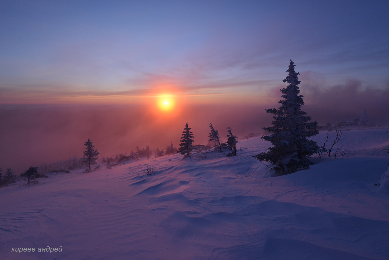
beautiful dawn in the harsh winter conditions
Tags: Chelyabinsk oblast · Zlatoust city
21
Picturesque Castles of the Sinyaya River in Yakutia
No comments · Posted by Sergei Rzhevsky in Nature, Regions, Travel
The Sinyaya River is a 597 km long river running through the territory of the Republic of Yakutia, the left tributary of the Lena River.
In the lower reaches of the river, not far from the confluence with the Lena and relatively close to Yakutsk, there is an amazing natural monument called Sinskiye Stolby (Pillars). Sinskiye Stolby on Google Maps. Photos by: Petr Ushanov.
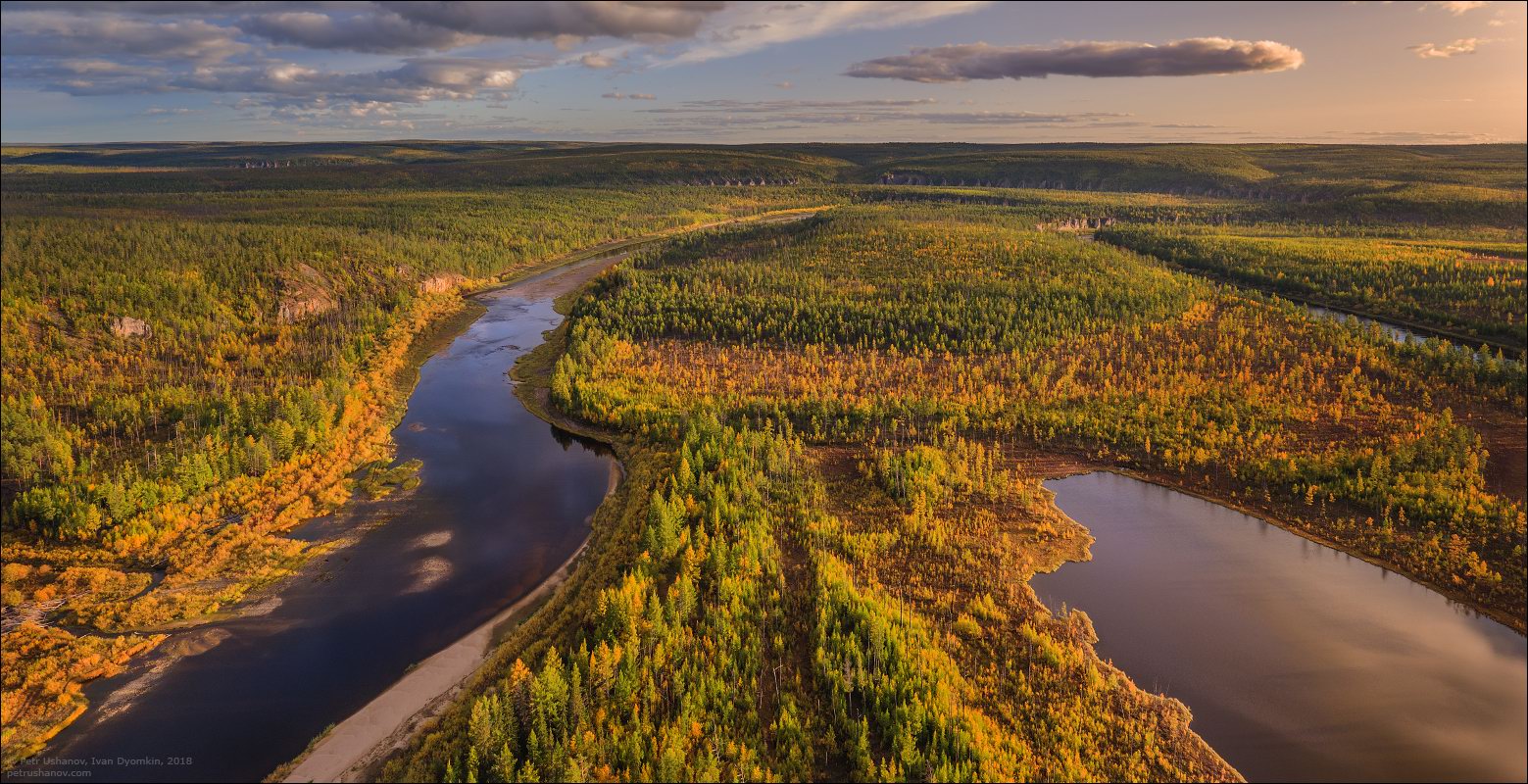
Tags: Sakha Republic · Yakutsk city
2
Putorana Plateau – Exotic Journey for Two
No comments · Posted by Alex Smirnov in Nature, Regions, Travel
The sight of the unassailable beauty of Putorana Plateau, located in the north-west of the Krasnoyarsk region, is breathtaking. Here the mountains do not have peaks, and the canyons seem bottomless. The lakes are hundreds of kilometers long, and the rivers are torn from the rocks, forming the highest waterfalls in Russia.
There are no typical landscapes for Russia on Putorana Plateau. The fairy-tale nature of this place pushes us to reflect on ancient creatures, originating from Slavic myths and fairy tales. If Peter Jackson saw this place in preparation for the shooting of The Lord of the Rings, New Zealand would have to try very hard to stay in the place of the favorite.
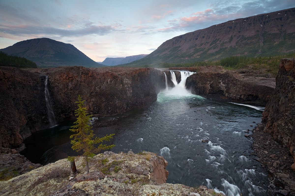
one of the most beautiful places in Russia
Tags: No tags
25
Seliger – the Most Transparent and Romantic Lake in Russia
No comments · Posted by Alex Smirnov in Nature, Regions, Travel
Lake Seliger is a famous Russian landmark. Located in the center of Valdai, it is quite far from the noise of civilization and at the same time only seven hours of going by car from Moscow. The ideal geographical location made it a very popular place for tourism.
Here come not only the Russians but also guests from many different countries. The special atmosphere of Seliger provides leisurely, comfortable rest, long and interesting conversations. Does the world have a more fertile soil for cultivating the colors of love?
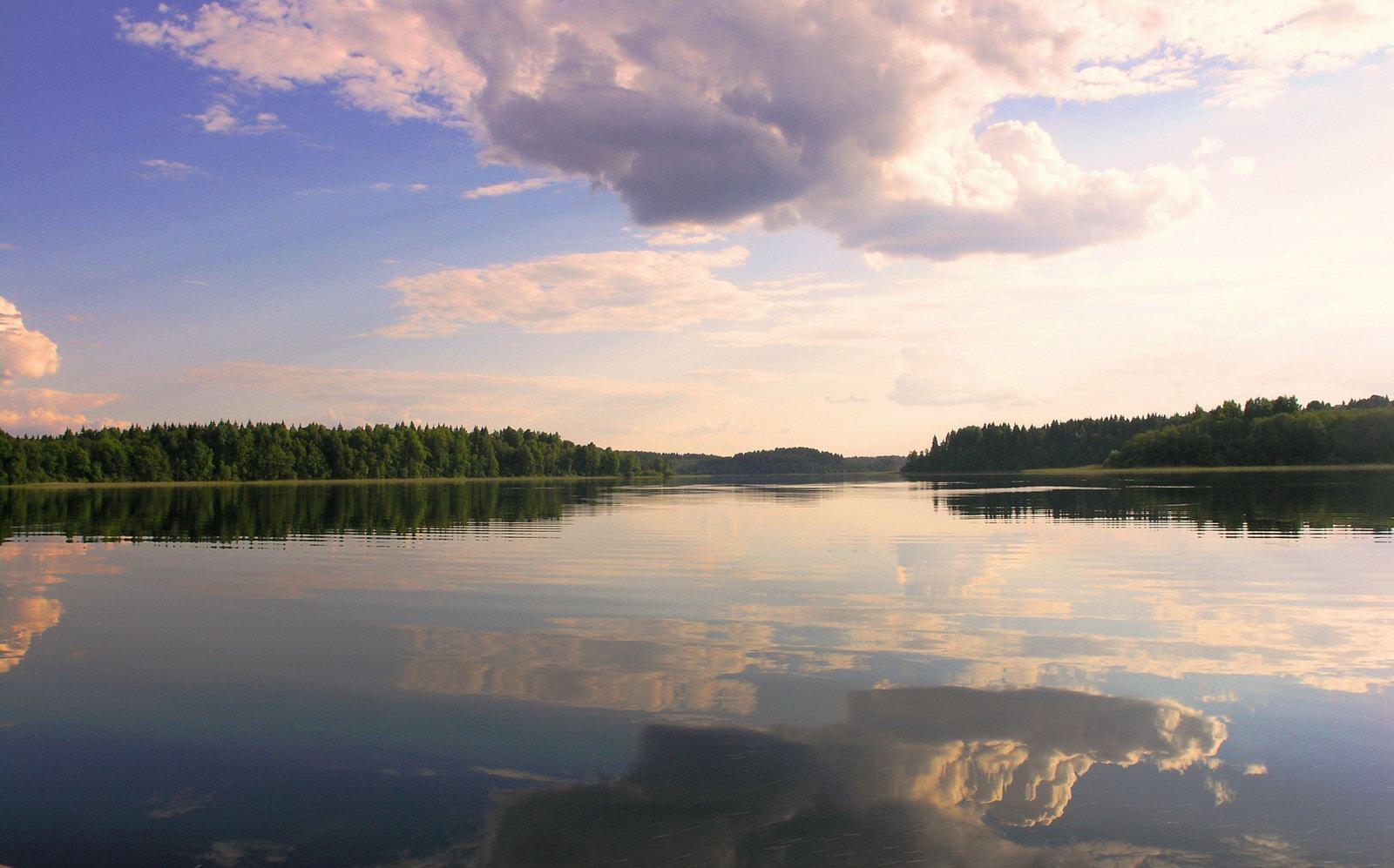
Seliger – a great place for outdoor recreation
Tags: No tags
14
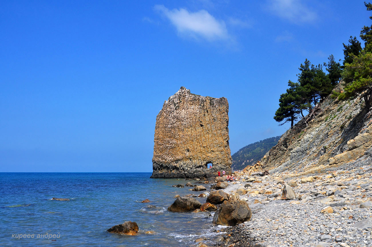
Parus (Sail) Rock – a natural monument near Gelendzhik
No comments · Posted by Sergei Rzhevsky in Nature, Regions, Travel
Parus (Sail) Rock is a natural monument located on the Black Sea coast, 17 km southeast of the resort town of Gelendzhik in the Krasnodar region.
The rock is a sandstone monolith standing vertically on the beach, separated from the main rock mass by a gap. The shape of the rock resembles the shape of a quadrangular sail, hence its name. Parus (Sail) Rock on Google Maps. Photos by: Andrei Kireev.
magnificent monument of nature
Tags: Gelendzhik city · Krasnodar krai