
CAT | Nature
11
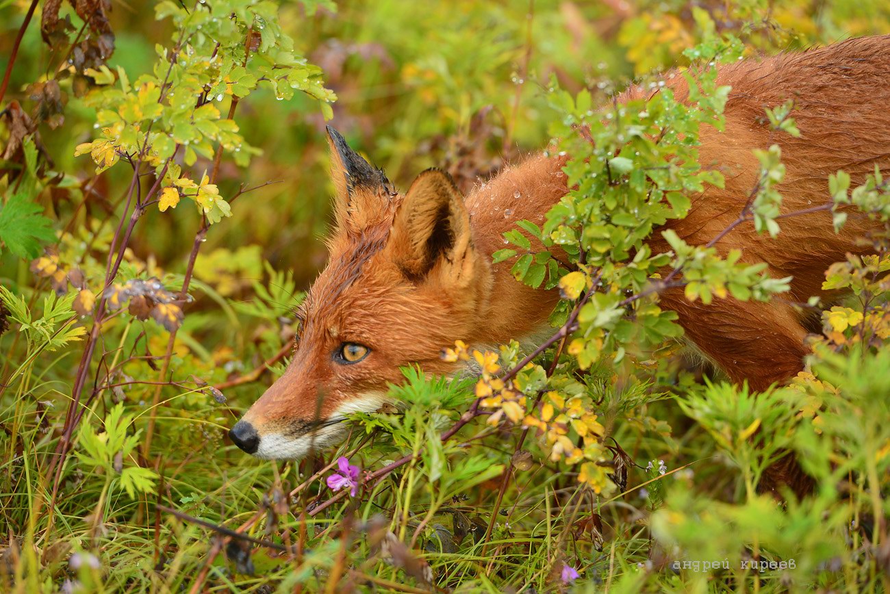
Kamchatka – the Land of Bears and Foxes
No comments · Posted by Sergei Rzhevsky in Nature, Photos, Regions
Kamchatka, a peninsula in Russia, is located in the north-eastern part of Eurasia. The peninsula, stretching from north to south for 1,200 km, is washed by the Sea of Okhotsk in the west, the Bering Sea and the Pacific Ocean in the east. The total area of Kamchatka is about 270 thousand square km.
A significant part of the territory of the Kamchatka Peninsula is allocated to specially protected areas. Among them are 3 state reserves, 5 natural parks, 8 federal and 23 local reserves, 105 natural monuments, 2 sanatorium-resort areas, and some other types of protected areas. The most photogenic representatives of the local fauna are numerous bears and foxes. Photos by: Andrei Kireev.
the beauty of untouched nature

Tags: Kamchatka krai
15
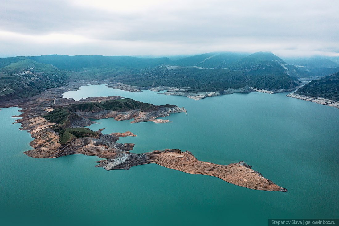
Chirkey Reservoir – the largest in the North Caucasus
No comments · Posted by Sergei Rzhevsky in Nature, Regions, Travel
Chirkey Reservoir, the largest reservoir in the North Caucasus, is located in the central part of the Republic of Dagestan. It was formed on the Sulak River as a result of the construction of the Chirkey hydroelectric power station.
The reservoir is also used for fishing and water supply. Its height above sea level is 335 m. The water surface area is 42.4 square km, the volume – 2.78 cubic km. The greatest depth is 220 m. The width of the reservoir exceeds 5 km. Chirkey Reservoir on Google Maps. Photos by: Slava Stepanov.
Tags: Dagestan Republic · Makhachkala city
6
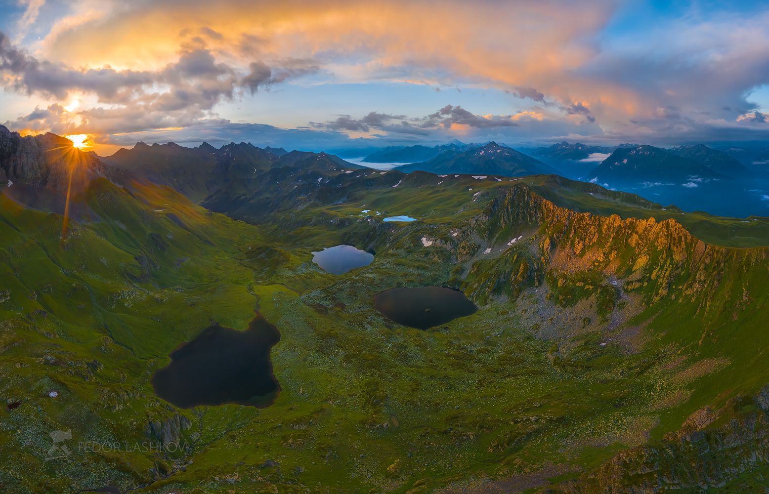
Atsgara Lakes in Karachay-Cherkessia
No comments · Posted by Sergei Rzhevsky in Nature, Regions, Travel
Atsgara lakes or the Pyatiozerye (“Five lakes”) valley are located at an altitude of about 2,500 meters above sea level in the Urupsky district of the Republic of Karachay-Cherkessia, about 26 km northwest of the village of Arkhyz and 7 km east of the village of Zagedan.
In total, there are more than 10 lakes here, but only 5 are large in size, their length is about 200-350 meters. The lakes are located on mountain terraces formed by an ancient glacier and at different heights relative to each other. In summer, these lakes warm up quite well and you can cool off in them. Atsgara Lakes in Karachay-Cherkessia on Google Maps. Photos by: Fedor Lashkov.
Tags: Cherkessk city · Karachay-Cherkessia Republic
22
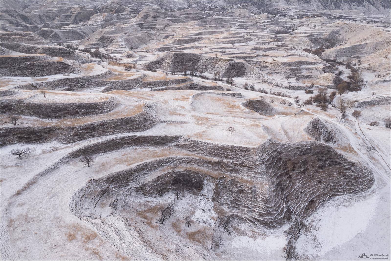
Snow-covered mountain terraces of Dagestan
No comments · Posted by Sergei Rzhevsky in Nature, Regions
The abandoned mountain terraces of Dagestan, several thousand years old, are among the most interesting sights of this region. The largest number of them has been preserved in the Gunib and Dadakhan districts.
The mountain terraces of Bali, China, Peru, and other regions of Southeast Asia and Latin America are known all over the world. In some countries, mountain terraces are UNESCO World Heritage Sites.
Tags: Abandoned · Dagestan Republic
4
Putorana Plateau – the land of lakes and waterfalls
No comments · Posted by Sergei Rzhevsky in Nature, Regions, Travel
Putorana is a mountain range (plateau), located in the heart of Siberia, in the northern part of Krasnoyarsk Krai.
The maximum height of the plateau is 1,701 m. Its area is about 250,000 square km, which is about the same as the area of the UK (242,495 square km). The Putorana Plateau on Google Maps. Photos by: Slava Stepanov.

Tags: Krasnoyarsk krai
28
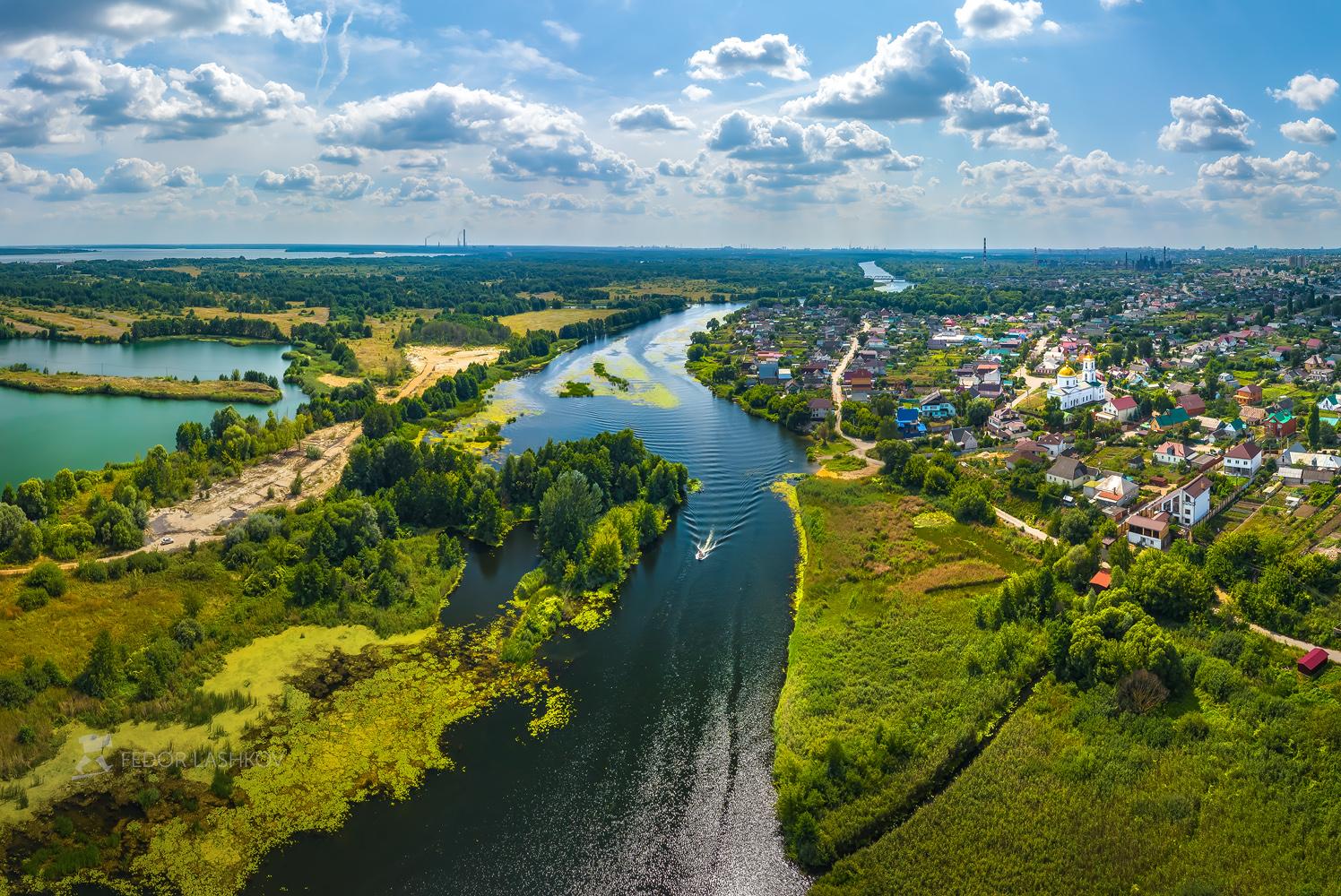
Summer in the Lipetsk Nature Reserve
No comments · Posted by Sergei Rzhevsky in Nature, Regions
The Lipetsk Reserve stretches along the left bank of the Voronezh River to the south of the city of Lipetsk. The territory of the reserve is about 13 thousand hectares. It protects the natural landscape of the area, including relic plants, rare insects inhabiting limestone rocks, birds, and wild animals.
Hunting is strictly prohibited here, fishing – only with permission. In 2004, the Lipetsk Reserve became part of the National Park, where, in addition to the protected area, it is planned to create a recreation area for people with a hotel, a nature museum, a zoo, and stables. Lipetsk Nature Reserve on Google Maps. Photos by: Fedor Lashkov.
beautiful sunny day near Lipetsk
Tags: Lipetsk city
6
Picturesque Landscapes along the Chuysky Trakt
No comments · Posted by Sergei Rzhevsky in Nature, Regions, Travel
The federal highway R256 “Chuya Trakt” (The Chuya Highway) is a federal highway Novosibirsk – Novoaltaysk (access road to Barnaul) – Biysk – Maima (access road to Gorno-Altaisk) – the state border with Mongolia.
The length of this highway passing through the territory of Novosibirsk Oblast, Altai Krai and the Altai Republic is about 968 kilometers. The Chuysky Trakt on Google Maps. Photos by: Alexandr Lipilin.
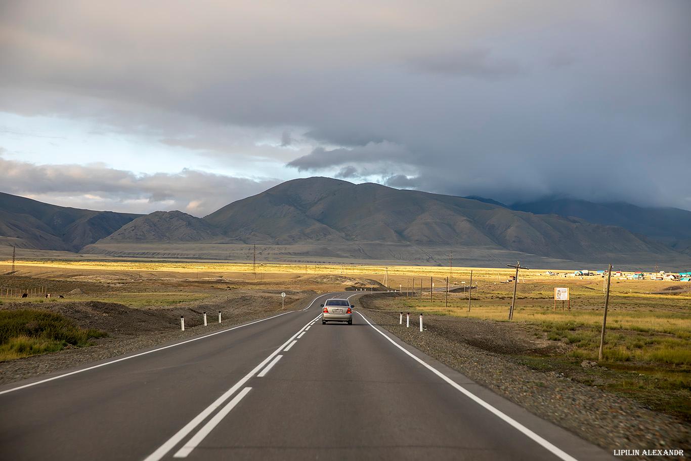
probably the most picturesque highway in Russia
Tags: Altai krai · Altay Republic
14
Franz Josef Land – the northernmost archipelago of Russia
No comments · Posted by Sergei Rzhevsky in Nature, Photos, Travel
Franz Josef Land is an archipelago (a group of islands located close together) in the Arctic Ocean, in northern Europe. It is the northernmost archipelago of Russia stretching for 375 km from east to west and 234 km from north to south.
It is part of Arkhangelsk Oblast and consists of more than 200 islands with a total area of about 16,134 square km. Franz Josef Land on Google Maps. Photos by: Slava Stepanov.

pristine nature of the Russian Arctic
Tags: Arkhangelsk oblast
20
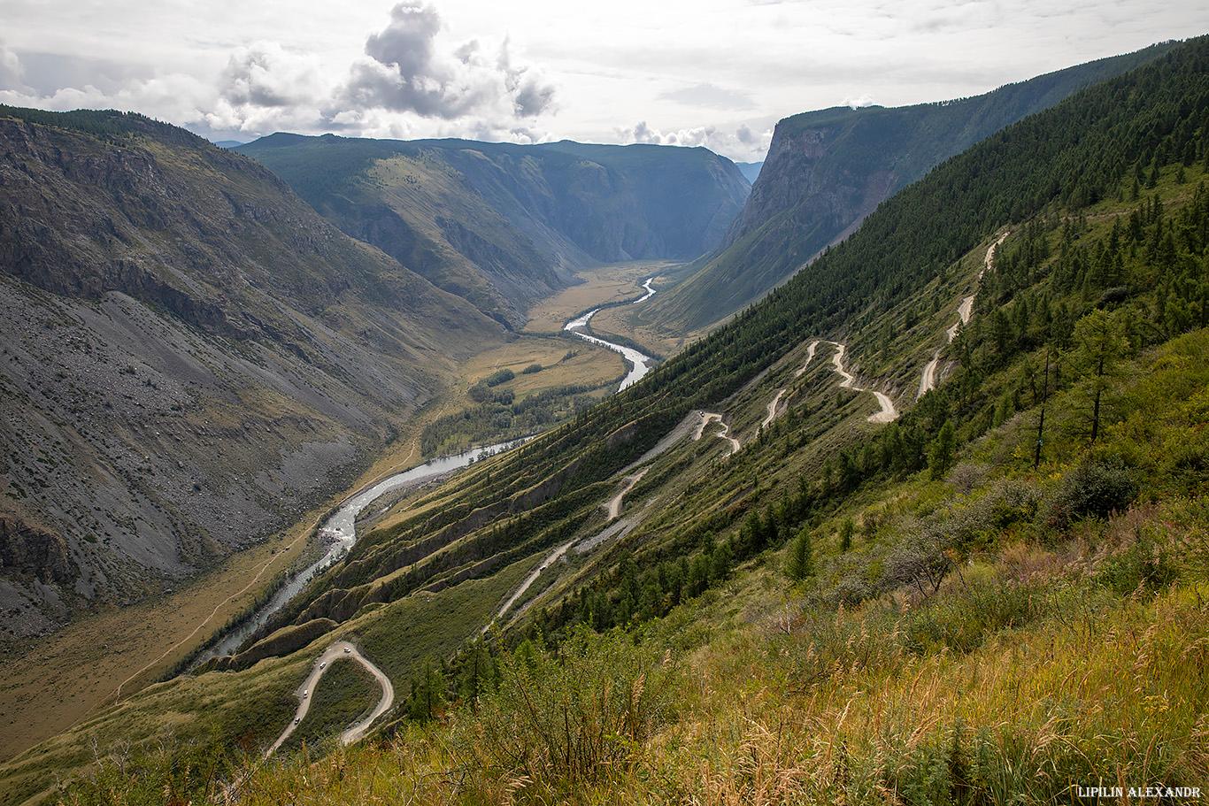
Katu-Yaryk – the most unusual pass in the Altai Republic
No comments · Posted by Sergei Rzhevsky in Nature, Regions, Travel
Katu-Yaryk Pass, one of the most difficult and dangerous passes in the Altai Mountains, is located on the territory of the Ulagan district of the Altai Republic.
Until 1989, there was no road descending from the Ulagan Plateau into the valley of the Chulyshman River. Residents of the surrounding villages used a steep horse trail or a waterway through Lake Teletskoye. Katu-Yaryk Pass on Google Maps. Photos by: Alexandr Lipilin.
Tags: Altay Republic
8
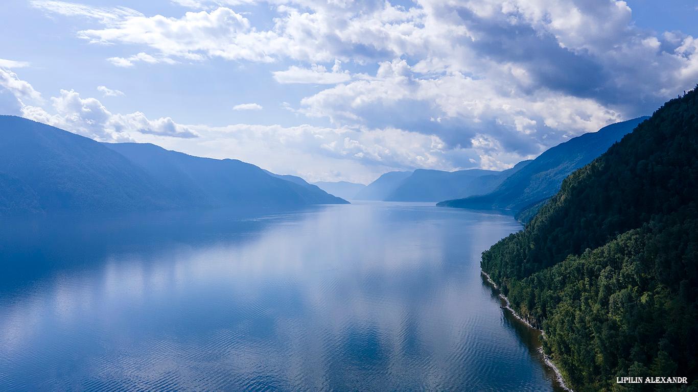
Lake Teletskoye – one of the natural symbols of Russia
No comments · Posted by Sergei Rzhevsky in Nature, Regions, Travel
Lake Teletskoye is a picturesque natural body of water located in the north-east of the Altai Mountains on the territory of the Altai Republic, about 120 km in a straight line from the regional capital Gorno-Altaysk.
One of the most popular natural attractions of Altai, it is included in the UNESCO World Cultural and Natural Heritage List as part of the complex “The Golden Mountains of Altai”. Lake Teletskoye on Google Maps. Photos by: Alexandr Lipilin.
Tags: Altay Republic · Gorno-Altaisk city