
18
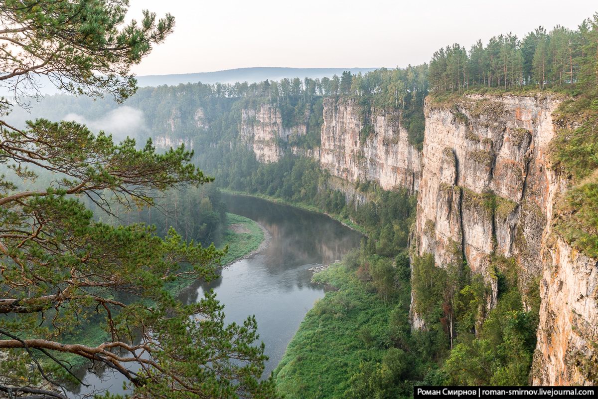
Bolshiye Pritesy Cliff in the Chelyabinsk Region
No comments · Posted by Sergei Rzhevsky in Nature, Regions, Travel
The cliff of Bolshiye Pritesy, located in the west of the Chelyabinsk region, is one of the most famous and popular sights of the Ay River. The height of this steep rocky wall is up to 100 meters.
The Ay River is one of the most beautiful rivers in the Urals. In the Bashkir language its name means “Moon” or “Moon River”. It flows through the territory of the Chelyabinsk region and the Republic of Bashkiria. The length of the river is 549 kilometers. It has a lot of picturesque cliffs, rocks, caves.

Tags: Chelyabinsk oblast
13
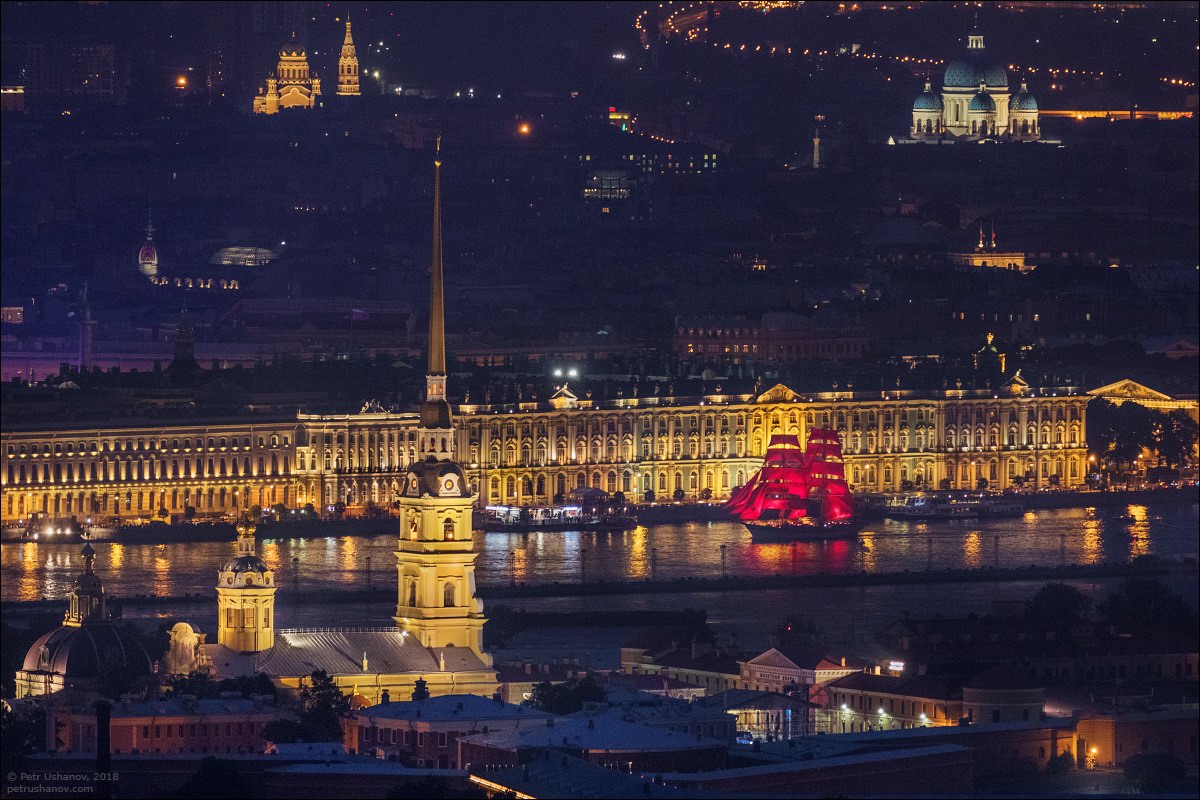
Scarlet Sails 2018 in St. Petersburg
1 Comment · Posted by Sergei Rzhevsky in Entertainment, Holidays, Photos
On the night of June 23-24, the annual show “Scarlet Sails” was held in St. Petersburg – the main graduation ceremony of Russia, a holiday dedicated to all school graduates.
For the first time “Scarlet Sails” was held in Leningrad in 1968. In that year, 25 thousand graduates of Soviet schools and technical schools gathered for the holiday. In 2018, this celebration turned 50, there were about 80 thousand graduates on the streets and embankments of the city. Photos by: Petr Ushanov.
Tags: Saint Petersburg city
10
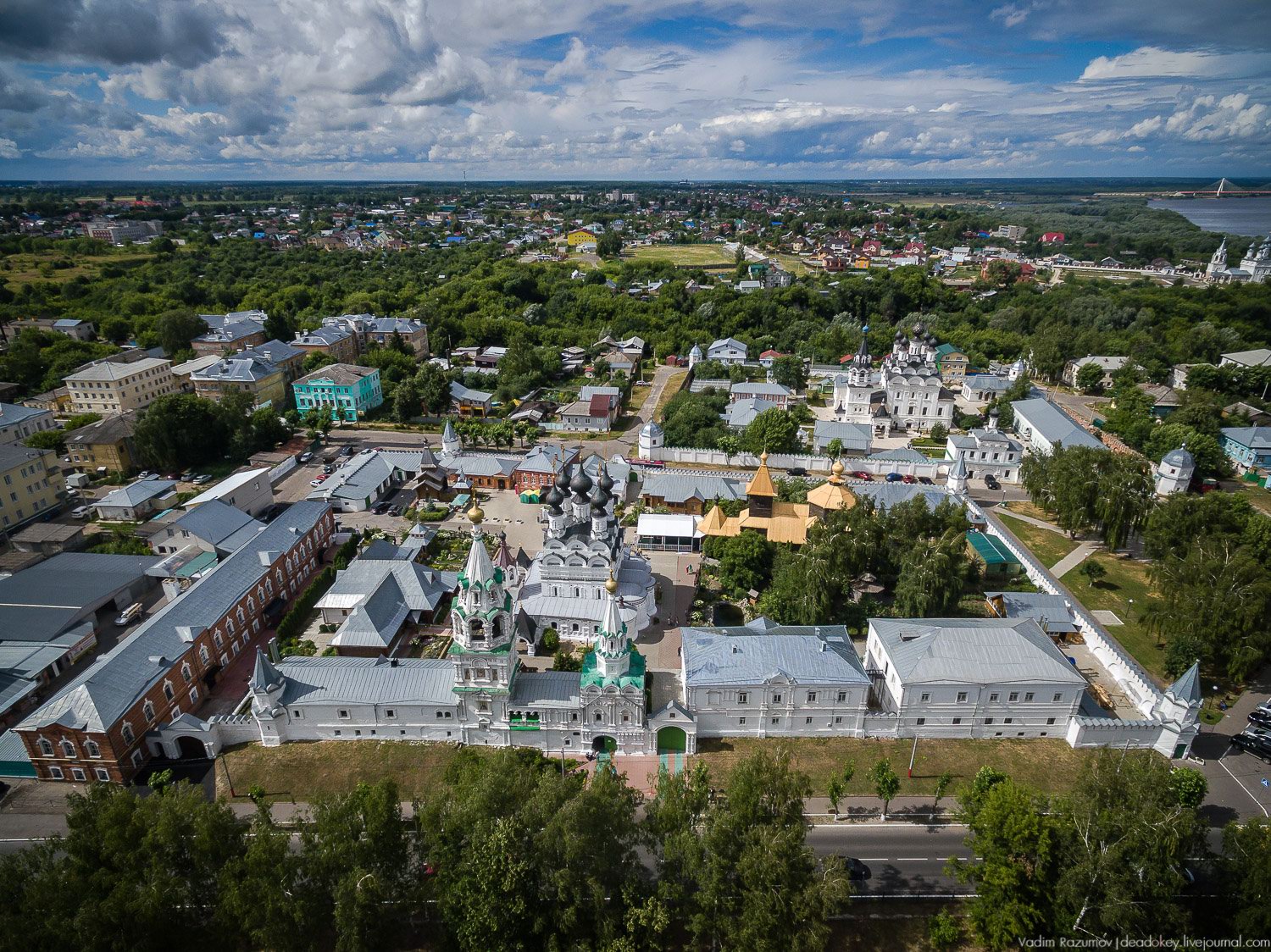
Holy Trinity Convent in Murom – the view from above
No comments · Posted by Sergei Rzhevsky in Architecture, Religion, Travel
The Holy Trinity Convent in Murom, one of the oldest cities in Russia located in the Vladimir region, 129 km southeast of Vladimir, is known for preserving the relics of St. Peter and Fevronia, who are revered in the country as patrons of the family and marriage.
It was founded in the second quarter of the 17th century (1643) by the Murom merchant Tarasy Borisovich Tsvetnov. Holy Trinity Convent in Murom on Google Maps. Photos by: Vadim Razumov.
Tags: Murom city · Vladimir oblast
3
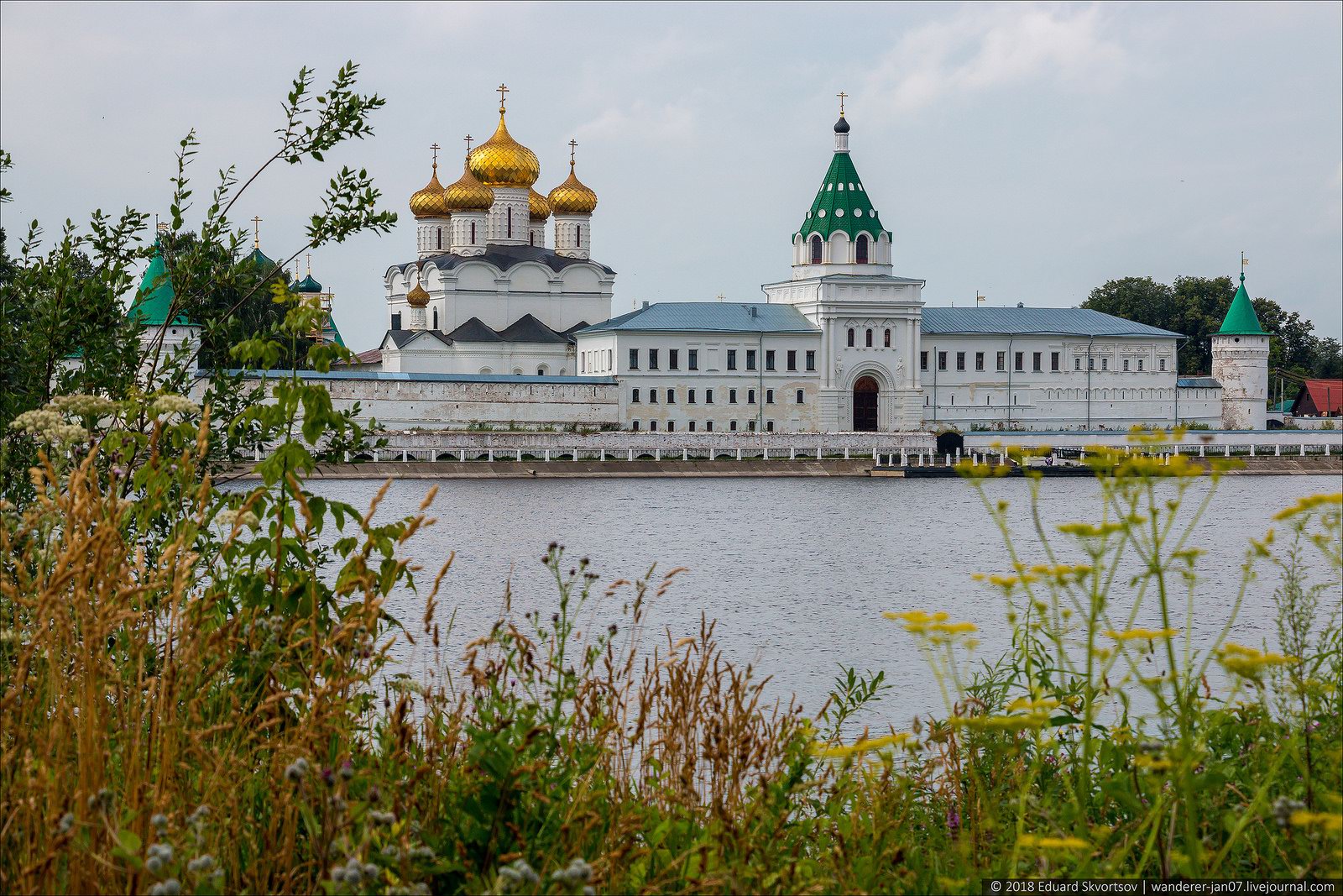
Ipatiev Monastery in Kostroma
No comments · Posted by Sergei Rzhevsky in Architecture, Religion, Travel
The Holy Trinity Ipatiev Monastery is located in the western part of Kostroma on the bank of the river of the same name near its confluence in the Volga. It is considered one of the symbols of the city.
The monastery was first mentioned in written sources in 1432. Although, it was founded about 100 years earlier. The compositional center of the monastery is the monumental five-domed Trinity Cathedral (1650-1652). Ipatiev Monastery on Google Maps. Photos by: Eduard Skvortsov.
Tags: Kostroma city
26
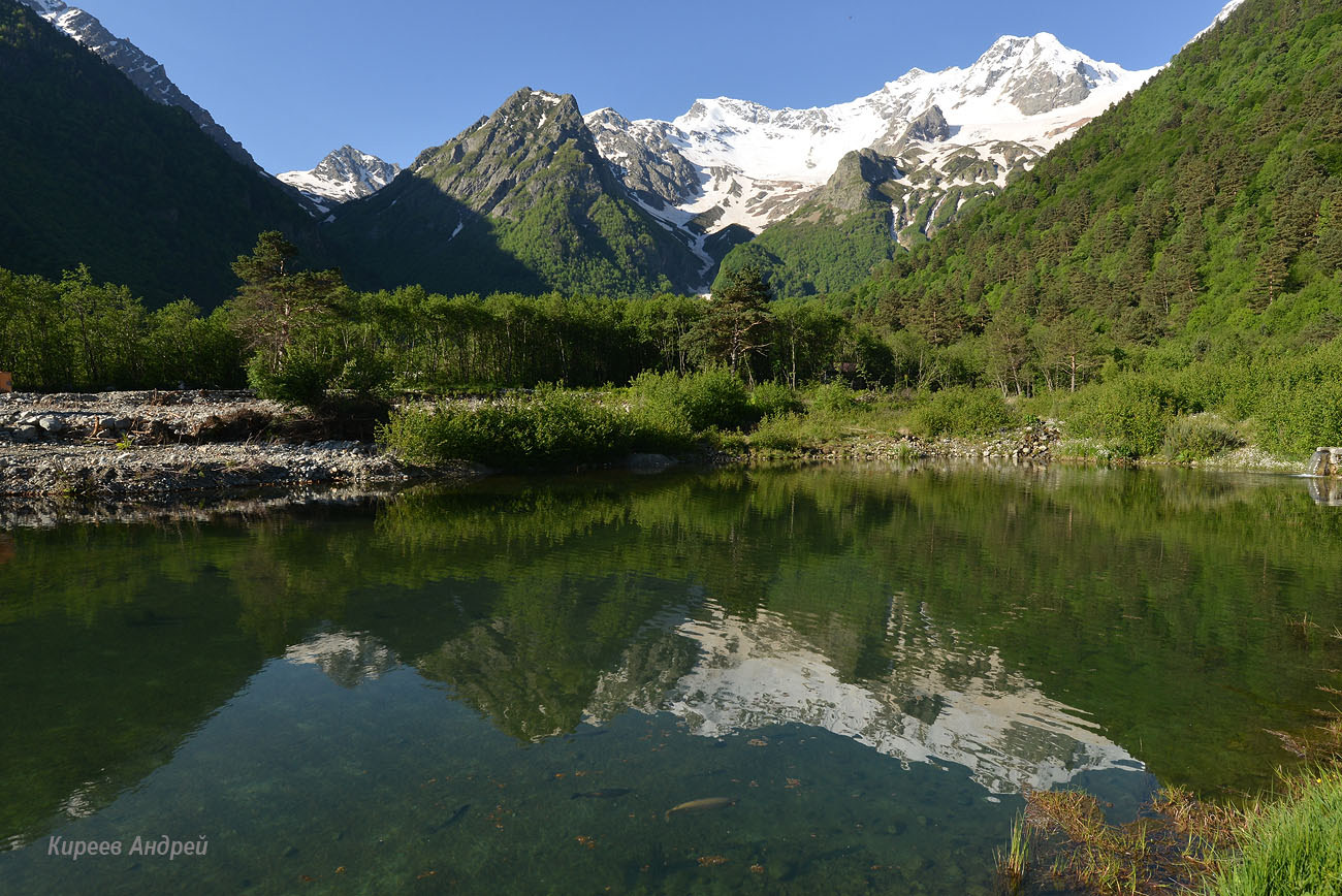
Beauty of Mountainous Digoria in North Ossetia
No comments · Posted by Sergei Rzhevsky in Nature, Regions, Travel
In the Caucasus there are a lot of interesting and beautiful places and one of them is Digoria located in the western part of the Republic of North Ossetia – Alania, on the northern slope of the Main Caucasian ridge.
Digoria, named after the local ethnic group of Ossetians-Digorians, is located on the territory of the Digorsky and Irafsky districts of North Ossetia. The mountainous part of Digoria is the most popular among travelers. Photos by: Andrei Kireev.
Tags: North Ossetia Republic
21
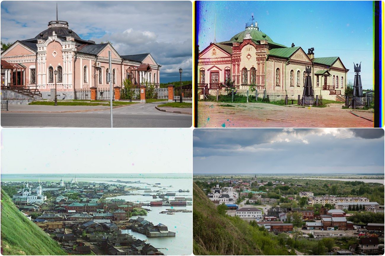
Photos of Tobolsk in 1912 and 2018
No comments · Posted by Sergei Rzhevsky in Cities, History, Photos
Tobolsk is a city with a population of about 100 thousand people located in the north of the Tyumen region. It was founded as a center for the development of Siberia in 1587.
Since 1708, Tobolsk was the center of the Siberian province stretching from the Urals to the Pacific Ocean. In the 19th century, Tobolsk lost its economic importance. Today, it is one of the most important center of cognitive tourism in Siberia.
Tags: Tobolsk city · Tyumen oblast
15
Awesome Posters for the World Cup in Russia
No comments · Posted by Sergei Rzhevsky in Art, Entertainment, Sports
Alexey Belous, a graphic designer from Tula, created 44 posters for the 2018 World Cup. The posters are dedicated to the cities and stadiums of the championship, as well as to all national teams.
On the posters dedicated to the stadiums, the author shows how this sports festival is held in the cities with football stadiums in their centers. The arenas are reminiscent of schemes and drawings, as the World Cup is a big construction project.
All cities and national teams of the World Cup in Russia.

cool posters of the World Cup 2018
Tags: Tula city · World Cup 2018
12
Frosty Dawn in Taganay National Park
No comments · Posted by Sergei Rzhevsky in Nature, Regions, Travel
Taganay is a national park located in the Southern Urals, in the western part of the Chelyabinsk region, 130 km from Chelyabinsk. The territorial center of the park is the city of Zlatoust.
The total area of the park is 568 sq. km. The following photos were taken in the area of the Meteorological Station “Taganay-Gora” – the most remote shelter of the national park located on a picturesque mountain plateau. Air temperature – minus 30 degrees Celsius. Taganay National Park on Google Maps. Photos by: Andrei Kireev.
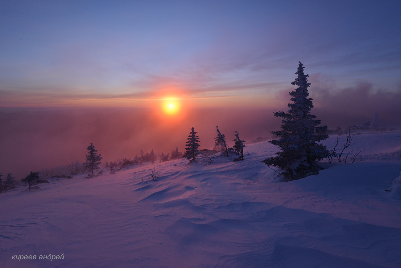
beautiful dawn in the harsh winter conditions
Tags: Chelyabinsk oblast · Zlatoust city
8
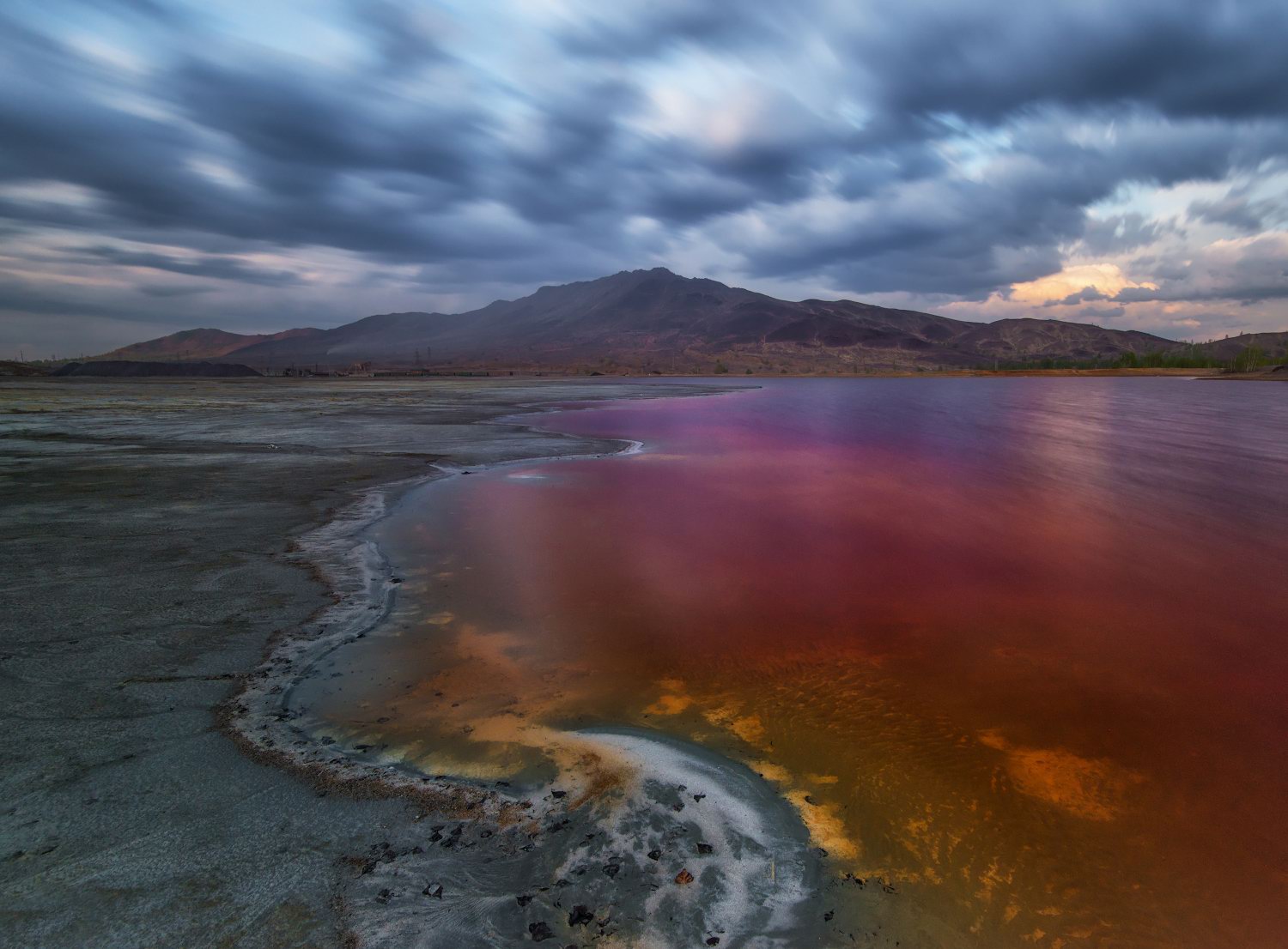
Colors of the Dead World of Karabash
No comments · Posted by Sergei Rzhevsky in Cities, Ecology, Photos
Karabash is a small town with a population of about 11,000 people located in the Chelyabinsk region, 112 km north-west of Chelyabinsk.
Today, it is one of the most polluted places in the world due to the fact that copper has been continuously produced here for more than 100 years, and the toxic chemicals resulting from it have often been discharged into the environment. Karabash on Google Maps. Photos by: Andrey Grachev.
Tags: Chelyabinsk oblast
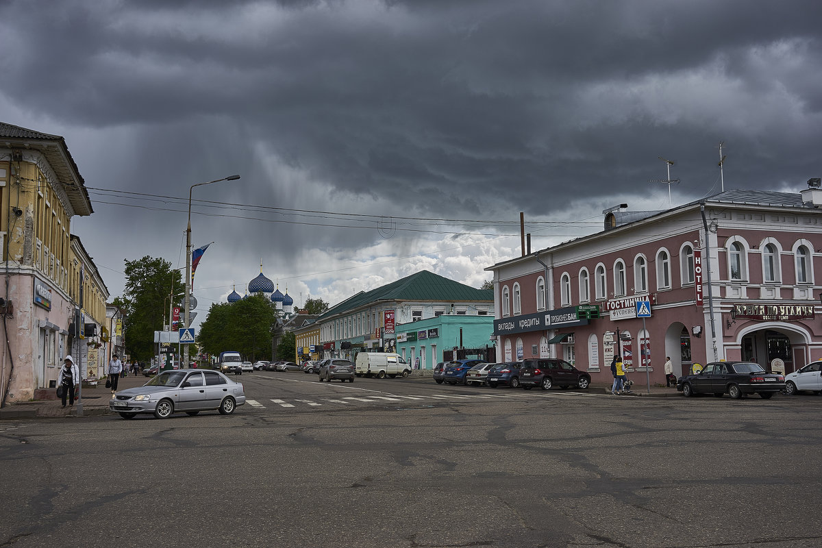
31
Walking around the town-museum of Uglich
No comments · Posted by Sergei Rzhevsky in Architecture, Cities, Travel
Uglich is a town with a population of about 32,000 people located in the Yaroslavl region, 109 km west of Yaroslavl and 250 km north of Moscow. This town, located on the Volga River (Uglich reservoir), was the center of the Uglich Principality in the 13th-16th centuries.
Today, this picturesque town is one of the stops on the popular tourist route “The Golden Ring”. Here you can find a lot of monuments of traditional Russian architecture. Uglich on Google Maps. Photos by: Mikhail Aritkin.
Tags: Yaroslavl oblast