
19
Church of St. Sergius of Radonezh on the Kulikovo Field
No comments · Posted by Sergei Rzhevsky in History, Regions
Church of St. Sergius of Radonezh on the Kulikovo Field, built in 1913-1917, is a monument-church standing on the alleged site of the Battle of Kulikovo (1380) in the southeast of Tula Oblast, about 122 km from Tula.
The architect of the church was Alexey Viktorovich Shchusev. An interesting feature of this church is that one of its towers is crowned by a dome in the shape of a helmet. The Kulikovo Field on Google Maps. Photos by: Vadim Razumov.
Tags: churches · Tula oblast
Just like everything else about Russia, its language also seems somewhat intimidating. While many languages of the world share alphabets that are similar to those of English, the Russian language takes an entirely different lead. And since the Russian language has a different alphabet structure, there’s a common misconception that it’s quite challenging to learn.
Tags: No tags
13
The Benefits of Studying in Russia For Foreigners
No comments · Posted by Alex Smirnov in Education
Should I Study Abroad in Russia?
Russia is usually not among those countries that come to mind when one is thinking about international studies. A country that is often underestimated owing that it has amazing offers for international students.
If you are still asking yourself, “Should I study abroad in Russia?”, then let’s find some reasons why you should include Russia on your list of prospective international study destinations.
Forget Japan, USA, Canada, or Israel, according to the Organization for Economic Cooperation and Development (OECD), Russia has the highest number of educated populations worldwide.
Photo by Nikolay Vorobyev.
Tags: No tags
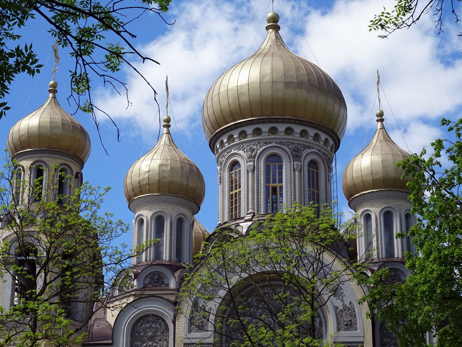
The Resurrection New Jerusalem Monastery is a monastery of the Russian Orthodox Church located in the town of Istra in Moscow Oblast, about 40 km northwest of Moscow.
The monastery was founded by Patriarch Nikon in 1656. According to his plan, the complex of holy places in Palestine was to be recreated near Moscow. By the end of 2016, restoration work was completed in the monastery. New Jerusalem Monastery on Google Maps. Photos by: Stanislav Konstantinov.
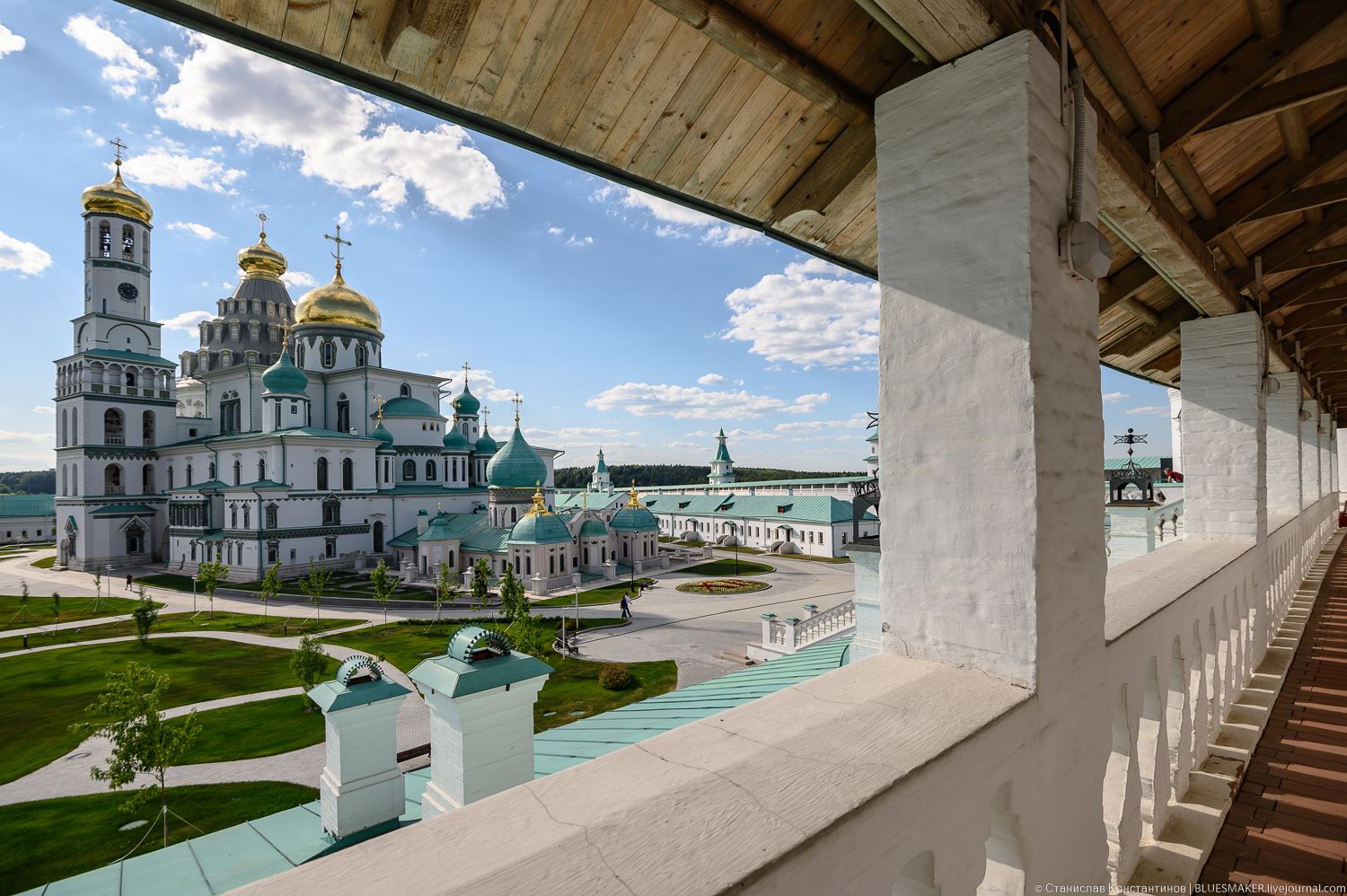
one of the best monasteries in Russia
Tags: Moscow city · Moskovskaya oblast
29
Church of the Icon of Our Lady of Akhtyrka in Moscow Oblast
No comments · Posted by Sergei Rzhevsky in Architecture, Photos, Regions
“Akhtyrka” is a former estate and park complex located on the banks of the Vorya River in Moscow Oblast near the city of Sergiev Posad, about 60 km north-east of Moscow. From 1734 to 1879, it belonged to the princes of the Trubetskoy family.
In 1922, the wooden palace burned down, other structures gradually collapsed. But the Church of the Icon of Our Lady of Akhtyrka (1821-1825) survived. In 1937, it was closed. In 1991, the church was returned to the community of believers, services were resumed. Today, it is a monument of architecture of federal significance. Akhtyrka Church on Google Maps. Photos by: Vadim Razumov.
![]()
Tags: churches · Moscow city · Moskovskaya oblast · Sergiev Posad city
21
The Pokrovsky Khotkov Convent near Moscow
No comments · Posted by Sergei Rzhevsky in Architecture, Regions, Religion
Khotkovo is a town with a population of about 21 thousand people located in Moscow Oblast, about 70 km northeast of the center of Moscow and 14 km southwest of Sergiev Posad.
The town originally appeared as a settlement near the Pokrovsky Khotkov Monastery, first mentioned in 1308. Today, the picturesque ensemble of the Pokrovsky Khotkov Convent is represented by buildings of the 18th-19th centuries. Khotkovo on Google Maps. Photos by: Vadim Razumov.
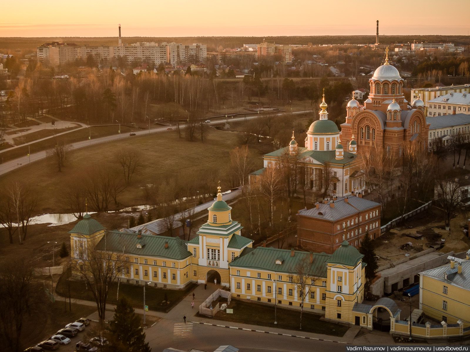
beautiful architectural ensemble
Tags: Moscow city · Moskovskaya oblast · Sergiev Posad city
12
Want to Speak Russian? Best Language Learning Platforms for 2020
No comments · Posted by Alex Smirnov in Education
For many centuries, in a world divided by boundaries and extremely clashing cultures, language has always been the unifying factor. Thanks to the ability to speak more than one language, it is possible to traverse the globe, interacting with people from different parts of the world.
Speaking Russian may not easy for non-Russians, but nearly everyone wants to learn the language. Even before the FIFA World Cup was staged in Russia, people have always enjoyed listening to Russians in blockbuster movies. The accent, the composure, and the oratory skills of Russians is intriguing.
Did you know, you can easily learn Russian and other foreign languages without enrolling in a class? There are multiple new language learning platforms from which you can train and get yourself learning your desired language. Without much ado, we will take a look at five of the best.

Tags: No tags
Arkhangelsk is a city with a population of about 350 thousand people located in the north of the European part of Russia, at the mouth of the Northern Dvina River, 30-35 kilometers from its confluence with the White Sea. It is the administrative center of Arkhangelsk Oblast and the largest city of the Russian North.
Founded in 1584, this city is traditionally considered the capital of Pomor’e – an original region located on the southern coast of the White Sea, distinguished by its culture and even a special dialect of the Russian language. Photos by: Slava Stepanov.

Tags: Arkhangelsk city
1
The Evolution of Religion in Russia: What Does it Look Like Today?
No comments · Posted by Alex Smirnov in Religion
Russia has gone through a religion upheaval over the past century – from one extreme to the next. Learn all about it and the state of religion in Russia in today.
The population of Russia sits well over 142,000,000 people. Of that population, there are five “traditional” religious groups. These include Christians, Muslims, and Jewish people. While it’s recognized as a multi-faith nation today, religion in Russia hasn’t always been so free.
Russian religion has historically waxed and waned according to the political structures of the time. It’s a complex history that anybody interested in Russia should know more about. Whether you’re a history buff or a general fact fanatic, the facts surrounding religion in Russia make for an incredible story. Keep reading to learn more.
Tags: No tags
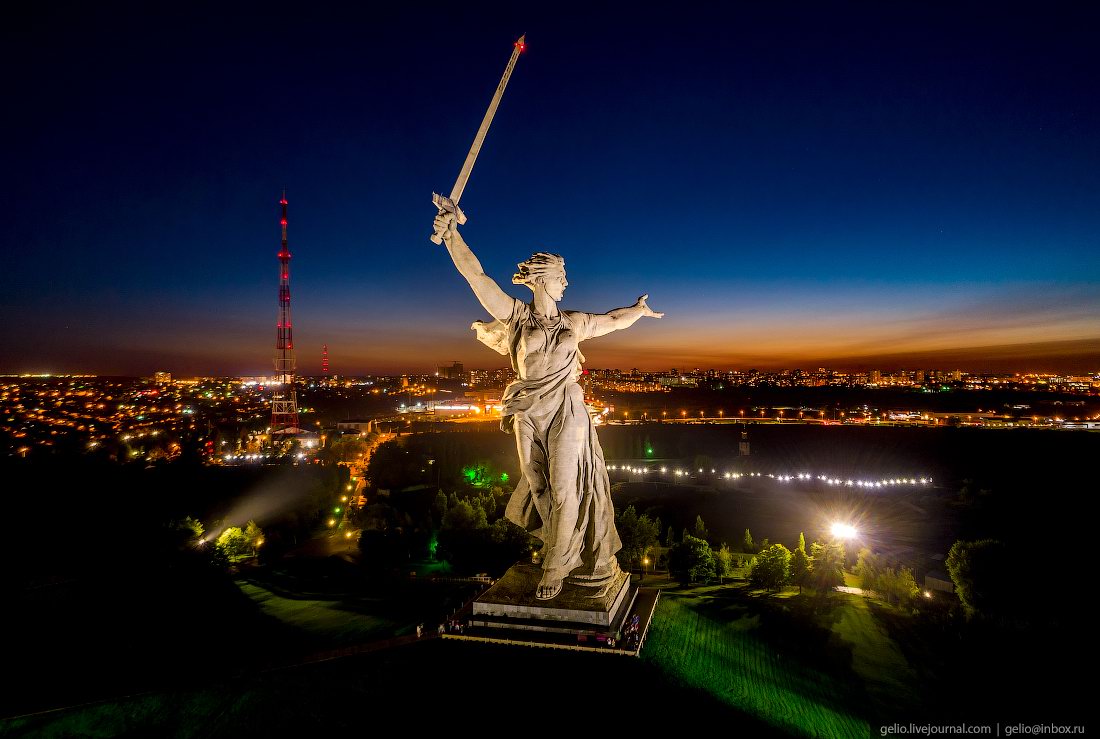
Volgograd is a city with a population of more than 1 million people located on the bank of the Volga River in the southeast of the European part of Russia, the administrative center of Volgograd Oblast. Until 1925, it was called Tsaritsyn, from 1925 to 1961 – Stalingrad.
This city is known in Russia and abroad as the site of one of the main battles of the Second World War – the Battle of Stalingrad. Several matches of the 2018 World Cup were held here. Photos by: Slava Stepanov.
Tags: Volgograd city