
CAT | Travel
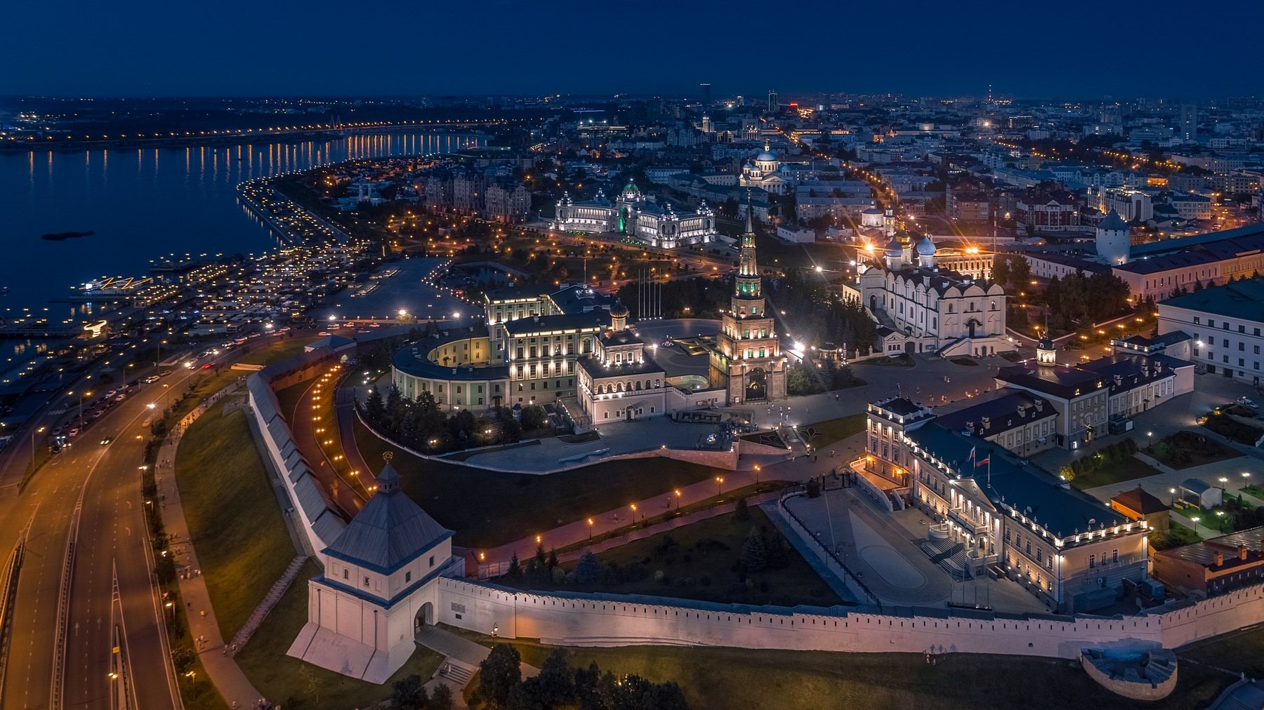
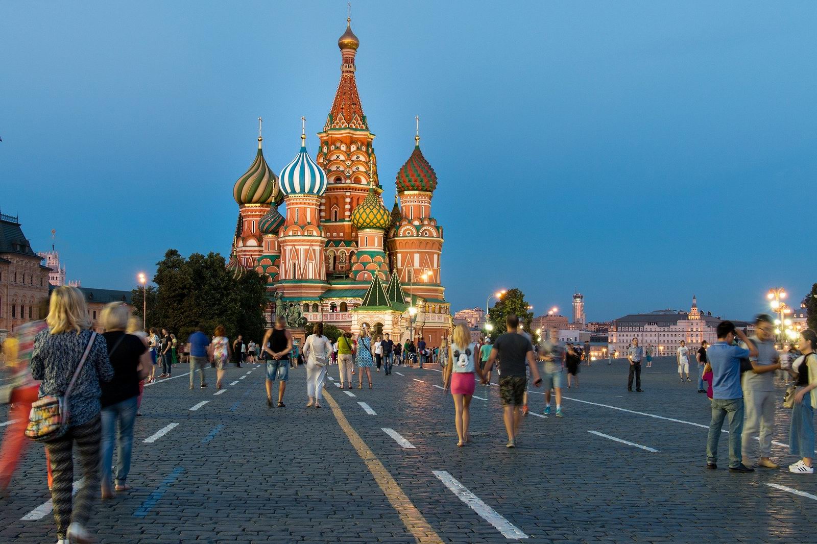
Kazan is the capital of the Republic of Tatarstan, a major port on the left bank of the Volga River, one of the largest economic, scientific, educational, religious, cultural, and sports centers of Russia.
This city, often called the third capital of Russia, is one of the most popular cities for tourists in Russia. Photos by: Kirill Zdorov.

Tags: Kazan city · Tatarstan Republic
4
Astrakhan – one of the oldest cities in southern Russia
No comments · Posted by Sergei Rzhevsky in Cities, Photos, Travel
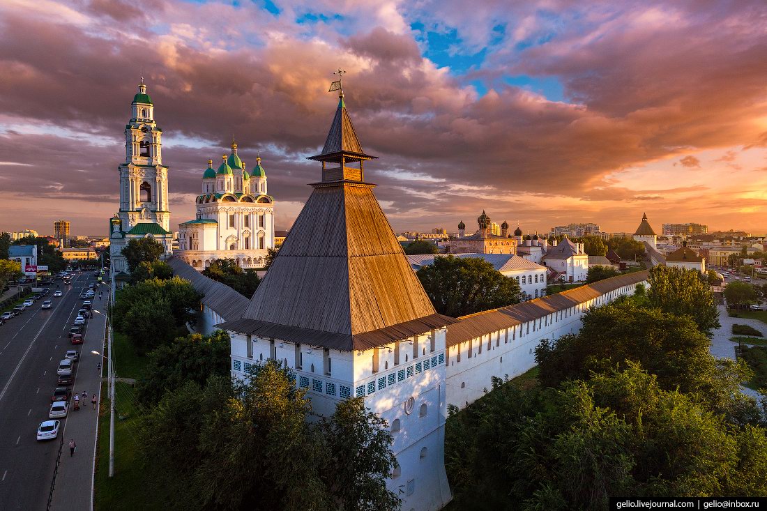
Astrakhan, the administrative center of Astrakhan Oblast, is one of the largest and oldest cities in southern Russia included in the list of historical cities of the country.
This city with a population of about half a million people is located in the upper part of the delta of the Volga River, on 11 islands of the Caspian Lowland, about 80 km from the Caspian Sea. Photos by: Slava Stepanov.
fly over the center of Astrakhan
Tags: Astrakhan city
26
Snow Covered Stone Pillars of Ulakhan-Sis
No comments · Posted by Sergei Rzhevsky in Nature, Regions, Travel
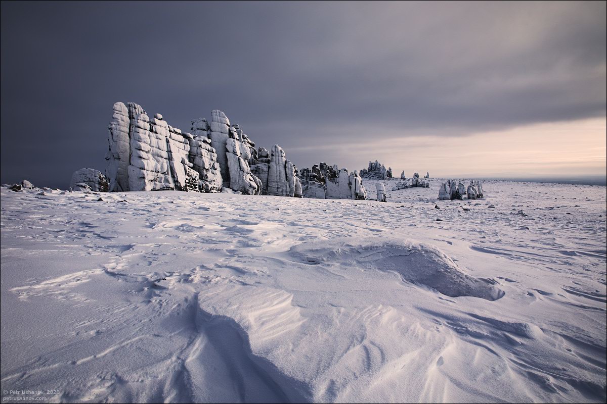
Ulakhan-Sis is a mountain range with a length of about 200 km and a height of up to 754 meters located among the endless swampy forests in the north-east of Yakutia.
Here you can see a large number of various granite pillars 25-30 meters high. This is a very inaccessible place, people don’t live here. The first tourists started visiting it only a few years ago. Ulakhan-Sis on Google Maps. Photos by: Petr Ushanov.
Tags: Sakha Republic · Yakutsk city
15
Syzran – the view from above
No comments · Posted by Sergei Rzhevsky in Cities, Photos, Travel
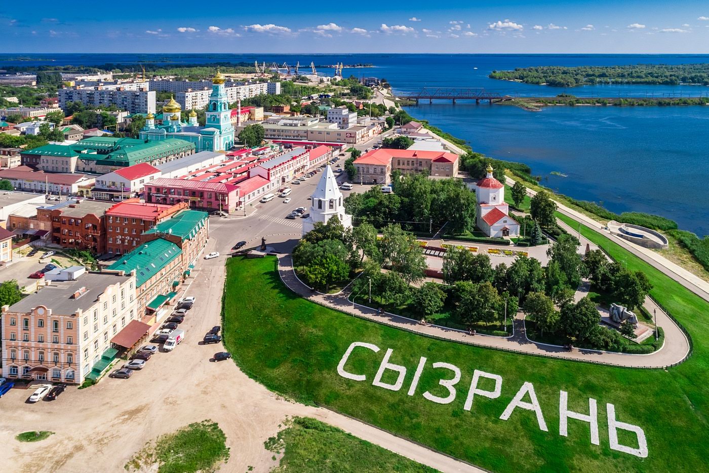
Syzran is a city with a population of about 173 thousand people located in the west of Samara Oblast, the third largest city in the region after Samara and Tolyatti.
The city is located on the right bank of the Volga River (Saratov Reservoir), at the mouth of the Syzranka River. In its central part, Syzran retained the appearance of a merchant Volga town of the 19th century. In total, there are 143 monuments of history, culture, and architecture on its territory. Photos by: Kirill Zdorov.
Tags: Samara oblast · Syzran city
7
Rybinsk – the view from above
No comments · Posted by Sergei Rzhevsky in Cities, Photos, Travel
Rybinsk, first mentioned in 1071, is the second largest city in Yaroslavl Oblast located on the banks of the Volga River, about 87 km northwest of Yaroslavl and 313 km north of Moscow.
During the time of the Russian Empire, it was the country’s largest grain trading center. After the construction of the Rybinsk Hydroelectric Power Station in the 1930s, the Rybinsk Reservoir located to the north-west of the city, became the largest artificial reservoir in the world of its time. Photos by: Roman Smirnov.

fly over the center of Rybinsk
Tags: Rybinsk city · Yaroslavl oblast
29
The Historic Island Town of Sviyazhsk
No comments · Posted by Sergei Rzhevsky in Cities, Regions, Travel
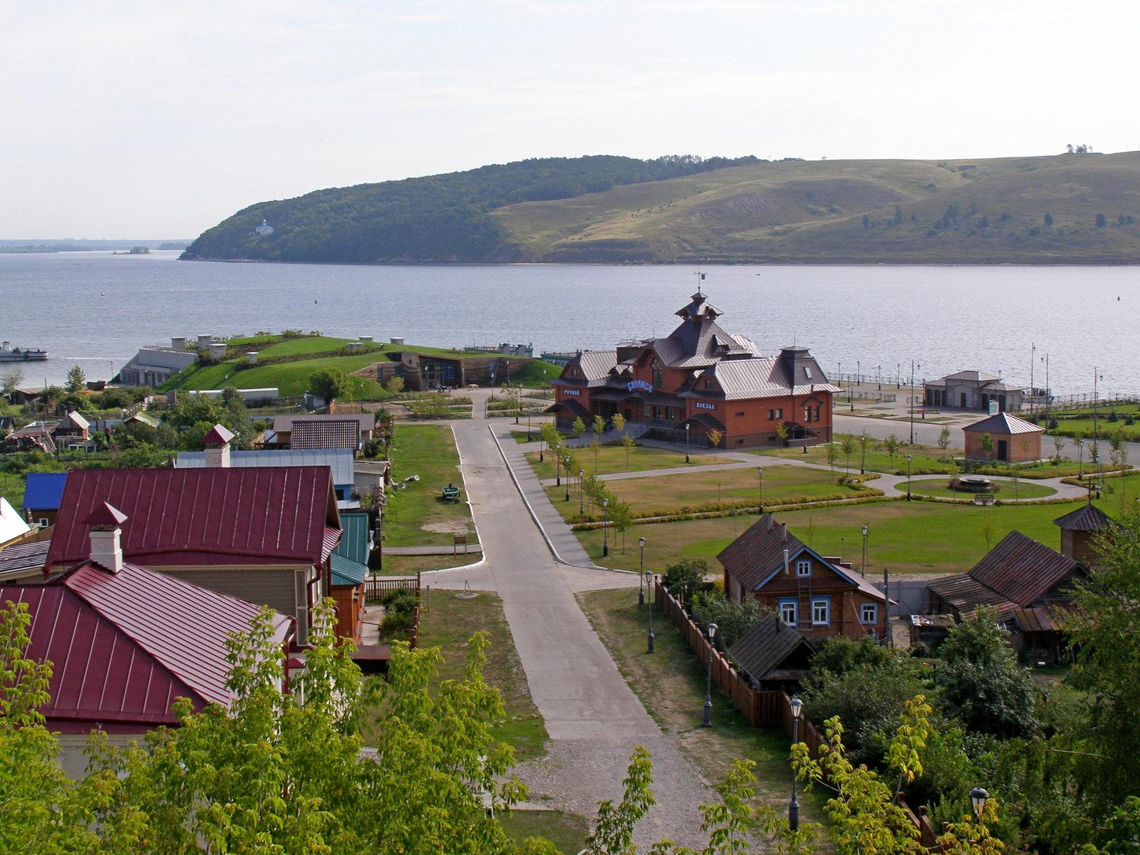
Sviyazhsk is a historic town with a population of about 240 people located on an island at the confluence of the Sviyaga and the Volga rivers in the Republic of Tatarstan, about 58 km south-west of Kazan.
Founded as a fortress in 1551, it became the base of Russian troops during the siege of Kazan, the capital of the Kazan Khanate, in 1552. Sviyazhsk became the first Orthodox town in the Middle Volga region, the center of the Christianization of the peoples of the Volga region. Sviyazhsk on Google Maps. Photos by: Alexander Butenko.
Sviyazhsk River Station.
Tags: Kazan city · Tatarstan Republic
21
The Epiphany Cathedral in Yelokhovo, Moscow
No comments · Posted by Sergei Rzhevsky in Architecture, Religion, Travel
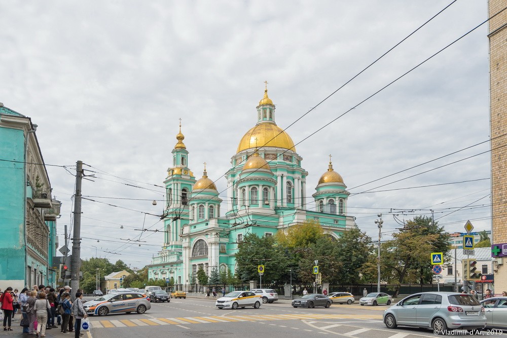
The Epiphany Cathedral in Yelokhovo is an Orthodox church located in Basmanny District of Moscow (Spartakovskaya Street, 15). It was built by the architect Evgraf Tyurin in 1835-1845. In the area of the cathedral, there was previously the village of Yelokhovo, which became part of Moscow in the 18th century.
The cathedral was constructed in the late Empire style with a dome rotunda in the center, with some features imitating the dome of St. Peter’s Basilica in Rome. The height of the cathedral is 56 meters, area – 1,164 square meters, capacity – 3,000 people. Today, it is one of the most beautiful Orthodox churches in Moscow. The Epiphany Cathedral in Yelokhovo on Google Maps. Photos by: Vladimir Dar.
Tags: Moscow city
12
Wooden Church of the Nativity of Mary in Rozhdestvenskaya
No comments · Posted by Sergei Rzhevsky in Architecture, Regions, Travel
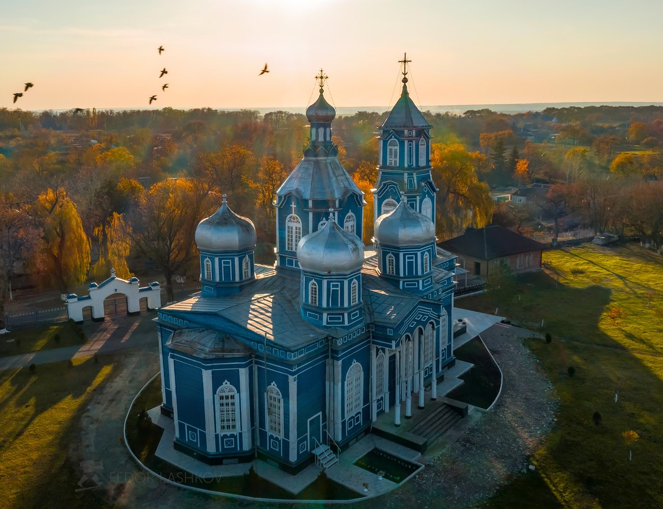
Rozhdestvenskaya is a stanitsa (a Cossack village) with a population of about 2,800 people located in Stavropol Krai in Southern Russia, about 35 km northwest of Stavropol. This settlement, founded in 1797, was named after the feast of the Nativity of the Blessed Virgin Mary.
The main architectural attraction of Rozhdestvenskaya is the Church of the Nativity of the Blessed Virgin Mary (1873) – one of the few preserved monuments of wooden architecture in the region, a cultural heritage site of regional importance. Rozhdestvenskaya on Google Maps. Photos by: Fedor Lashkov.
Tags: churches · Stavropol krai
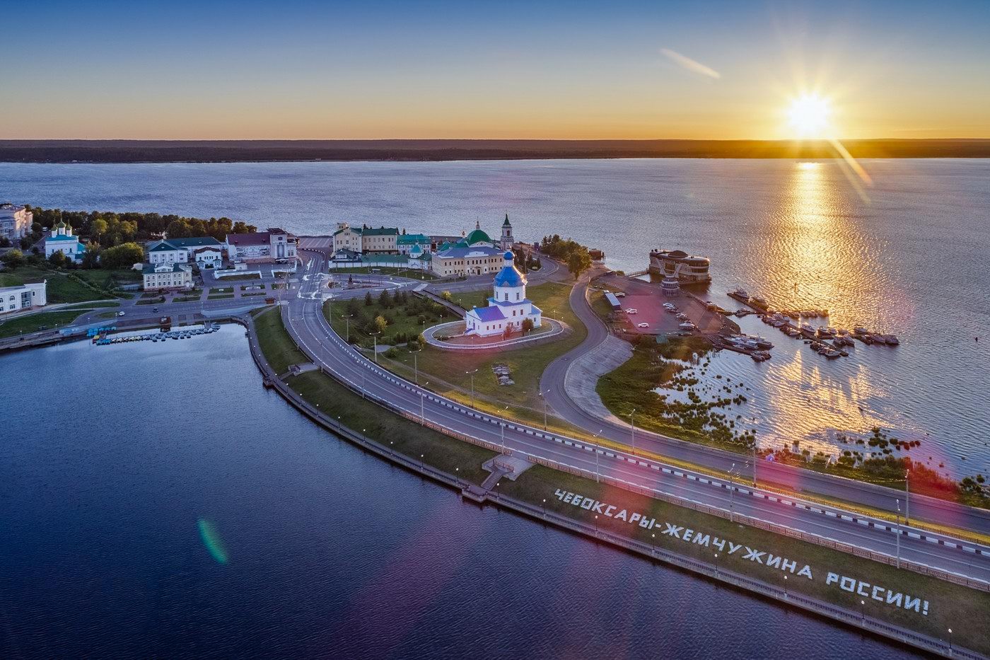
Cheboksary (Shupashkar in the Chuvash language) is a city in Russia with a population of about half a million people standing on the bank of the Volga River, the capital of the Chuvash Republic.
Located about 671 km east of Moscow, it is one of the cleanest and most comfortable cities in Russia. Photos by: Kirill Zdorov.
Dawn in the historic center of Cheboksary. The sign says: “Cheboksary – the pearl of Russia!”
Tags: Cheboksary city · Chuvashia Republic
23
Tours to Russia from America – what you need to know
No comments · Posted by Alex Smirnov in Travel
Russia is one of the most attractive recent destinations. The country fascinates millions of visitors with its epic landscapes, world-class museums, and diverse society. Planning a trip to this unknown country of contrasts is exciting and cannot be underestimated to enjoy a successful trip.
Touring in Russia can be easy and fascinating, if you know some things every visitor should know to avoid misunderstandings. Tourism in Russia is well developed, and if you buy all-inclusive Russia tour packages, you will be given all the necessary information by your travel agent. On the other hand, if you decide to go independently, you need to prepare for your trip carefully.
Tags: No tags