
CAT | Regions
22
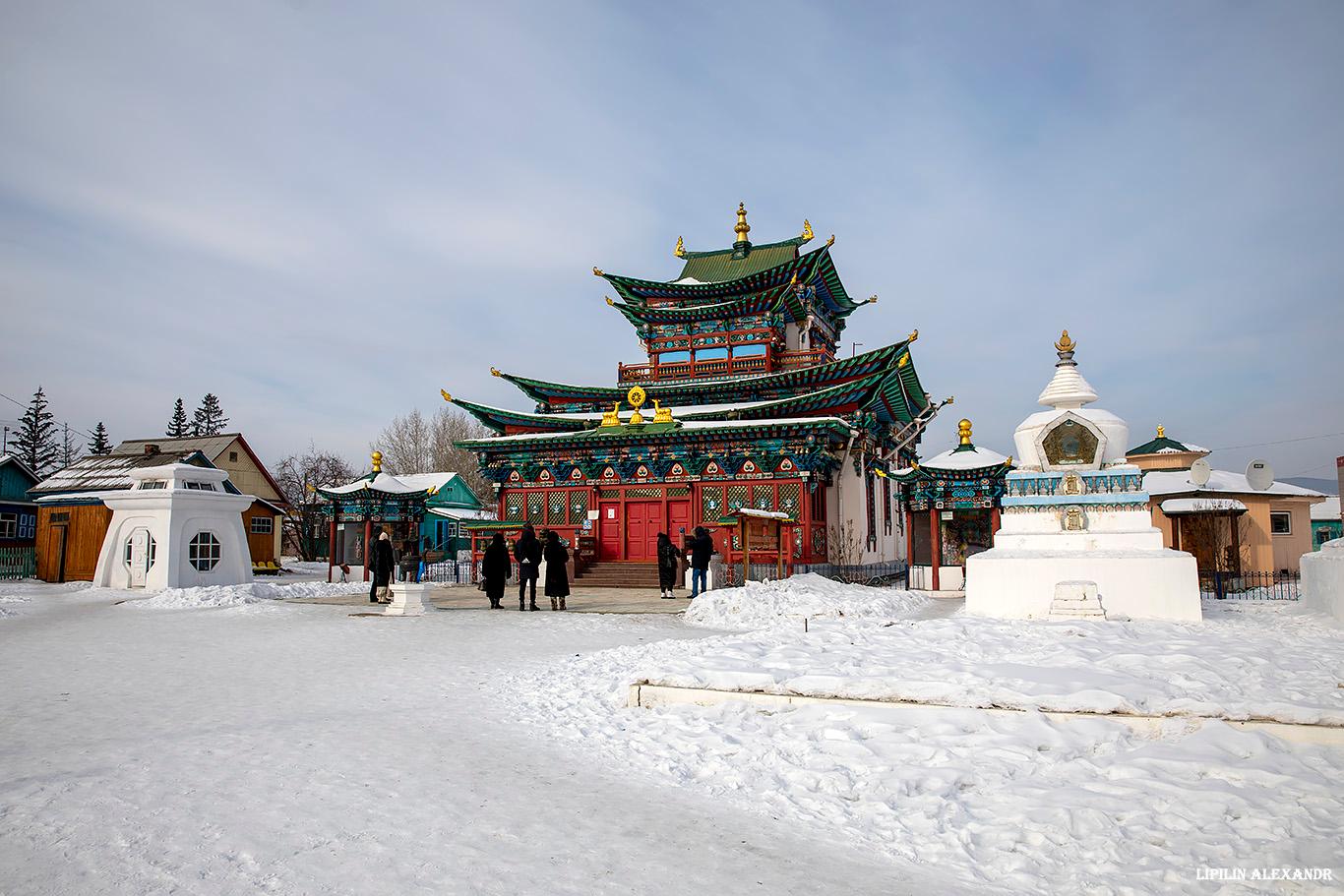
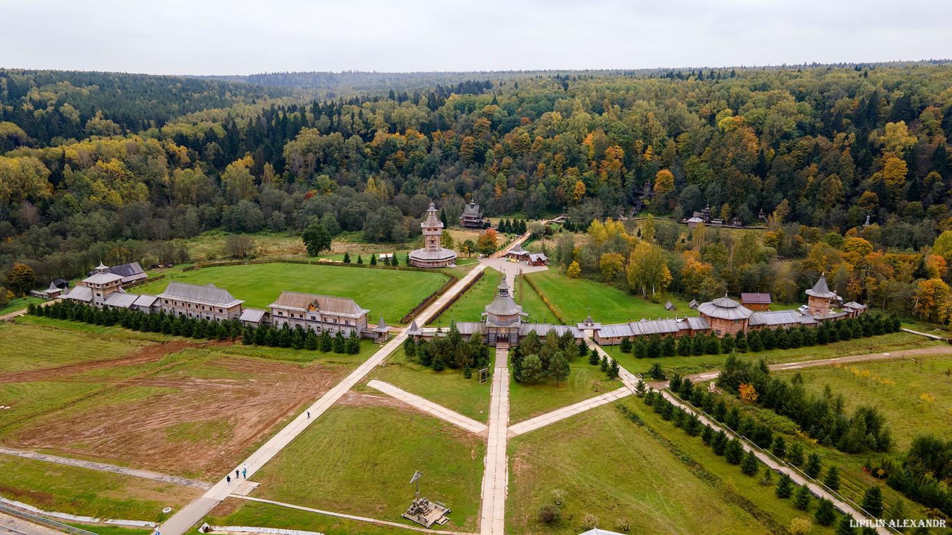
Ivolginsky Datsan – the center of Buddhism in Russia
No comments · Posted by Sergei Rzhevsky in Regions, Religion, Travel
Ivolginsky Datsan “Khambyn Khuree” (“Abode of the Wheel of Teaching, bringing happiness and full of joy”) is a Buddhist monastery-university, the center of the Buddhist traditional Sangha of Russia, which is the largest Buddhist community in Buryatia and one of the largest in the country.
This monument of history and architecture is located in the Republic of Buryatia in the village of Verkhnyaya Ivolga, about 36 km west of the center of Ulan-Ude, the capital city of the republic. Ivolginsky Datsan on Google Maps. Photos by: Alexandr Lipilin.

Tags: Buryat Republic · Ulan-Ude city
22
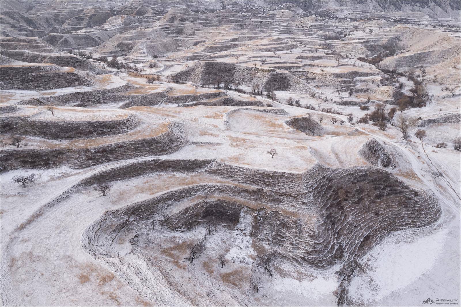
Snow-covered mountain terraces of Dagestan
No comments · Posted by Sergei Rzhevsky in Nature, Regions
The abandoned mountain terraces of Dagestan, several thousand years old, are among the most interesting sights of this region. The largest number of them has been preserved in the Gunib and Dadakhan districts.
The mountain terraces of Bali, China, Peru, and other regions of Southeast Asia and Latin America are known all over the world. In some countries, mountain terraces are UNESCO World Heritage Sites.
Tags: Abandoned · Dagestan Republic
28
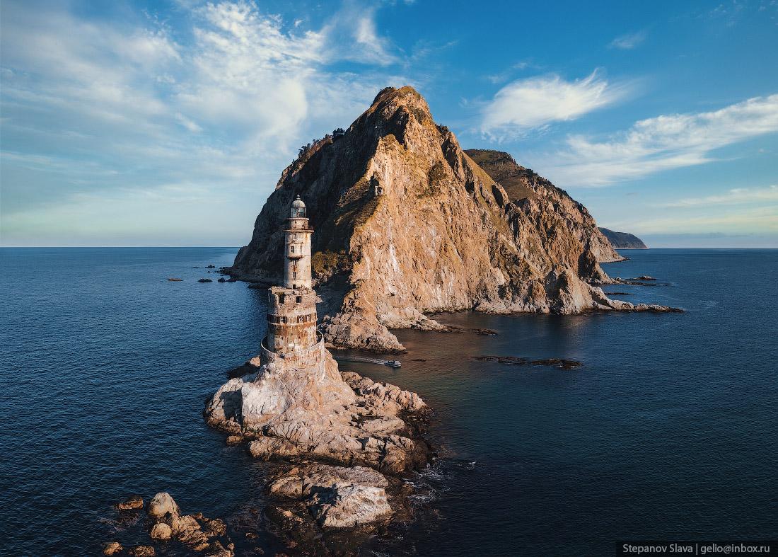
Abandoned Aniva Lighthouse on Sakhalin Island
1 Comment · Posted by Sergei Rzhevsky in Architecture, Regions, Travel
The Aniva Lighthouse is an amazingly picturesque abandoned lighthouse located on Cape Aniva in the very south of Sakhalin Island in the Far East of Russia. The height of the building is 31 meters, the height of light – 40 meters above sea level.
This mysterious place is an important tourist attraction of Sakhalin. Tourists usually come here on private boats. The lighthouse is gradually destroyed by water and wind. In the coming years, it is quite possible that repairs will be carried out to preserve this unique building. The Aniva Lighthouse on Google Maps. Photos by: Slava Stepanov.
Tags: Abandoned · Sakhalin oblast
4
Putorana Plateau – the land of lakes and waterfalls
No comments · Posted by Sergei Rzhevsky in Nature, Regions, Travel
Putorana is a mountain range (plateau), located in the heart of Siberia, in the northern part of Krasnoyarsk Krai.
The maximum height of the plateau is 1,701 m. Its area is about 250,000 square km, which is about the same as the area of the UK (242,495 square km). The Putorana Plateau on Google Maps. Photos by: Slava Stepanov.

Tags: Krasnoyarsk krai
Khunzakh is a very picturesque village with a population of 4 thousand people located in the southern mountainous part of the Republic of Dagestan, 140 km southwest of the city of Makhachkala, at an altitude of about 1,700 meters above sea level.
The houses here are built on the very edge of the Khunzakh plateau, where the height of sheer cliffs reaches 100 meters. Khunzakh on Google Maps. Photos by: Slava Stepanov.
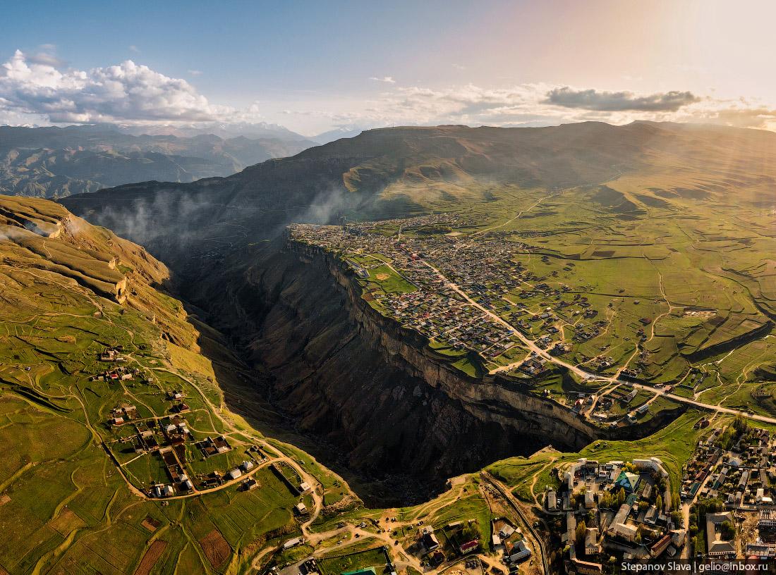
very picturesque mountain village
Tags: Dagestan Republic · Makhachkala city
23
Natural Spring Gremyachiy Klyuch in Moscow Oblast
No comments · Posted by Sergei Rzhevsky in Regions, Religion, Travel
Gremyachiy Klyuch is a natural spring located on the right bank of the Vondiga River, about 80 km northeast of Moscow, in the Sergiev Posad district of Moscow Oblast. The temperature of the water in the spring is constant all year round (6 degrees Celsius) and is considered curative.
According to legend, the spring appeared thanks to the prayer of Sergius of Radonezh (1314-1392), one of the most highly venerated saints of the Russian Orthodox Church. Today, the approaches to it have been landscaped, a church, a chapel, a refectory, a church shop with souvenirs, and baths have been built.
very picturesque tourist destination
Tags: Moscow city · Moskovskaya oblast
28
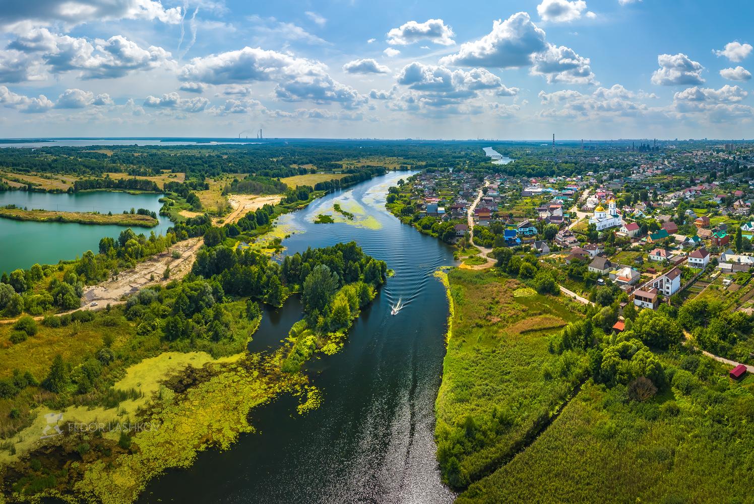
Summer in the Lipetsk Nature Reserve
No comments · Posted by Sergei Rzhevsky in Nature, Regions
The Lipetsk Reserve stretches along the left bank of the Voronezh River to the south of the city of Lipetsk. The territory of the reserve is about 13 thousand hectares. It protects the natural landscape of the area, including relic plants, rare insects inhabiting limestone rocks, birds, and wild animals.
Hunting is strictly prohibited here, fishing – only with permission. In 2004, the Lipetsk Reserve became part of the National Park, where, in addition to the protected area, it is planned to create a recreation area for people with a hotel, a nature museum, a zoo, and stables. Lipetsk Nature Reserve on Google Maps. Photos by: Fedor Lashkov.
beautiful sunny day near Lipetsk
Tags: Lipetsk city
6
Picturesque Landscapes along the Chuysky Trakt
No comments · Posted by Sergei Rzhevsky in Nature, Regions, Travel
The federal highway R256 “Chuya Trakt” (The Chuya Highway) is a federal highway Novosibirsk – Novoaltaysk (access road to Barnaul) – Biysk – Maima (access road to Gorno-Altaisk) – the state border with Mongolia.
The length of this highway passing through the territory of Novosibirsk Oblast, Altai Krai and the Altai Republic is about 968 kilometers. The Chuysky Trakt on Google Maps. Photos by: Alexandr Lipilin.
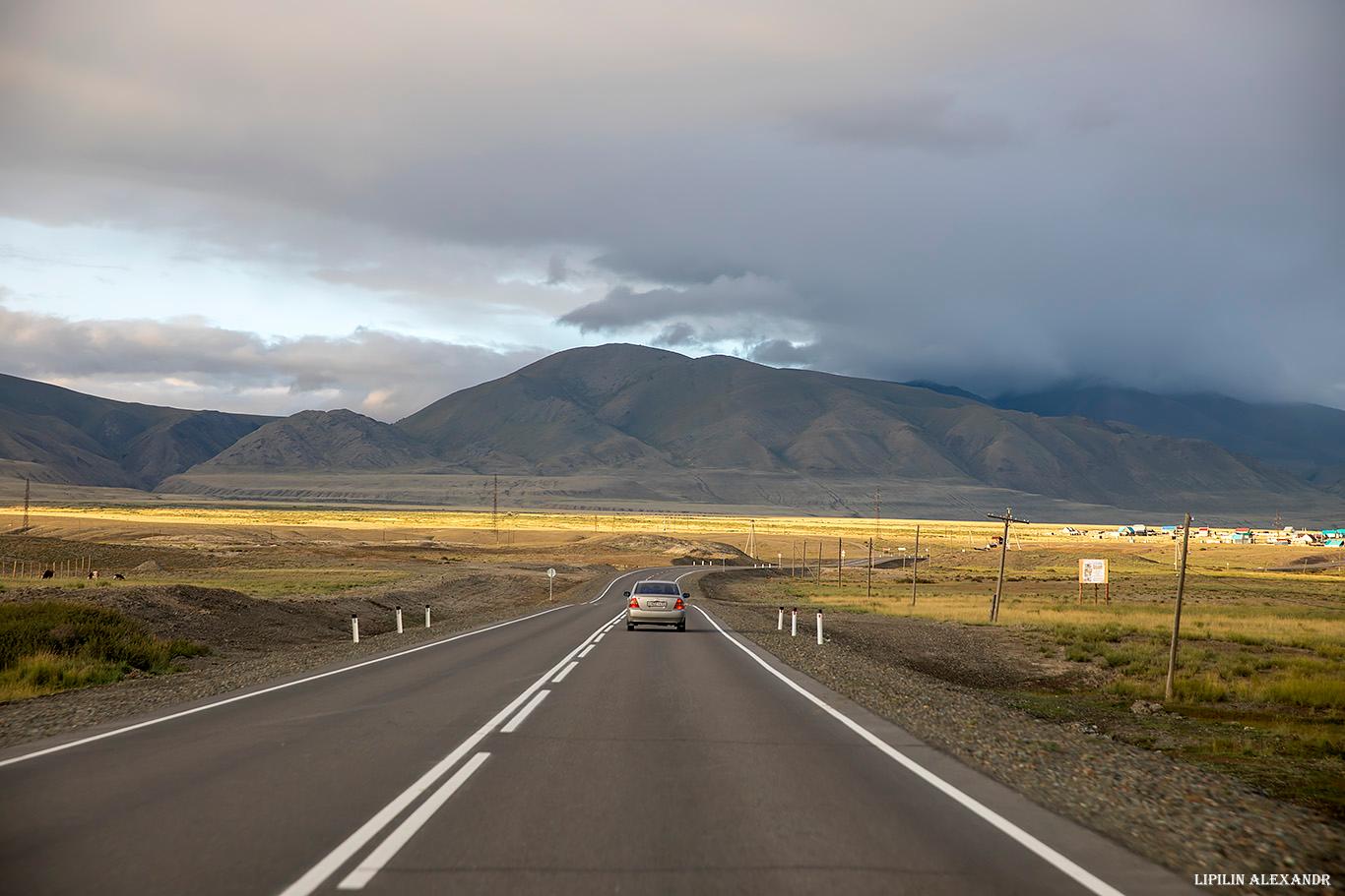
probably the most picturesque highway in Russia
Tags: Altai krai · Altay Republic
31
Vasilyevsky (Shcherbatovsky) Castle in Moscow Oblast
No comments · Posted by Sergei Rzhevsky in Architecture, Regions, Travel
Vasilyevsky Castle (also known as Shcherbatovsky Castle) is located in the village of the sanatorium named after Alexander Herzen in Moscow Oblast, about 65 west of the center of Moscow.
It was built by the architect Peter Boitsov by order of Prince Alexander Shcherbatov in the right-bank part of his estate in 1881. Vasilyevsky (Shcherbatovsky) Castle on Google Maps. Photos by: Alexandr Lipilin.

Tags: Moscow city · Moskovskaya oblast · Russian Empire
20
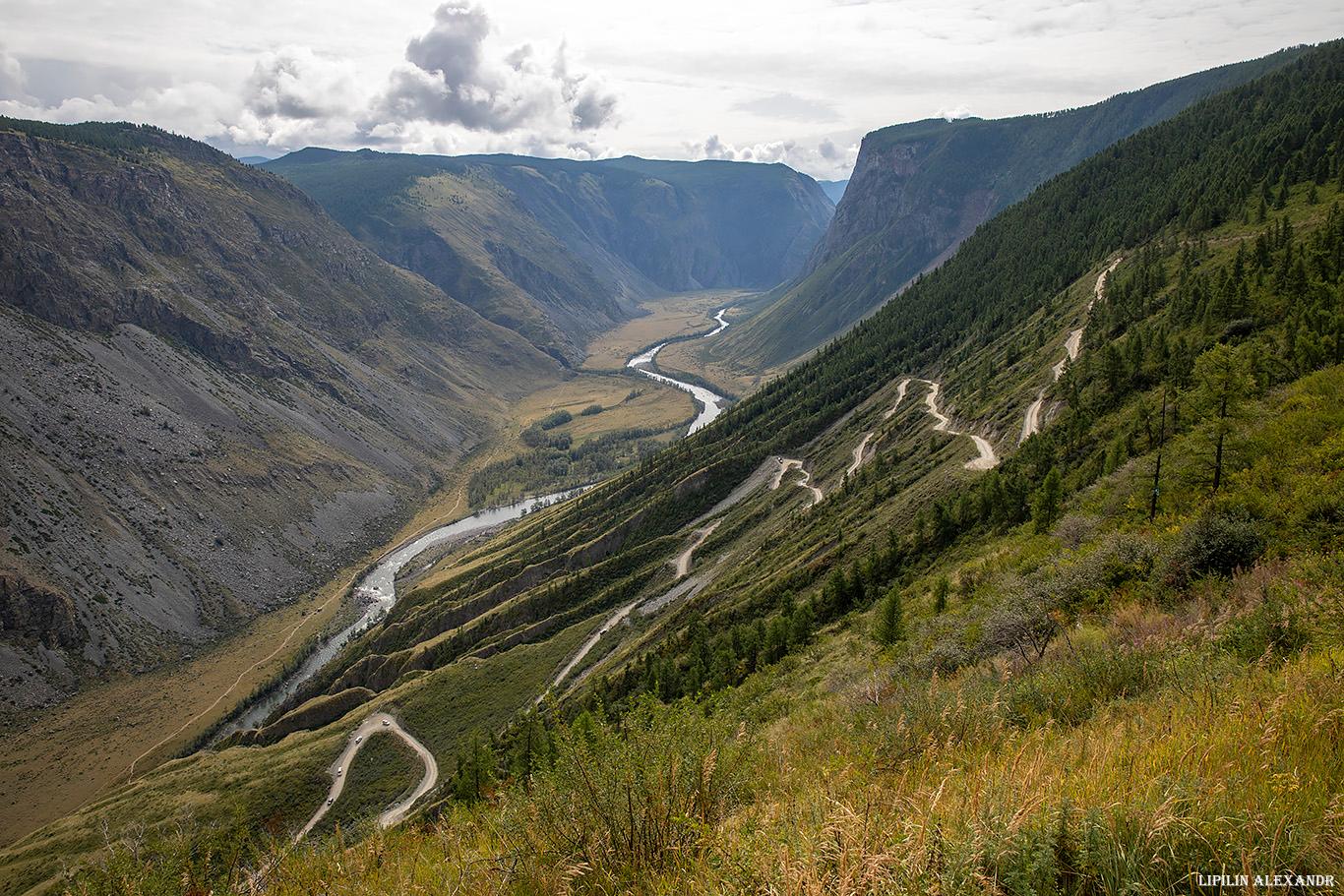
Katu-Yaryk – the most unusual pass in the Altai Republic
No comments · Posted by Sergei Rzhevsky in Nature, Regions, Travel
Katu-Yaryk Pass, one of the most difficult and dangerous passes in the Altai Mountains, is located on the territory of the Ulagan district of the Altai Republic.
Until 1989, there was no road descending from the Ulagan Plateau into the valley of the Chulyshman River. Residents of the surrounding villages used a steep horse trail or a waterway through Lake Teletskoye. Katu-Yaryk Pass on Google Maps. Photos by: Alexandr Lipilin.
Tags: Altay Republic