
CAT | Regions
Kenozersky National Park is a natural and historical-cultural complex located in the south-western part of the Arkhangelsk region, at the junction of the Plesetsk and Kargopol districts.
In 2004, the park received the status of a biosphere reserve and was included in the UNESCO list of biosphere reserves.
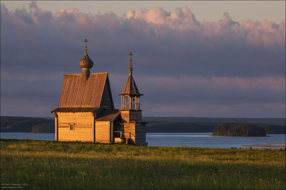
preserved corner of ancient Russia

Tags: Arkhangelsk oblast
5
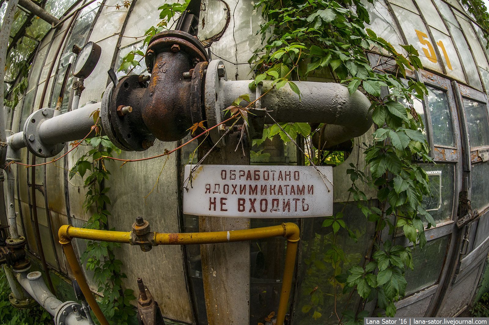
Abandoned greenhouse complex near Moscow
No comments · Posted by Sergei Rzhevsky in Nature, Photos, Regions
This greenhouse complex, consisting of dozens of greenhouses and located somewhere in the Moscow region, was opened in the 1960s. It was used to grow a variety of plants (annual flowers, perennial trees, shrubs) for landscaping of Moscow and several cities in the region.
Several years ago, the complex stopped working and eventually became an abandoned object with a crazy atmosphere of a post-apocalyptic world. Photos by: Lana Sator.
Tags: Abandoned · Moskovskaya oblast
28
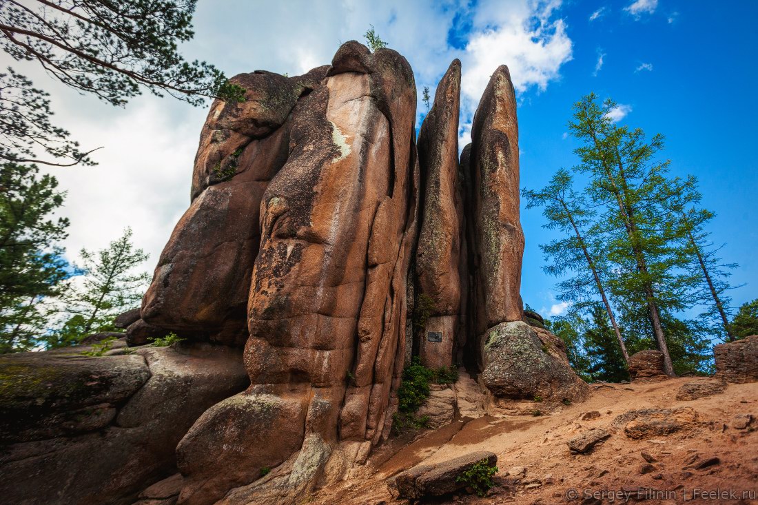
The State Nature Reserve “Stolby”
No comments · Posted by Sergei Rzhevsky in Nature, Regions, Travel
The state nature reserve “Stolby” (“Pillars”) is located in the north-western spurs of the Eastern Sayan – a mountain range in southern Siberia. From the north-east it is adjacent to the city of Krasnoyarsk, a city bus ( “Turbaza” stop) goes to the border of the reserve.
This is a unique corner of Siberian nature with diverse landscapes, one of the main natural attractions of the Krasnoyarsk region. Photos by: Sergey Filinin.
Tags: Krasnoyarsk krai
22
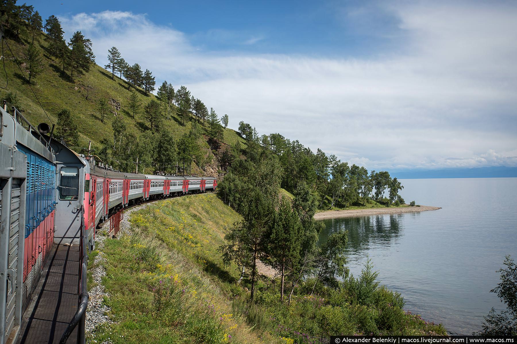
The train ride along the shore of Lake Baikal
1 Comment · Posted by Sergei Rzhevsky in Entertainment, Regions, Travel
If you are going to visit Lake Baikal in the Irkutsk region, you should definitely take part in the following trip – a train ride along the shore of Baikal on the historical part of the Trans-Siberian Railway.
The Circum-Baikal Railway was the most complex and expensive part of the Trans-Siberian Railway of the Russian Empire. Today, it has become a place for a unique guided tour. Photos by: Alexander Belenkiy.
Tags: Irkutsk oblast
14
The white waterfalls of the southern Kamchatka
No comments · Posted by Sergei Rzhevsky in Nature, Regions, Travel
Kamchatka, a peninsula stretching from north to south for 1,200 km, is located in the north-eastern part of Eurasia, in Russia. This is one of the most beautiful regions in the country known mainly for its volcanoes.
One of the interesting places can be found at a distance of one-day walk from Pauzhetka village, on the outer slope of Koshelev volcano. The water in the local rivers and waterfalls has a distinct white color due to the concentrated alumina. Photos by: lusika33.
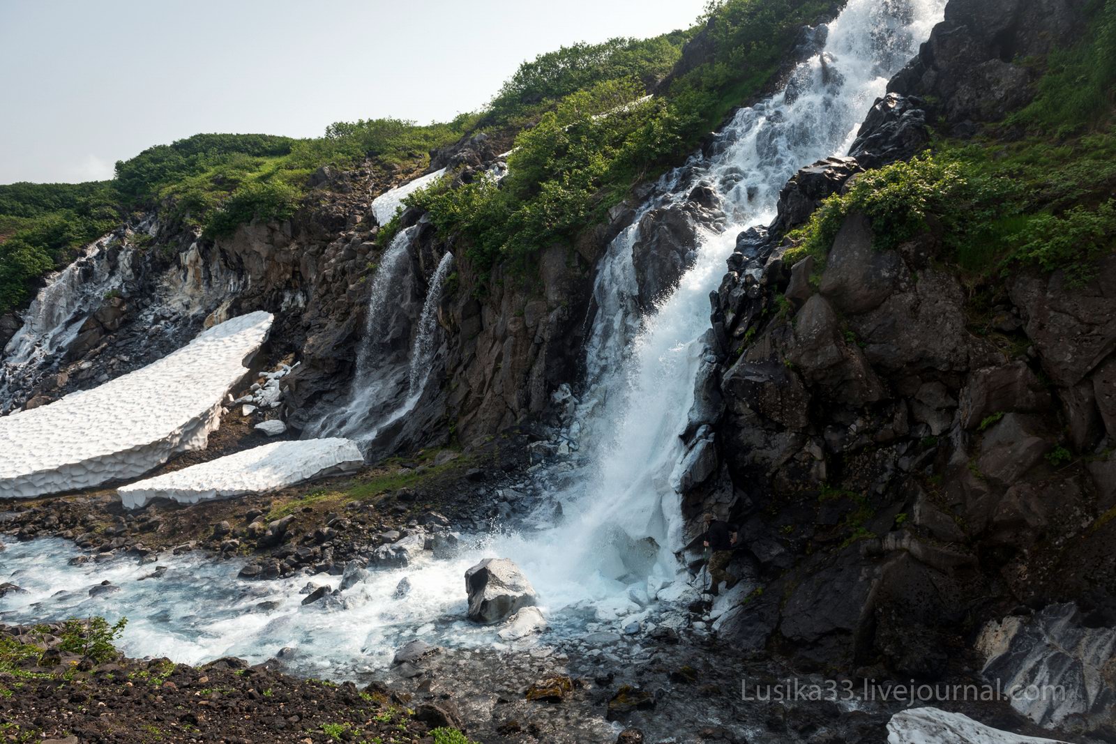
Tags: Kamchatka krai
9
The lava fields and dead forest of Tolbachik
1 Comment · Posted by Sergei Rzhevsky in Nature, Regions, Travel
Tolbachik is a volcanic massif located in the east of Kamchatka. It consists of two major volcanoes – Ostry Tolbachik (extinct) (3,682 m) and Plosky Tolbachik (active) (3,140 m). Around them there are dozens of smaller ridges and cones.
The lava fields of Tolbachik, a huge river of lava emerged only a few years ago, look like landscapes of Mordor. Tolbachik on Google Maps. Photos by: Anton Petrus.
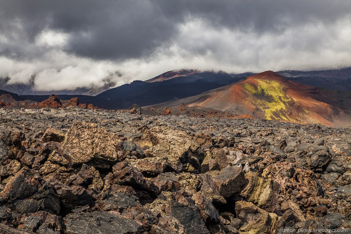
Tags: Kamchatka krai
26
Abandoned ancient village in the mountains of Dagestan
2 Comments · Posted by Sergei Rzhevsky in History, Regions, Travel
Gamsutl is a picturesque Avar village located on top of Mount Gamsutlmeer, in Gunibsky district of Dagestan. This village is one of the oldest settlements on the territory of the republic.
Translated from the Avar, the word “gamsutl” means “at the foot of the khan’s fortress”, from what historians have concluded that once, in ancient times, Khan chose this place to build his fortress or tower. Gamsutl on Google Maps. Photos by: Olga Stanina.

explore the abandoned settlement
Tags: Abandoned · Dagestan Republic
13
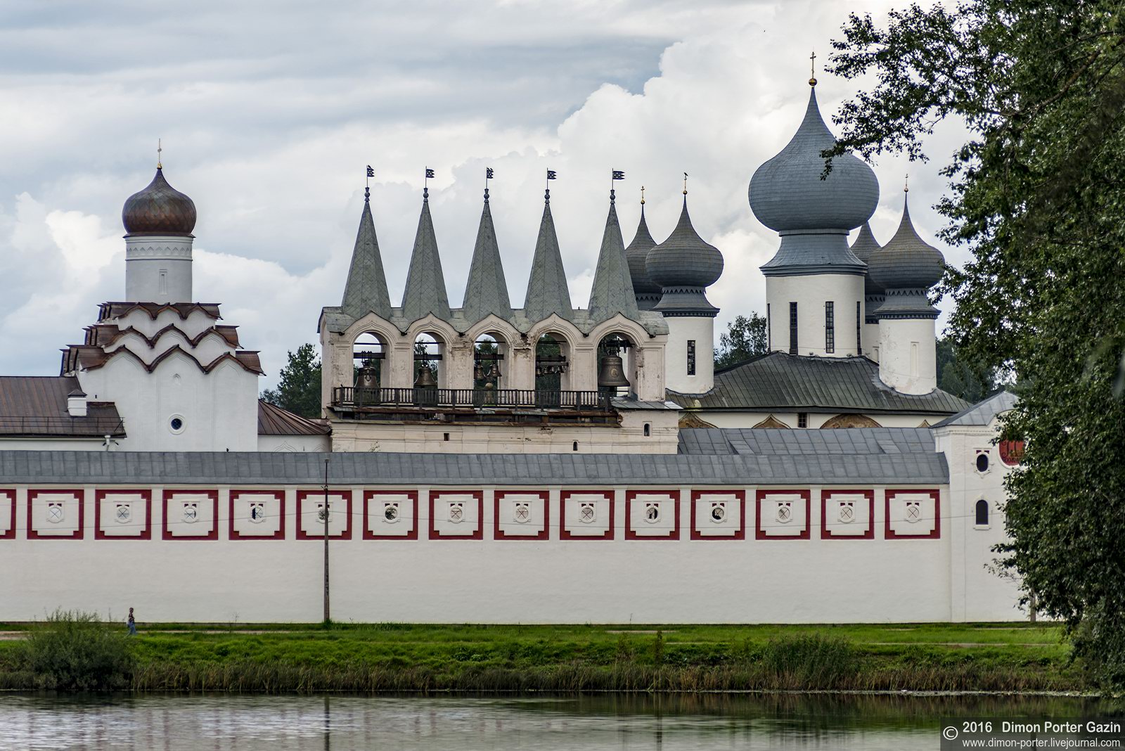
Tikhvin Assumption Monastery
No comments · Posted by Sergei Rzhevsky in Regions, Religion, Travel
The Marian Tikhvin Assumption Monastery is an Orthodox monastery located in the town of Tikhvin in the Leningrad region, about 220 kilometers east of St. Petersburg.
Pimen, the Archbishop of Novgorod, founded the monastery by the order of Ivan the Terrible in 1560. The main relic of the monastery is the miracle-working Tikhvin Icon of the Holy Mother. Tikhvin Monastery on Google Maps. Photos by: Dmitriy Gazin.
Tags: Leningrad oblast
9
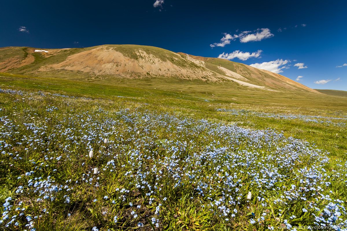
The beauty of the wild flowers of all colors in Altai
No comments · Posted by Sergei Rzhevsky in Nature, Photos, Regions
Altai is a true sanctuary of wild flowers. You can easily find large flower meadows of all colors – from bright orange to sky blue.
Most of the following photos were made during a trip on the Ukok plateau located in the extreme south of the Altai Republic, on the border of Kazakhstan, China, Mongolia, and Russia. Photos by: Anton Petrus.
Forget-me-nots.
Tags: Altay Republic
1
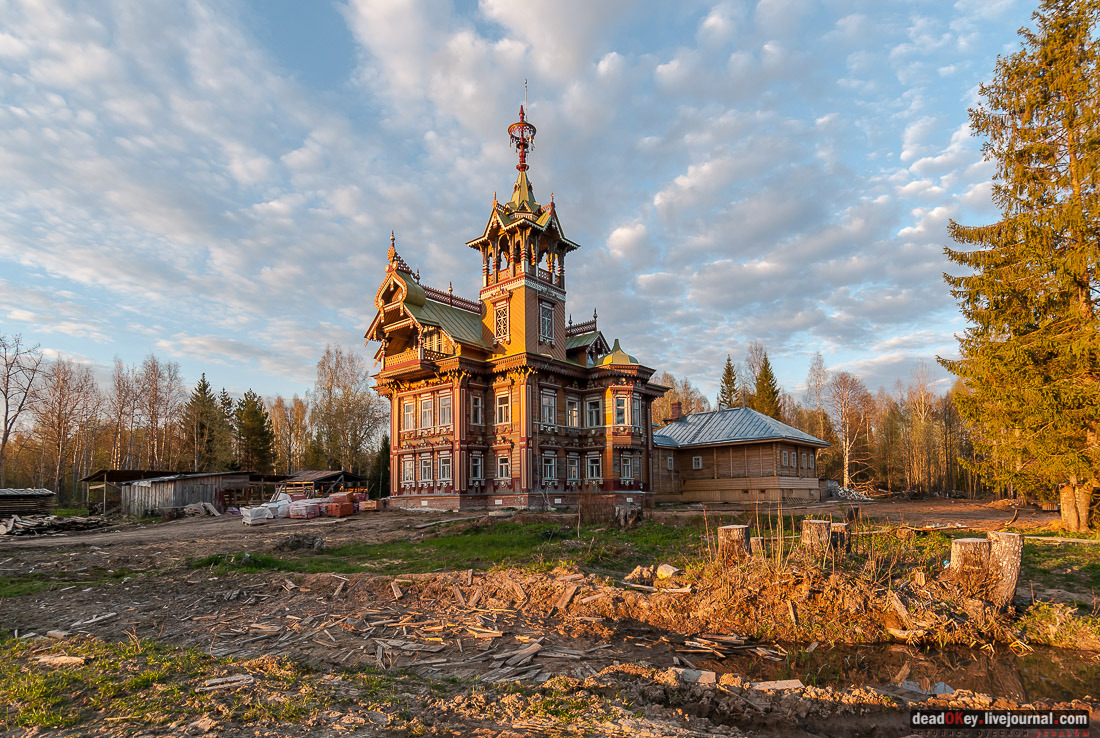
The Wooden Palace in Astashovo
1 Comment · Posted by Sergei Rzhevsky in Architecture, Regions, Travel
In the Chukhlomsky district of the Kostroma region, hidden between forests and abandoned villages, there is a beautiful wooden palace designed by the famous architect Ivan Ropet (1845-1908).
The house was built by Martyan Sazonov for Yelizaveta Dobrovolskaya, his second wife, in the late 19th century. He was of peasant origin but that did not stop him to go to St. Petersburg and become a major construction businessman. Photos by: Vadim Razumov.
Tags: Kostroma oblast