
7
Nikolai Bugrov’s Summer Dacha in Volodarsk
No comments · Posted by Sergei Rzhevsky in Architecture, Regions, Travel
Volodarsk is a small town with a population of about 10 thousand people located in Nizhegorodskaya Oblast, about 60 km west of Nizhny Novgorod. In most cases, the main tourist attraction of small Russian towns is the local museum of local lore and Volodarsk is no exception.
However, the museum in Volodarsk occupies a unique wooden building known as “Nikolai Bugrov’s Summer Dacha” – one of the few surviving houses of similar architecture in the European part of Russia. Photos by: Anna Sukhareva and Yaroslav Gunin.


Tags: Nizhegorodskaya oblast · Nizhny Novgorod city · Russian Empire
Maykop (“the valley of apple trees” from the Adyghe language) is a city with a population of about 139 thousand people located in the south of European Russia, the capital of the Republic of Adygea.
The main urban development of Maykop was carried out in Soviet times and it was done quite systematically. The streets of the city for the most part are strictly perpendicular to each other, its entire center consists of identical city blocks. Photos by: Slava Stepanov.
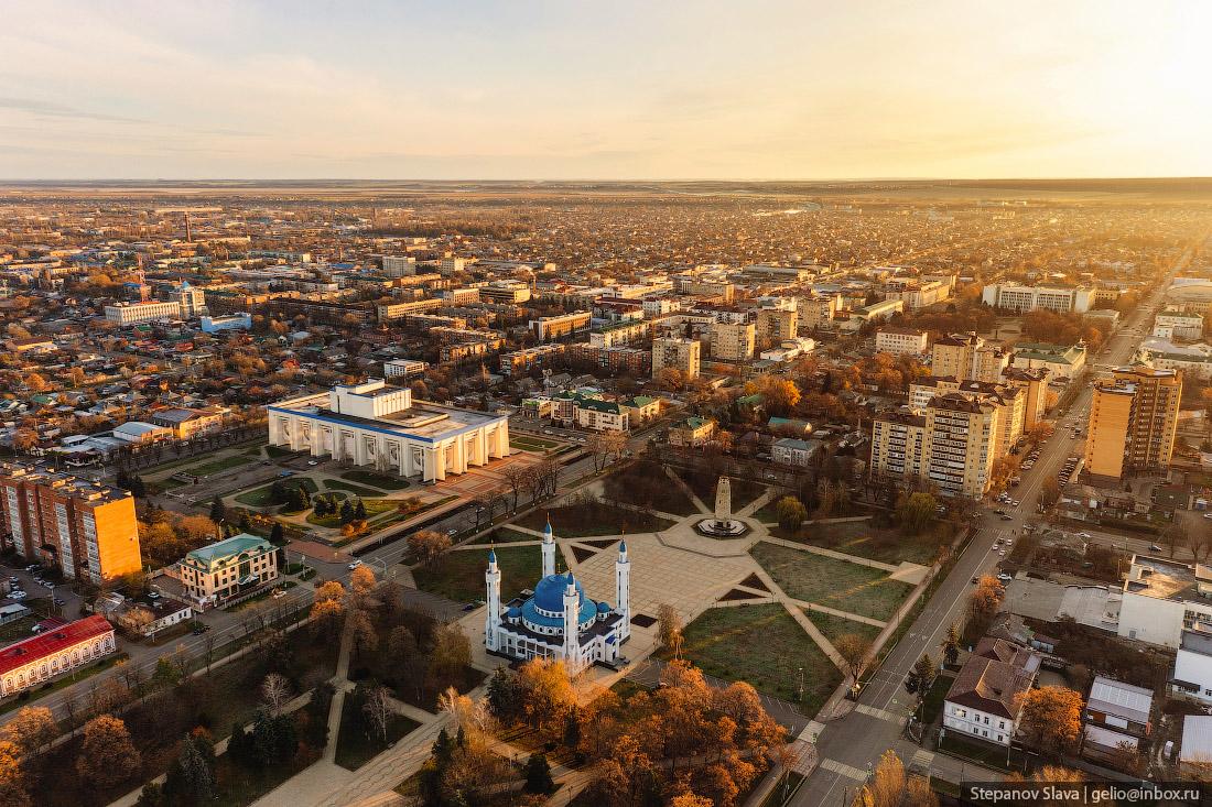
Tags: Adygeya Republic · Maykop city
8
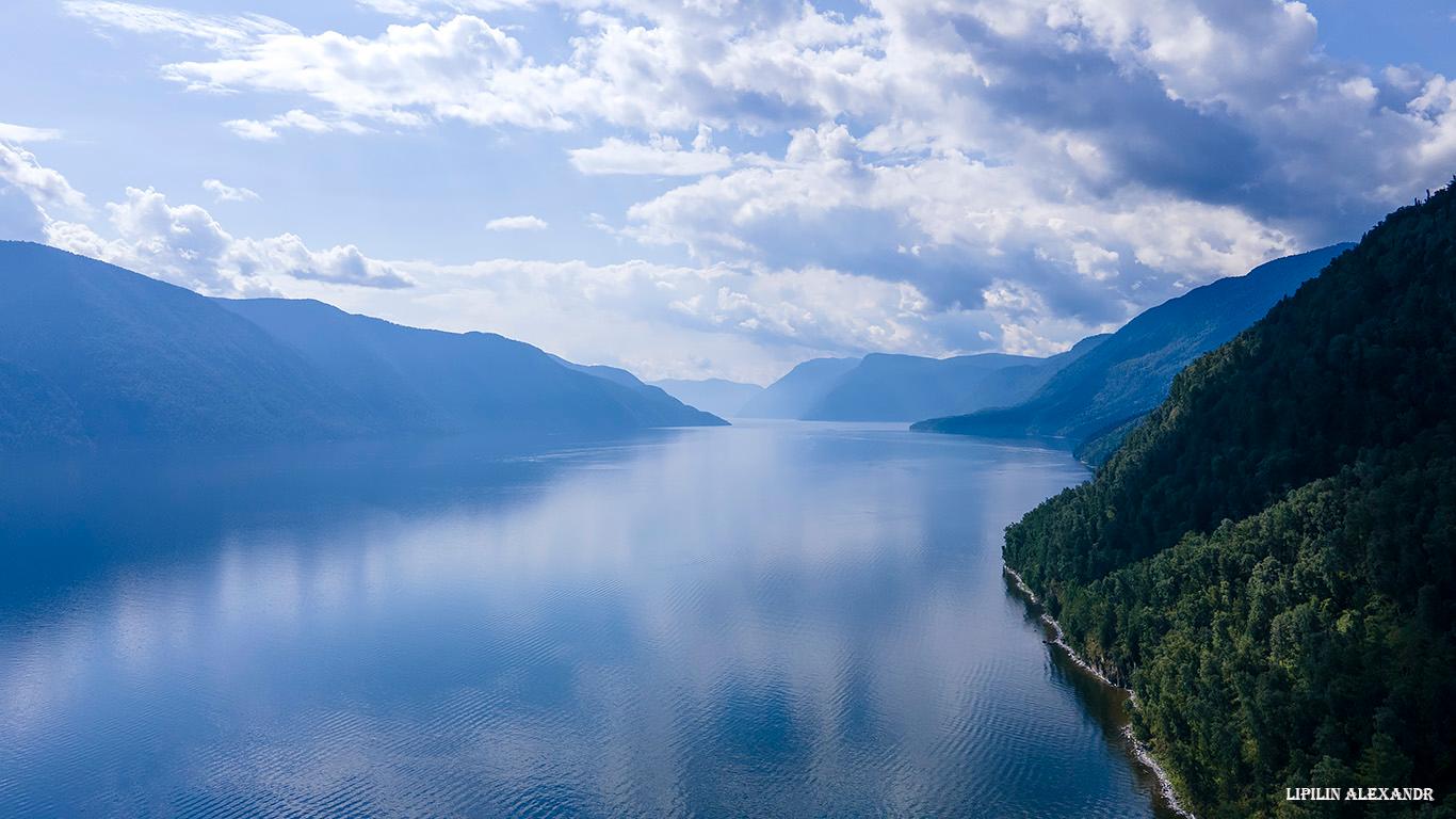
Lake Teletskoye – one of the natural symbols of Russia
No comments · Posted by Sergei Rzhevsky in Nature, Regions, Travel
Lake Teletskoye is a picturesque natural body of water located in the north-east of the Altai Mountains on the territory of the Altai Republic, about 120 km in a straight line from the regional capital Gorno-Altaysk.
One of the most popular natural attractions of Altai, it is included in the UNESCO World Cultural and Natural Heritage List as part of the complex “The Golden Mountains of Altai”. Lake Teletskoye on Google Maps. Photos by: Alexandr Lipilin.
Tags: Altay Republic · Gorno-Altaisk city
27
Gamsutl – a ghost village in the mountains of Dagestan
1 Comment · Posted by Sergei Rzhevsky in History, Regions, Travel
Gamsutl is an abandoned village located at an altitude of about 1.5 thousand meters above sea level in the southern mountainous part of the Republic of Dagestan in the North Caucasus.
Translated from the Avar language, the word “gamsutl” means “at the foot of the khan’s fortress.” It is likely that the khan, the founder of Gamsutl, lived on the top of the mountain, and his troops were stationed on its slopes. The approximate age of the village is 2 thousand years.
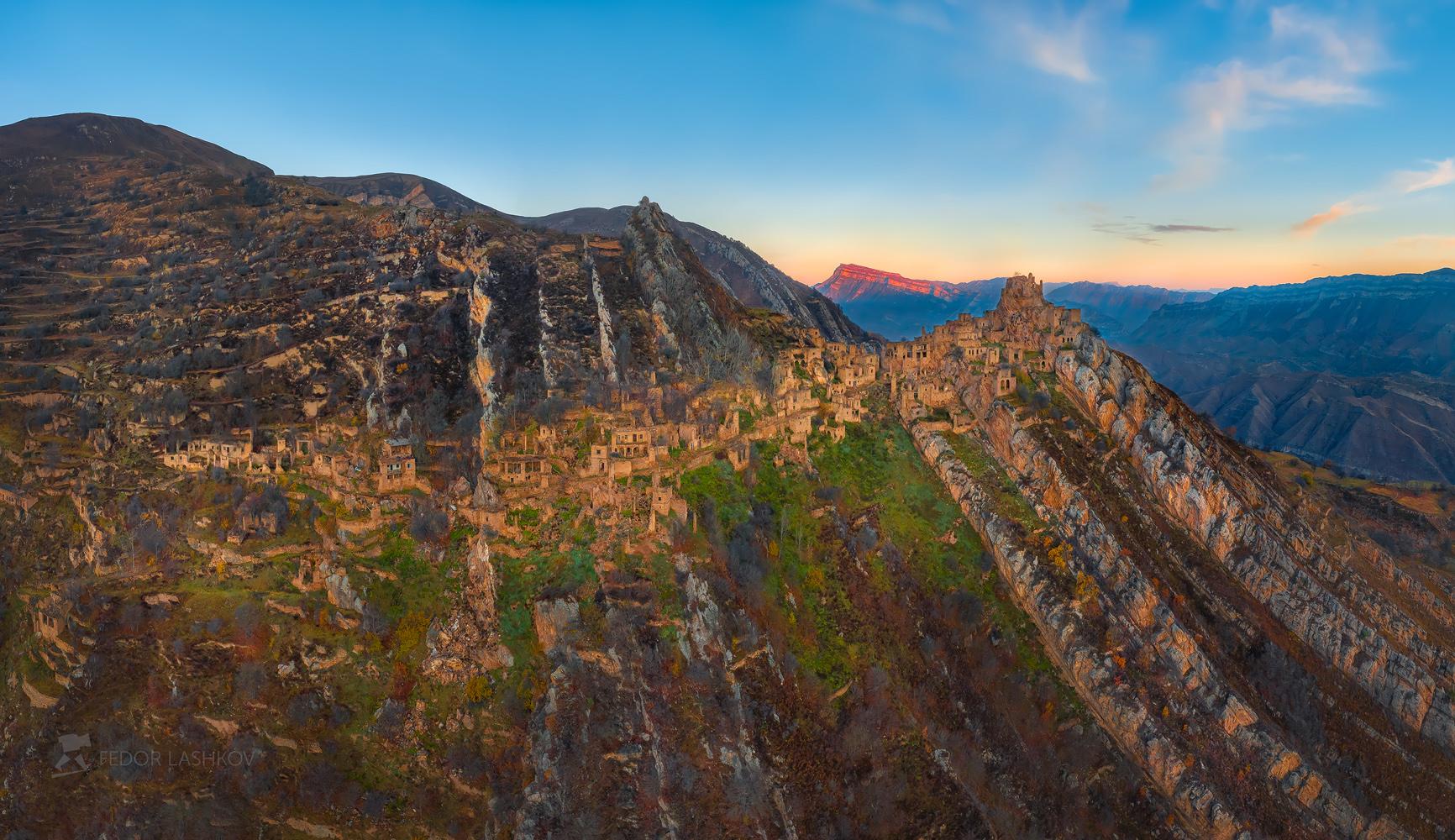
very picturesque abandoned village
Tags: Abandoned · Dagestan Republic
20
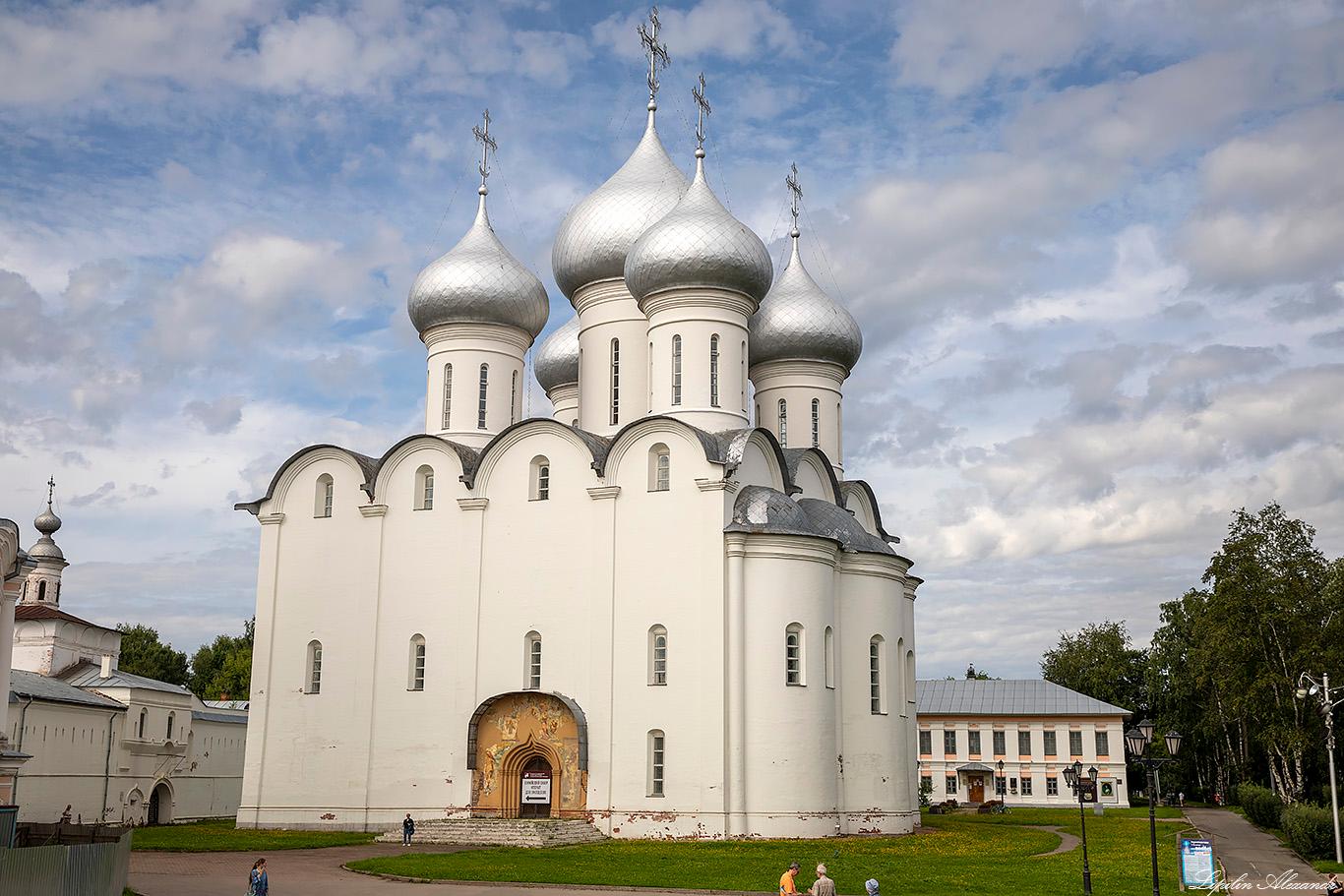
Saint Sophia Cathedral in Vologda
No comments · Posted by Sergei Rzhevsky in Cities, Religion, Travel
Saint Sophia Cathedral is the oldest preserved stone structure on the territory of Vologda, a Russian city known for its particularly valuable historical heritage. It is one of the largest buildings of the era of Ivan the Terrible, constructed in 1568-1570s.
The Assumption Cathedral in Moscow was chosen as an architectural model. In the Saint Sophia Cathedral in Vologda, you can see preserved frescoes of the 17th century and the iconostasis of the first half of the 18th century. Photos by: Alexandr Lipilin.
Tags: Vologda city
9
Pevek – the northernmost town in Russia
No comments · Posted by Sergei Rzhevsky in Cities, Travel
Pevek is an Arctic port town with a population of about 4.5 thousand people located on the shores of the Arctic Ocean in the Chukotka Autonomous Okrug. It is the northernmost town in Russia.
The name of the town comes from the Chukchi word “peekinei”, which means “thick, swollen mountain” – the name of the hill (sopka) at the foot of which Pevek stands. Pevek on Google Maps. Photos by: Slava Stepanov.

Tags: Chukotka okrug
31
Advertising of Soviet cars in the 1960s-1970s
No comments · Posted by Sergei Rzhevsky in History, Technology
In the USSR, a personal car was a luxury, and for only a few, it was a common means of transportation. Even if you had enough money, you still could not freely buy it at a car dealership like today.
To do this, you had to wait your turn for several years, since the number of cars produced at the factories was significantly lower than the potential demand. Until the early 1970s, the main priority was given to trucks, in particular, army multi-axle tractors and four-wheel drive dual-use trucks.
1961. ZAZ-965 “Zaporozhets”.
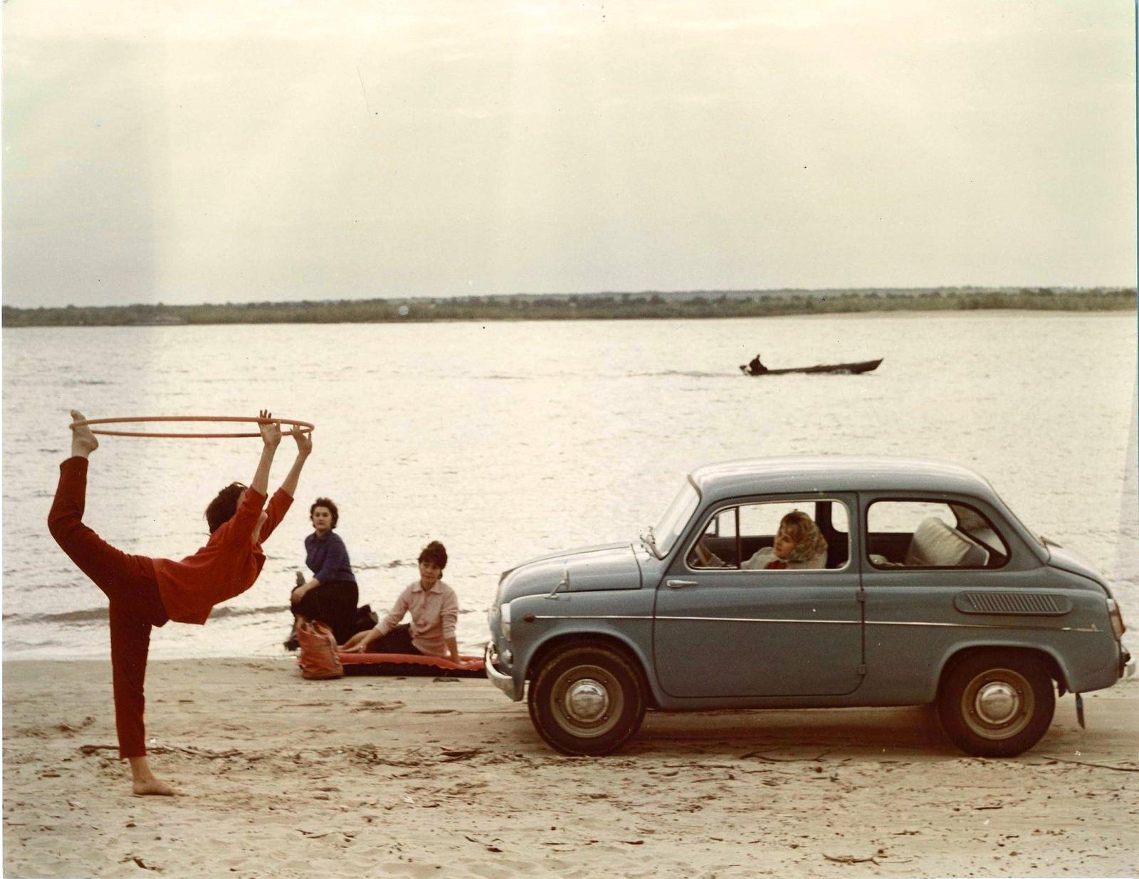
Soviet advertising in all its glory
Tags: Soviet past · Tolyatti city
23
Suzdal – a unique old Russian town
No comments · Posted by Sergei Rzhevsky in Architecture, Cities, Travel
Suzdal is a town-reserve with a population of about 9,600 people located in Vladimir Oblast, about 37 km north of Vladimir.
By the abundance of monuments and the preservation of its original appearance, Suzdal is unique for Russia. You can see a large number of monuments of cult and civil architecture of the 13th – 19th centuries here. Photos by: Vladimir Lipetskikh.
Cathedral of the Nativity of the Blessed Virgin Mary (1222-1225) and the Suzdal Kremlin.
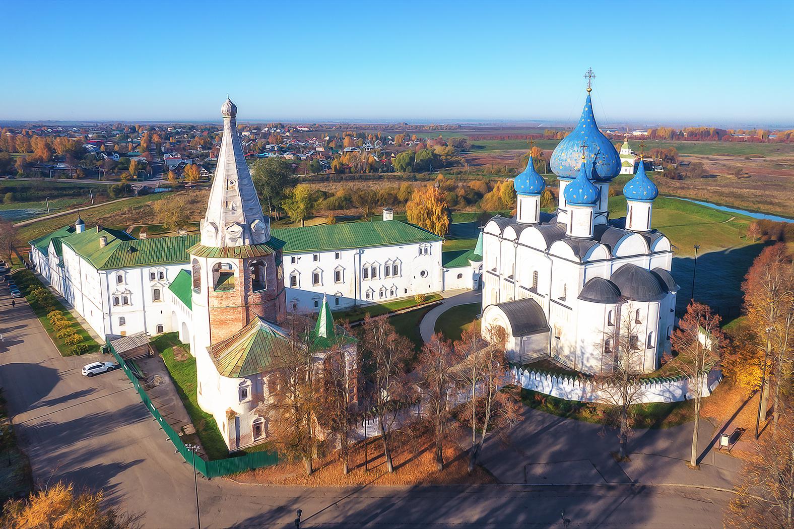
amazing old Russian provincial town
Tags: Suzdal city · Vladimir oblast
12
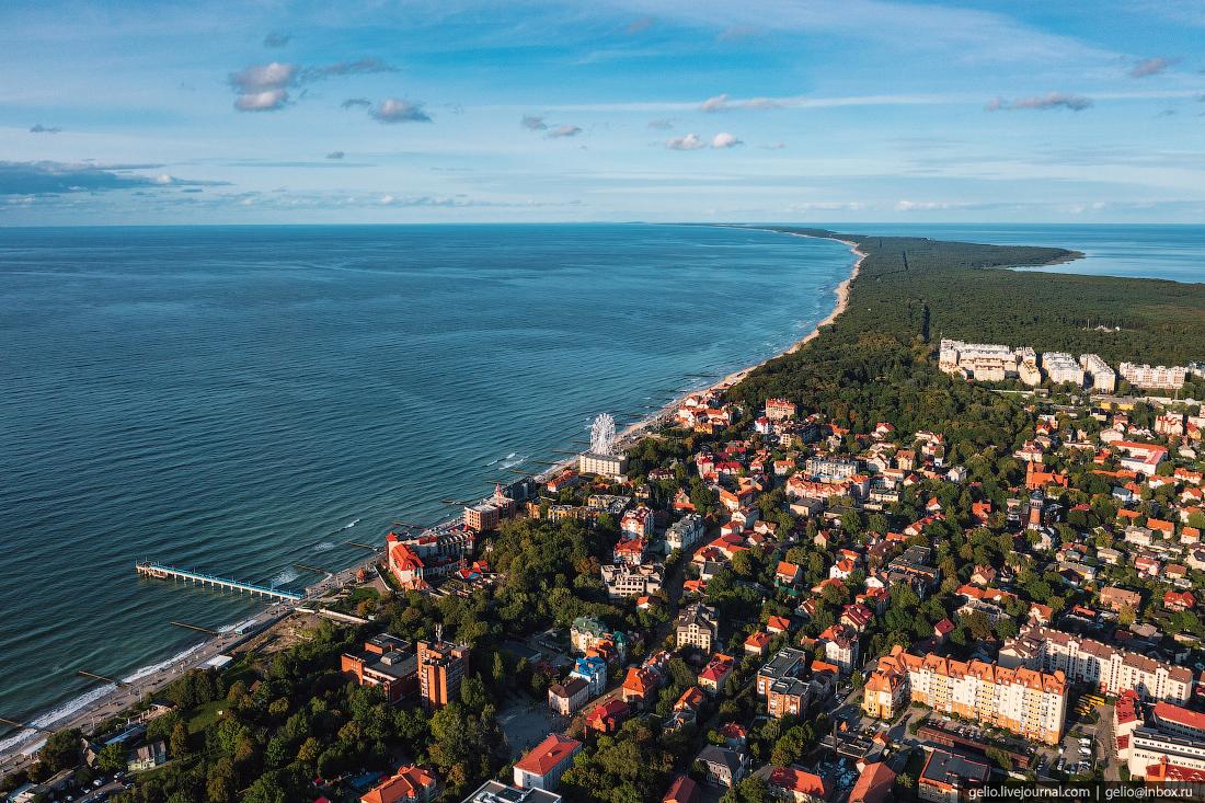
Zelenogradsk – a resort town by the Baltic Sea
No comments · Posted by Sergei Rzhevsky in Cities, Travel
Zelenogradsk (until 1946 – Cranz) is a resort town with a population of about 17 thousand people located in Kaliningrad Oblast of Russia.
The town stands on the coast of the Baltic Sea, about 25 kilometers north of Kaliningrad. Zelenogradsk on Google Maps. Photos by: Slava Stepanov.
Tags: Kaliningrad oblast
6
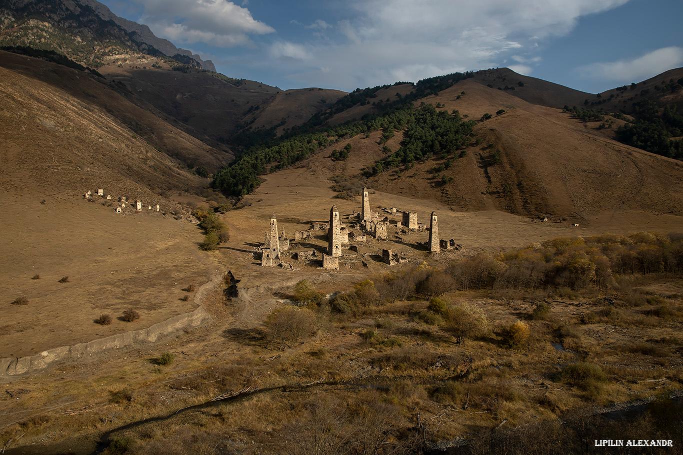
Tower Complex “Targim” in Ingushetia
No comments · Posted by Sergei Rzhevsky in Regions, Travel
Targim is an old abandoned settlement located in the southern part of the Republic of Ingushetia at an altitude of 1,080 meters above sea level.
On its territory there is an architectural complex “Targim” with a number of historical objects: tower-type dwellings, 4 battle towers up to 30 meters high, 4 semi-battle towers, and 16 dilapidated residential towers, as well as 19 crypt burial grounds, 2 mausoleums, and 5 sanctuaries. The tower complex “Targim” on Google Maps. Photos by: Alexandr Lipilin.
Tags: Ingushetia Republic