
22
Vladivostok Shrouded in Dense Summer Fog
No comments · Posted by Sergei Rzhevsky in Cities, Photos
Vladivostok is a large city and seaport located in the Russian Far East, on the peninsula Muraviev-Amur and islands in Peter the Great Bay, Sea of Japan.
The climate in the city is monsoon. One of its characteristics is the formation of dense fog that can envelop the city for several days. Up to 90% of foggy days are registered from April to August.
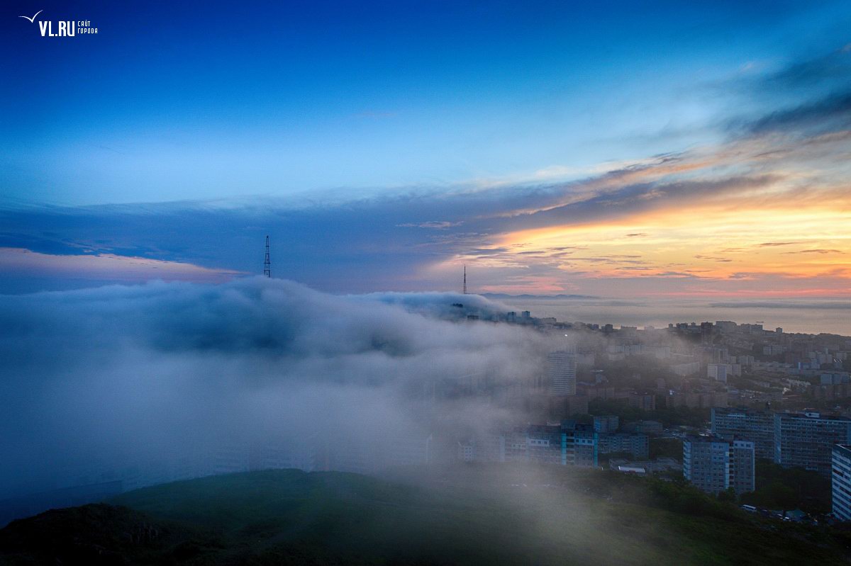
Tags: Vladivostok city
19
The beauty of Lago-Naki Plateau in the Caucasus
No comments · Posted by Sergei Rzhevsky in Nature, Photos, Travel
In the Caucasus, there are so many interesting places, and one of them is Lago-Naki Plateau located in the Western Caucasus, at an altitude of about 2,000 meters above sea level.
Almost the entire territory of the plateau, known for its alpine meadows, is part of the Maikop District of the Republic of Adygea.
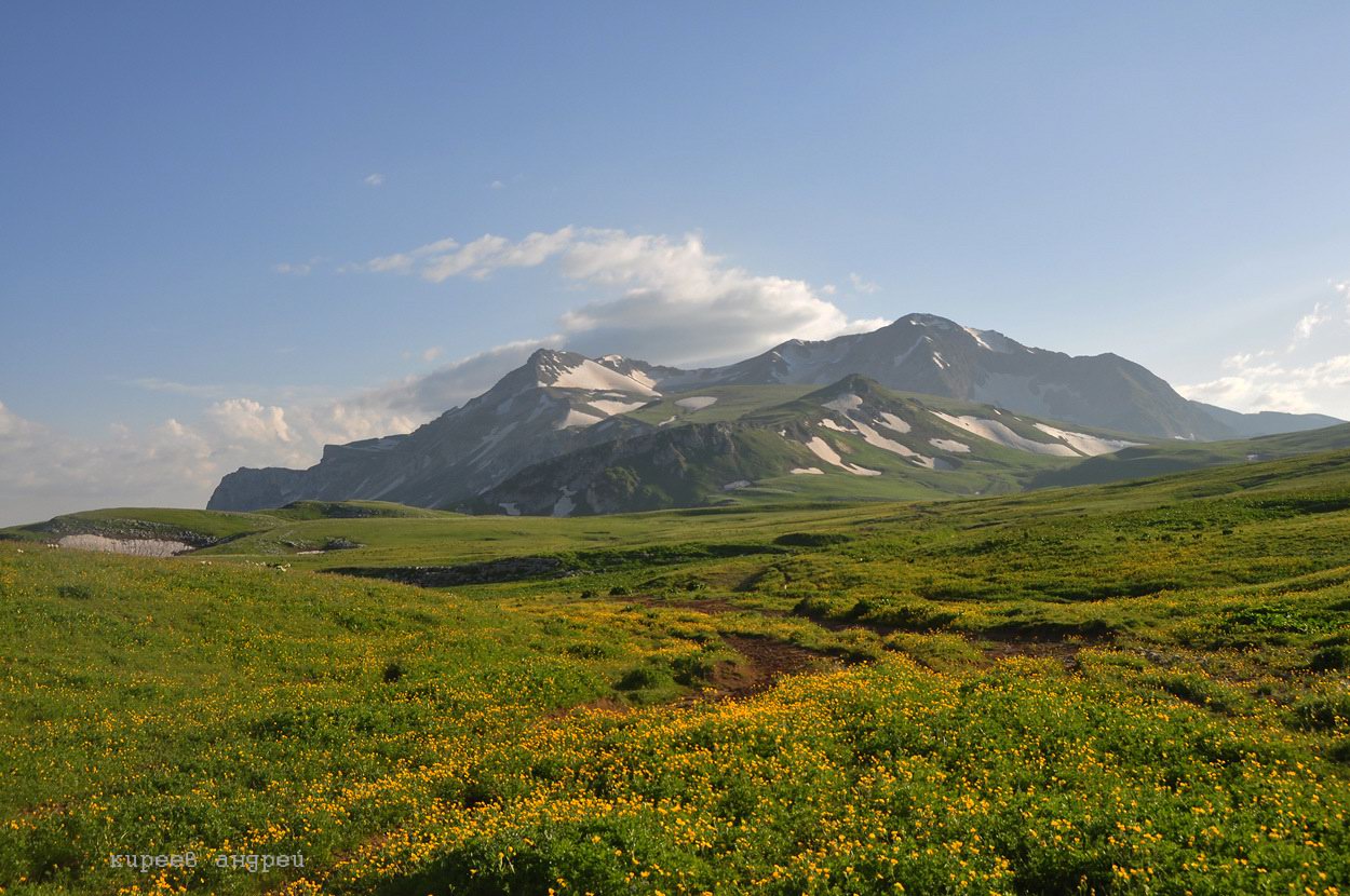
pristine nature of the Caucasus
Tags: Adygeya Republic
16
The return of the cruiser “Aurora” after restoration
No comments · Posted by Alex Smirnov in Cities, History, Video
July 16, 2016, the cruiser “Aurora” returned to the place of its permanent parking on the Petrograd embankment in St. Petersburg. Since September 2014 the ship was undergoing repairs at the Kronstadt sea plant.
Tags: Saint Petersburg city
14
Kazan Kremlin and the fireworks on the City Day
No comments · Posted by Sergei Rzhevsky in Cities, Holidays, Photos
Kazan Kremlin is the oldest part of Kazan, a complex of architectural, historical and archaeological sites that reveal the long history of the city. It is included in the list of UNESCO World Heritage Sites.
August 30 is the official day of the city of Kazan and Tatarstan Republic. Festive events in honor of this day usually end with colorful fireworks. Photos by: Petr Ushanov.

fireworks over the Kazan Kremlin
Tags: Kazan city
10
The draft concept of St. Catherine Cathedral in Ekaterinburg
No comments · Posted by Sergei Rzhevsky in Architecture, Art, Cities
One of the main attractions of Ekaterinburg is an abandoned unfinished television tower, the tallest building in the city (219 meters). Construction began in 1983, but, in 1991, because of the crisis in the country, it was stopped.
Since that time a number of projects for the reconstruction of the tower appeared, but none of them was approved. Recently, one more interesting project has been proposed.
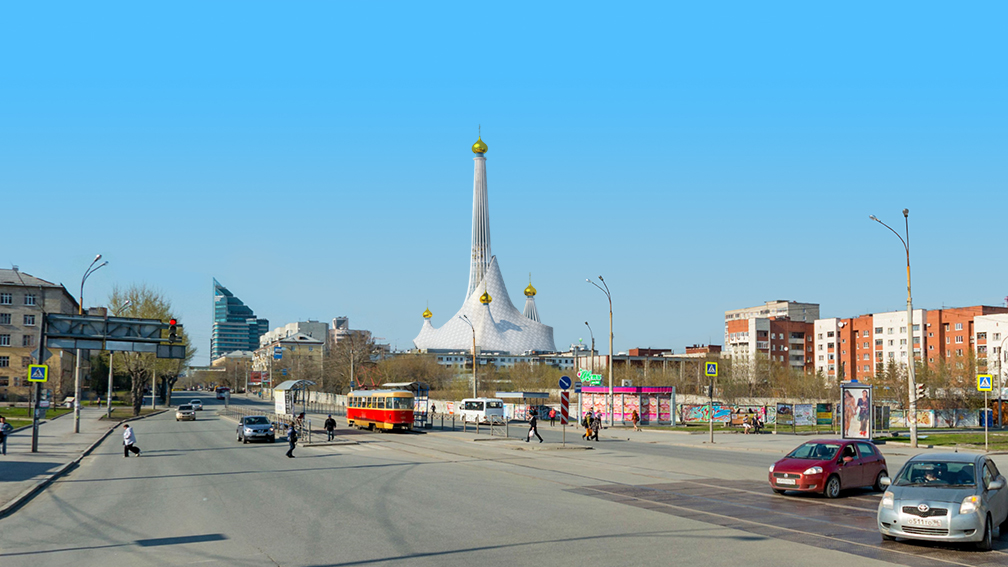
Tags: churches · Ekaterinburg city
Russia’s only amber museum is located in the defensive tower “Der Dona” in Kaliningrad (Marshal Vasilevsky Square, 1).
The museum exhibition occupies 28 halls with a total area of more than one thousand square meters. A significant part of the collection consists of amber pieces with inclusions of fragments of ancient flora and fauna. Photos by: Alexander Lipilin.
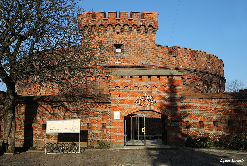
Tags: Kaliningrad city
3
Omsk – the view from above
No comments · Posted by Sergei Rzhevsky in Cities, Photos, Travel
Omsk is one of the largest cities in Russia and the second largest city in Siberia after Novosibirsk. In 2015, the city’s population was about 1.2 million people.
Omsk was founded at the confluence of the rivers Irtysh and Om in 1716. It was a fortress defending the southern border of the country. The main development of the city occurred in the 20th century. In 2016, Omsk celebrates its 300th anniversary. Photos by: Slava Stepanov.
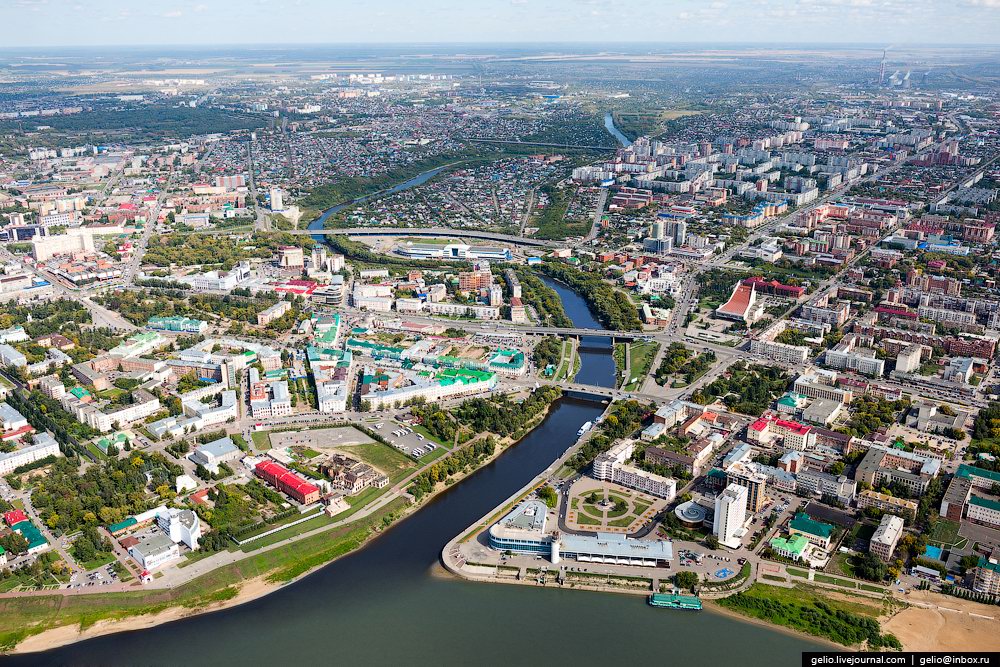
Tags: Omsk city
29
Early in the morning in the historic village of Vvedenye
No comments · Posted by Sergei Rzhevsky in Photos, Regions, Travel
Vvedenye is a small village with a population of about 500 people located in the Shuyskiy district of the Ivanovo region, about 10 km north-west of the town of Shuya and 32 km from Ivanovo, the regional capital.
This is one of the most interesting villages of the Ivanovo region with a rich history and a number of temple complexes. The history of the village is directly connected with Nikolo-Shartomskiy monastery founded in the 14th century.

one foggy morning in Russian province
Tags: churches · Ivanovo oblast
25
Explore the Pavlovsk Palace in St. Petersburg
No comments · Posted by Sergei Rzhevsky in Art, History, Photos
The State Art-Architectural Palace-Park Museum-Reserve “Pavlovsk” is a palace and park ensemble of the late 18th – early 19th centuries, located in the town of Pavlovsk, a suburb of St. Petersburg.
The centerpiece of the complex is the Pavlovsk Palace, the summer palace of Paul I, Emperor of the Russian Empire in 1796-1801.
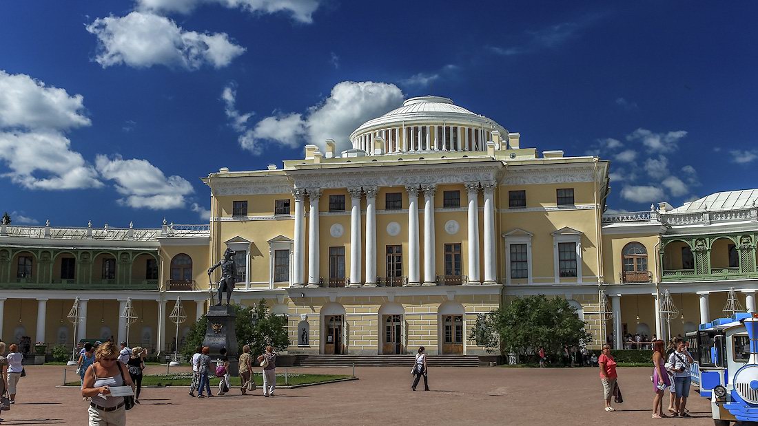
Tags: Saint Petersburg city
21
The Flooded Bell Tower of Kalyazin
No comments · Posted by Sergei Rzhevsky in Photos, Regions, Travel
Kalyazin is a small town with a population of about 13 thousand people located in the Tver region, on the right bank of the Volga River (Uglich Reservoir), 200 km from Moscow and 160 km from Tver.
In 1939-1940, part of the territory of the old town, including all the main historical and architectural monuments, was flooded during the construction of the Uglich hydroelectric power station.

the bell tower in the middle of the Volga
Tags: Tver oblast