
9
People of the Early Soviet Era
No comments · Posted by Sergei Rzhevsky in Art, History, People
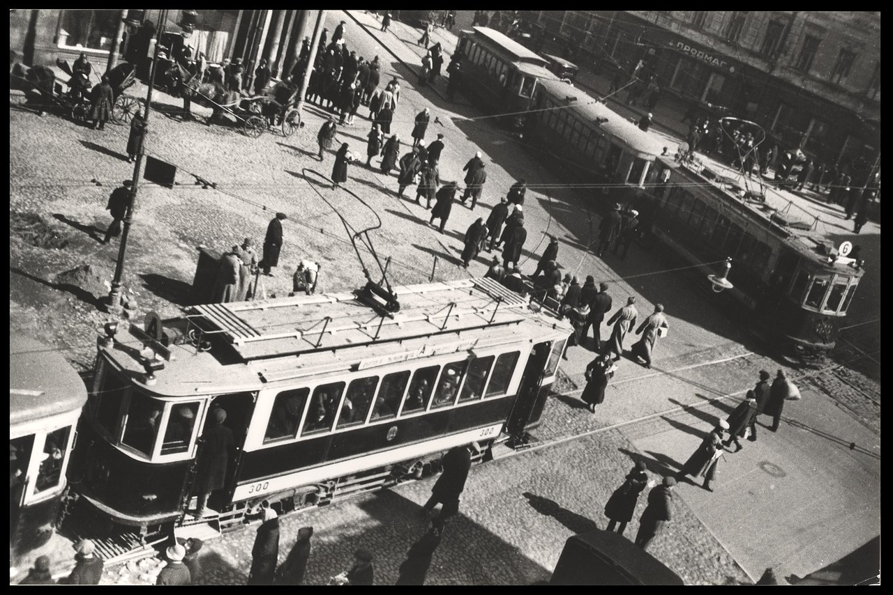
Alexander Mikhailovich Rodchenko (1891-1956) was a Russian and Soviet painter, graphic artist, poster artist, sculptor, photographer, theater and film designer, and correspondent. He was one of the founders of constructivism and a pioneer of design and advertising in the USSR.
Rodchenko is perhaps the most famous Russian photographer; almost everyone in Russia has seen at least a couple of his photographs. Let’s take a look at some of his works. Source: humus.
On the corner of Myasnitskaya Street in Moscow (1920s).
people in the early Soviet Union
Tags: Soviet past
8
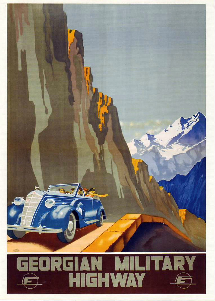
Posters from Stalin’s Soviet Union Luring Foreign Tourists
2 Comments · Posted by Sergei Rzhevsky in Art, History, Travel
It is widely believed that Stalin’s Soviet Union was a country almost completely closed to foreigners. However, advertising for “Intourist” (the organization responsible for foreign tourism in the USSR), founded in the 1930s, offers a somewhat different assessment.
The country desperately needed foreign currency for industrialization, so every means possible was used to attract wealthy foreign tourists to the USSR. And this wasn’t limited to the major cities of Moscow and Leningrad.
Tags: Moscow city · posters · propaganda · Saint Petersburg city · Soviet past
20
The Submarine Fleet of the Russian Empire
No comments · Posted by Sergei Rzhevsky in History, Photos, Technology
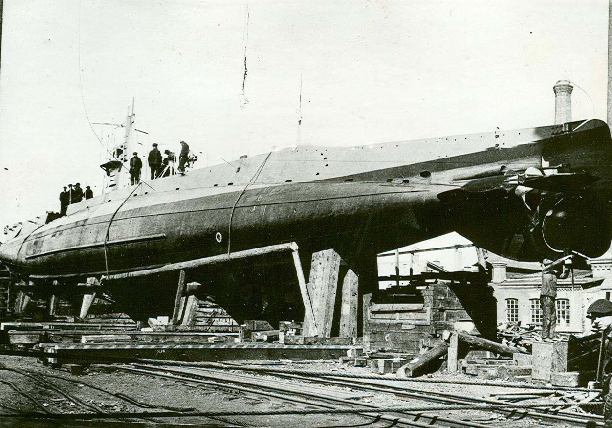
During the Soviet era, a widespread myth circulated that Russia (the Russian Empire) before 1917 was a backward peasant country without developed industry or technology. However, the situation was not so clear-cut, and here is one example.
Russia was one of the first in the world to begin developing a submarine fleet. On March 19, 1906, by decree of Emperor Nicholas II, the Russian Navy received a new type of weapon – military submarines. By August 1914, the fleet had approximately 15-22 combat-ready submarines. By 1916-1917, the total number reached about 50-60 units (including those under construction).
An AG-class submarine on one of the Baltic Shipyard’s piers.
unique photos of the first Russian submarines
Tags: Russian Empire
1
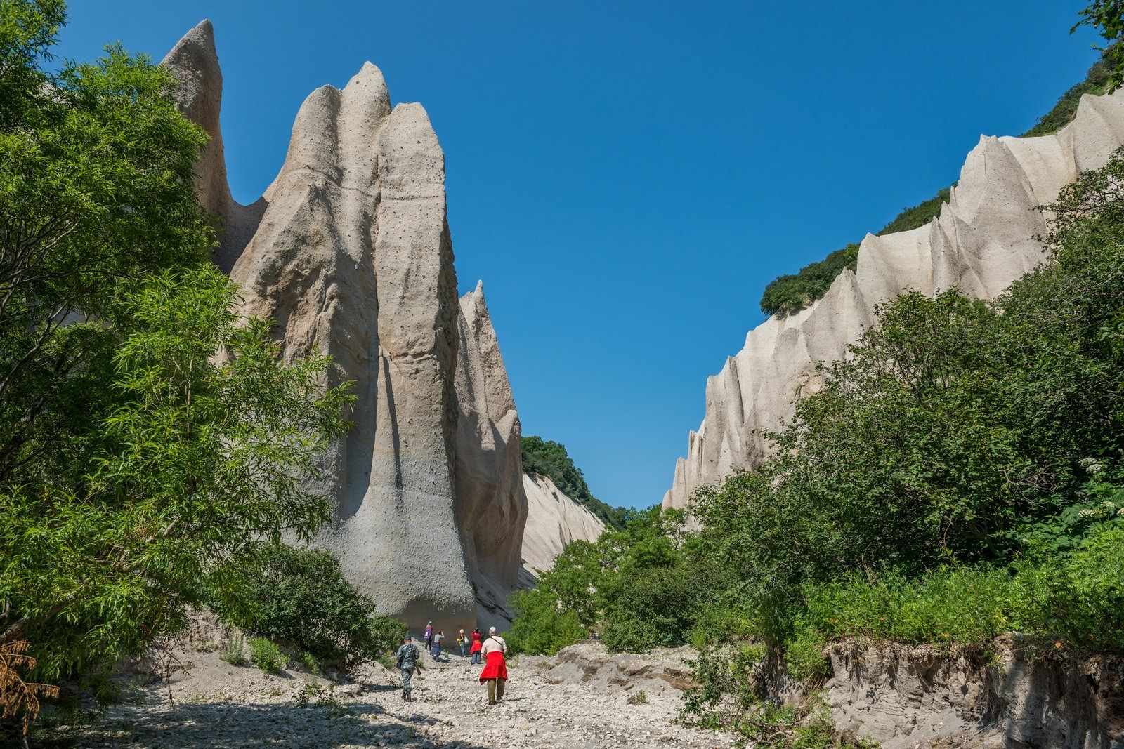
Kutkhiny Baty – Amazing Pumice Rocks in Kamchatka
No comments · Posted by Sergei Rzhevsky in Nature, Photos, Travel
Kutkhiny Baty, a bizarre curtain of pumice rocks, is a unique natural monument located approximately 4 kilometers from the source of the Ozernaya River (Kuril Lake) in Kamchatka.
According to legend, Kutkh – a powerful spirit, the creator of the world, people, and nature – lived in Kamchatka and traveled its rivers and seas. One day, he prepared to leave, and so he placed his “baty” (traditional pumice boats) on the banks of the Ozernaya River, intending to return for them later.
The legend imbues this place with sacred significance and makes it special in the eyes of the indigenous peoples of Kamchatka. “Kutkhiny Baty” can be translated as “The Boats of the God Kutkh.”
Kamchatka never ceases to amaze
Tags: Kamchatka krai · Petropavlovsk-Kamchatsky city
7
Belyany – Unique Russian River Giants
1 Comment · Posted by Sergei Rzhevsky in History, Photos, Technology
Today, if you ask Russians what a “belyana” is, it’s unlikely anyone would be able to answer. But these giant ships plied the Volga and Vetluga rivers just about a hundred years ago.
Belyana is a wooden, unpainted, flat-bottomed barge used for rafting timber along the Volga and Kama rivers in the 19th and early 20th centuries. These ships were perhaps the most unique river vessels in the world.
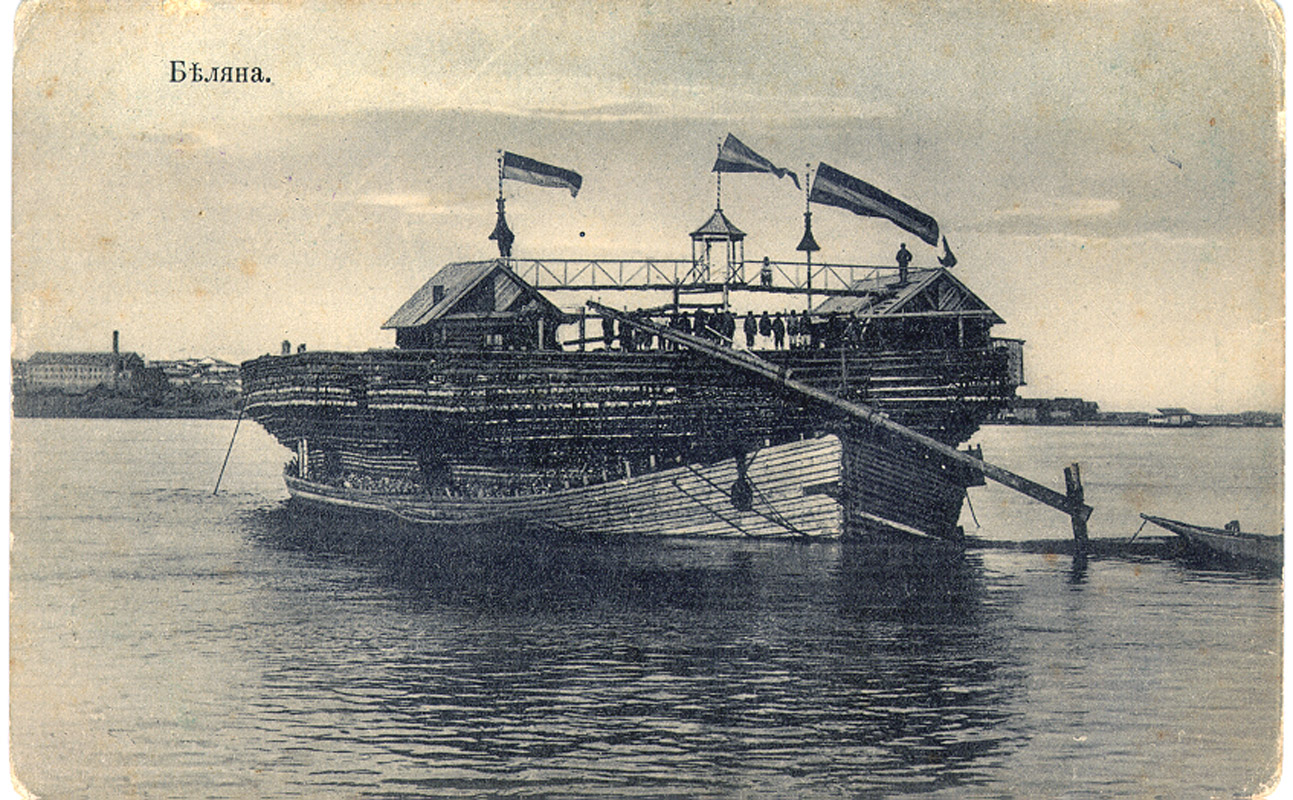
unique giant Russian wooden ships
Tags: Astrakhan city · Volgograd city
22
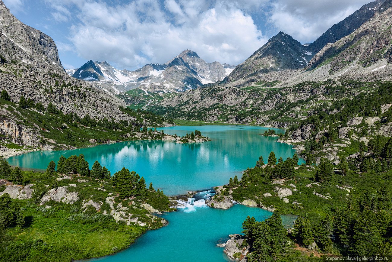
Lake Darashkol – the Hidden Treasure of Altai
No comments · Posted by Sergei Rzhevsky in Nature, Regions, Travel
Darashkol (in the Altai language “Dyarash Kol” means “beautiful lake”) is a glacial high-altitude lake (2,133 meters above sea level) located in the Altai Mountains in the southern part of the Altai Republic in Western Siberia.
The lake is situated on the territory of the Belukha Nature Park, which also includes the Kucherlinskoye and Akkemskoye lakes, and is a UNESCO World Cultural and Natural Heritage Site. Lake Darashkol on Google Maps. Photos by: Slava Stepanov.
Tags: Altay Republic
7
Unique Color Panoramas of the Russian Empire
No comments · Posted by Sergei Rzhevsky in History, Photos, Regions
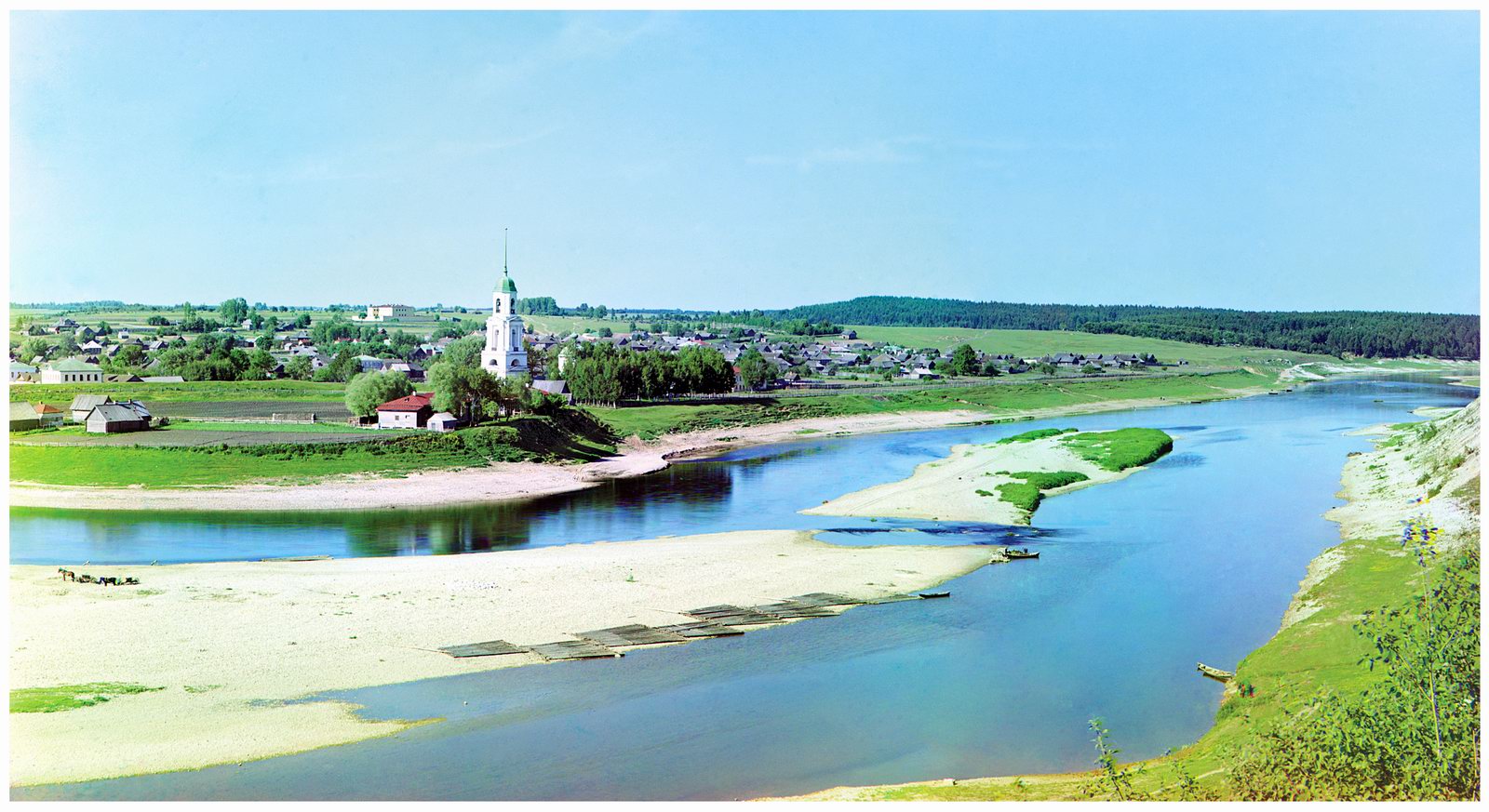
Sergei Mikhailovich Prokudin-Gorsky (1863-1944) was a Russian photographer, chemist (a student of Dmitri Mendeleev), inventor, publisher, teacher, and public figure. He made significant contributions to the development of photography and cinematography. He was a pioneer of color photography in Russia and the creator of the “Collection of Landmarks of the Russian Empire.”
Between 1909 and 1916, Prokudin-Gorsky traveled across a significant portion of the Russian Empire, photographing old churches, monasteries, factories, towns, villages, and a variety of everyday scenes.
The town of Zubtsov (Tver Oblast) on the Volga River (1910).
the last years of the Russian Empire
Tags: Russian Empire
19
Stalin’s Soviet Union – Moscow in 1953-1954
No comments · Posted by Sergei Rzhevsky in History, People, Photos
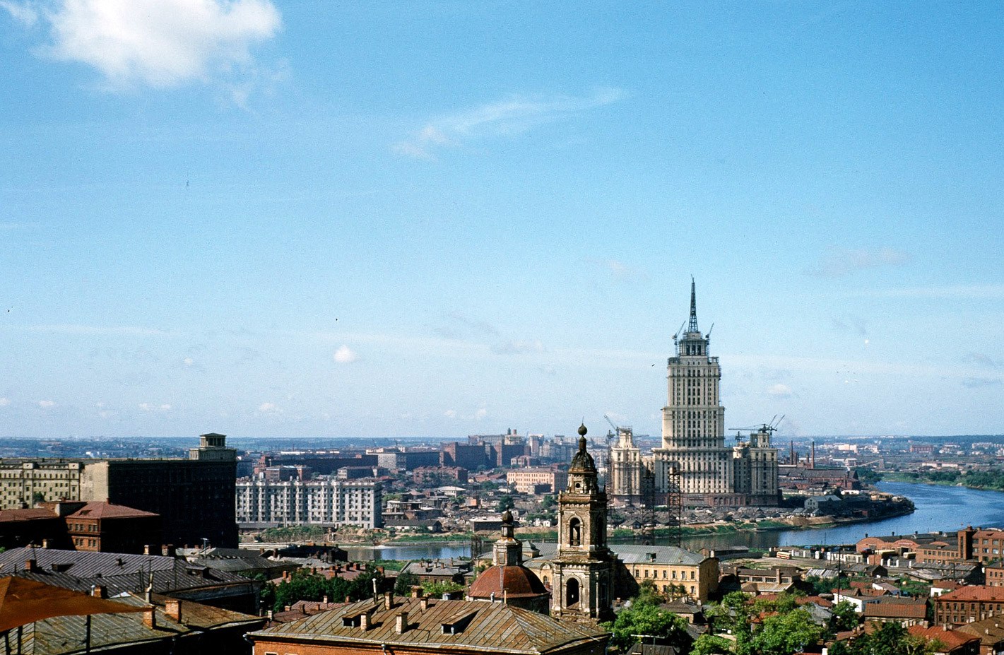
Major Martin Manhoff spent more than two years in the Soviet Union in the early 1950s. He served as assistant military attaché at the US Embassy, located near Red Square.
Manhoff, a talented photographer, captured hundreds of scenes from everyday life in the Soviet Union, both in Moscow and in other regions of the USSR.
The construction of the hotel “Ukraine” from the roof of the US Embassy on Novinsky Boulevard. The Church of the Nine Martyrs of Cyzicus (1954) is visible on the left.
Tags: Moscow city · Soviet past
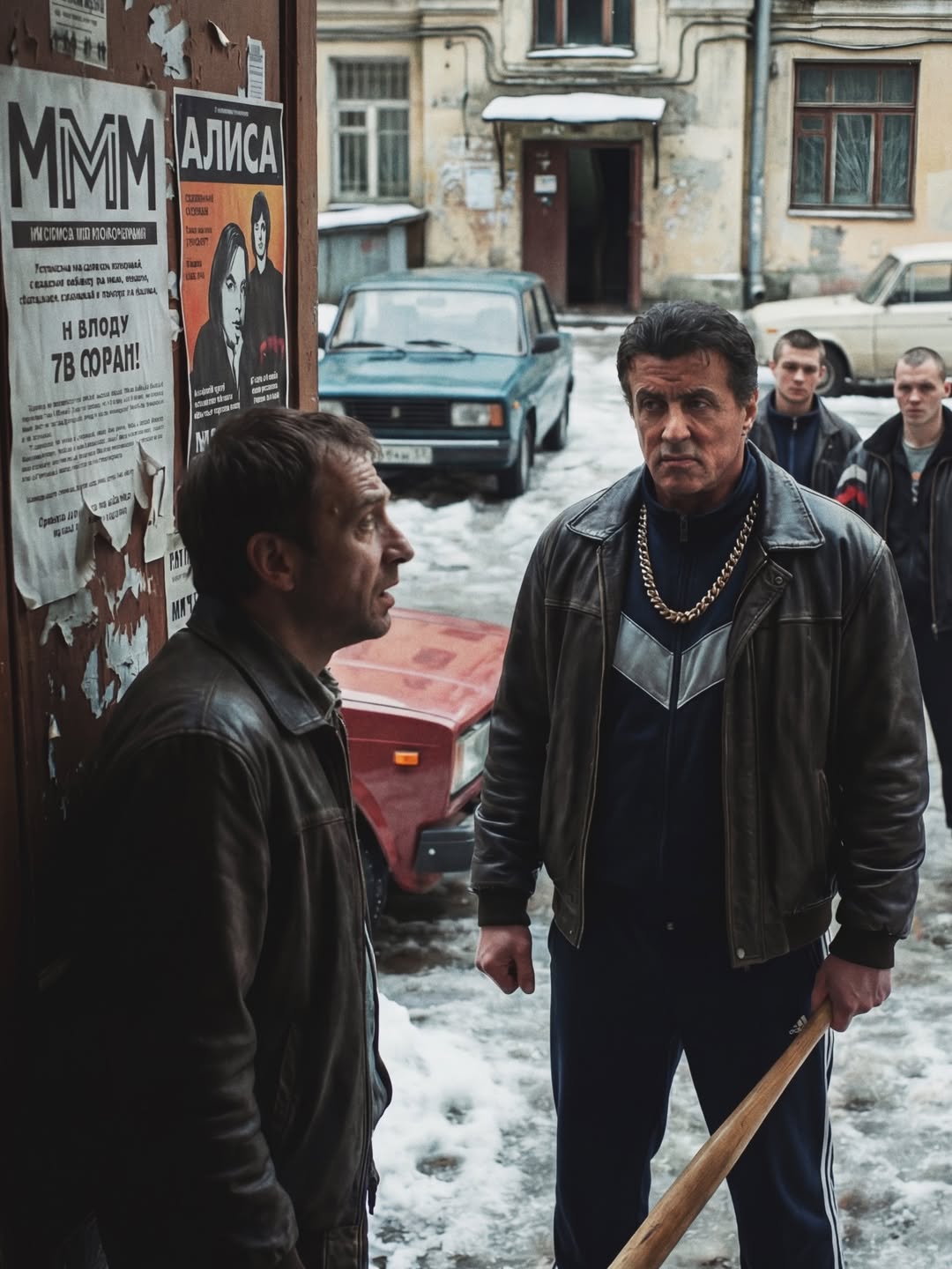
3
If Hollywood Stars Lived in 1990s Russia
No comments · Posted by Sergei Rzhevsky in Art, Entertainment, People
The following project created by Pavel Meleshkin uses digital manipulation to place Western celebrities into authentic photographs of Russian street scenes from the 1990s.
The goal of the project was to create a humorous contrast between global stars and the harsh, everyday reality of post-Soviet Russia. Pavel Meleshkin is known for this and similar art projects where he integrates famous figures into provincial Russian settings.
1. Sylvester Stallone
Tags: No tags
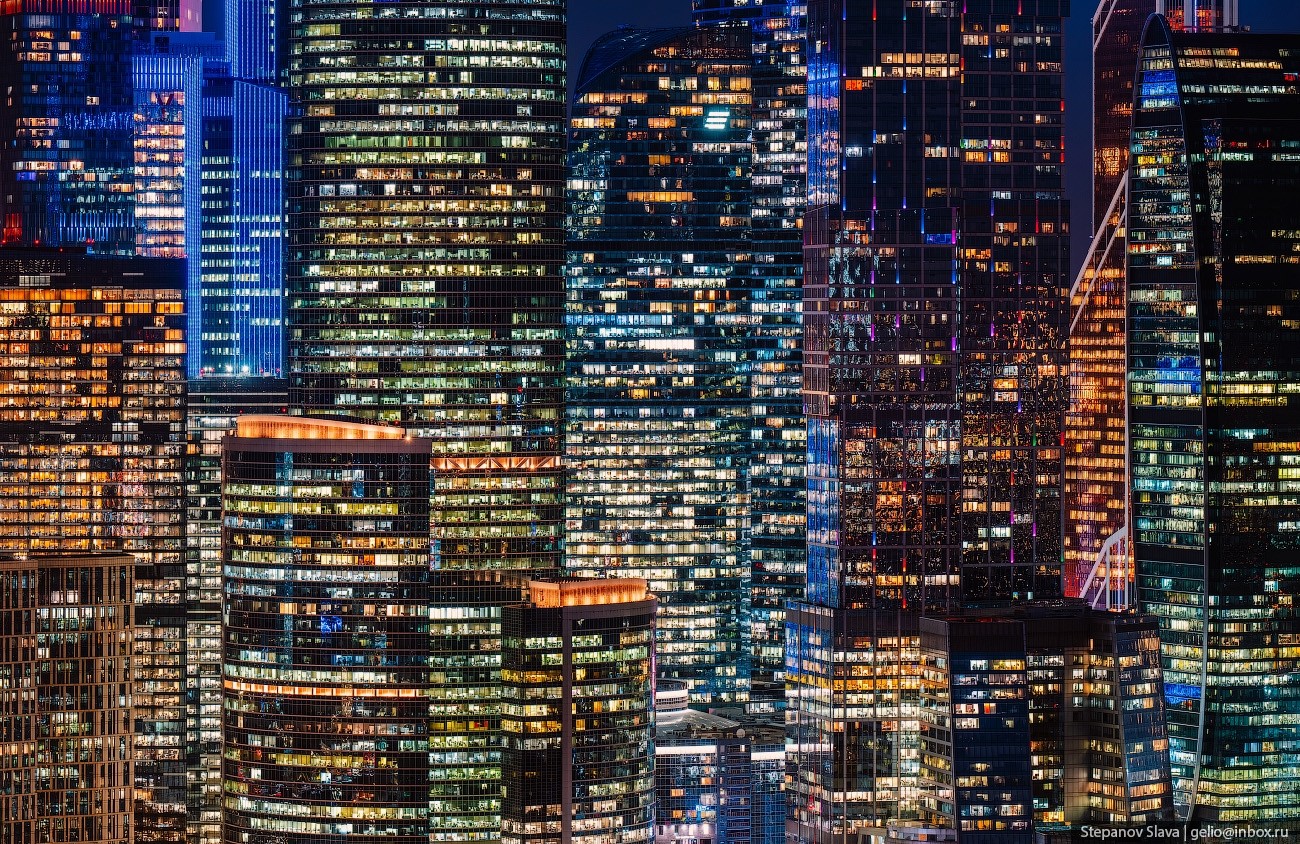
25
Moscow – the Center of Office Jobs in Russia
No comments · Posted by Sergei Rzhevsky in Business, Cities, People
Moscow is a key economic and financial center of Russia, home to a significant concentration of office jobs. This is due to the concentration of headquarters of large companies, government agencies, financial institutions, and the IT sector.
In 2025, Moscow saw a record volume of office space commissioned – 704,000 square meters. This is the highest figure since 2015, when the volume was 720,000 square meters. In 2026, the announced volume of new projects exceeds 1 million square meters. Photos by: Slava Stepanov.
Tags: Moscow city