
CAT | Travel
19
Architecture of the historical town of Kineshma
No comments · Posted by Sergei Rzhevsky in Architecture, Cities, Travel
Kineshma is a town (since 1777) with a population of about 77 thousand people, located in the northeastern part of Ivanovo Oblast, about 400 km northeast of Moscow. In 2010, it was included in the list of historical settlements of federal significance.
The town stands on the right bank of the Volga stretching along it for more than 11 kilometers. In Kineshma, both ordinary urban buildings of the 19th century and a number of architectural sights of the 19th – early 20th centuries have been preserved.
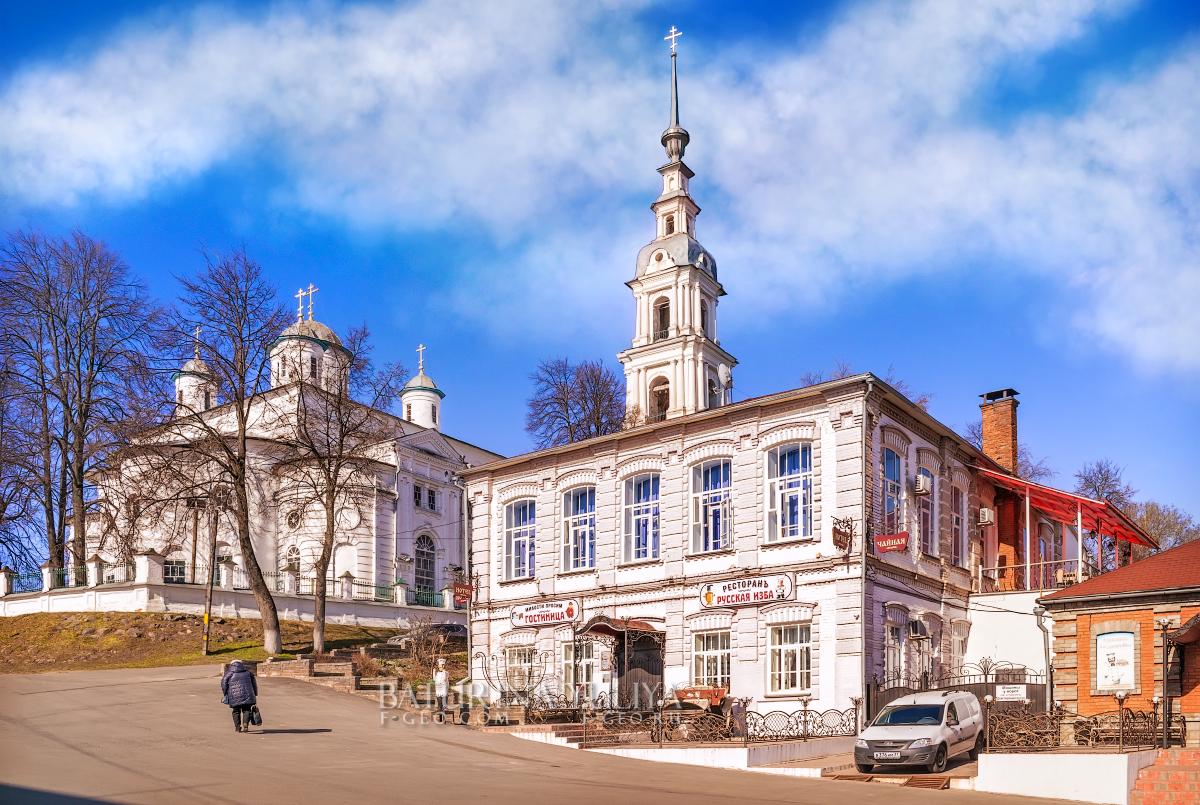
feel the vibe of the old Russian merchant town

Tags: Ivanovo oblast
22
Ivolginsky Datsan – the center of Buddhism in Russia
No comments · Posted by Sergei Rzhevsky in Regions, Religion, Travel
Ivolginsky Datsan “Khambyn Khuree” (“Abode of the Wheel of Teaching, bringing happiness and full of joy”) is a Buddhist monastery-university, the center of the Buddhist traditional Sangha of Russia, which is the largest Buddhist community in Buryatia and one of the largest in the country.
This monument of history and architecture is located in the Republic of Buryatia in the village of Verkhnyaya Ivolga, about 36 km west of the center of Ulan-Ude, the capital city of the republic. Ivolginsky Datsan on Google Maps. Photos by: Alexandr Lipilin.
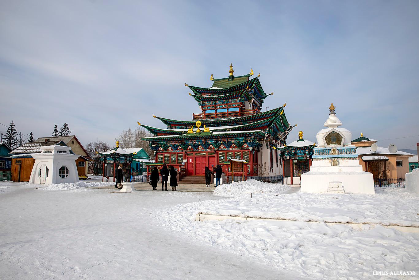
Tags: Buryat Republic · Ulan-Ude city
27
Syktyvkar – the view from above
No comments · Posted by Sergei Rzhevsky in Cities, Photos, Travel
Syktyvkar is a city with a population of about 220 thousand people, the capital of the Komi Republic, located in the north-east of the European part of Russia.
The distance from Moscow to Syktyvkar (in a straight line) is about 1,000 km in a northeasterly direction. Its name, translated from the Komi language, means “the city on the Sysola River”. Photos by: Slava Stepanov.
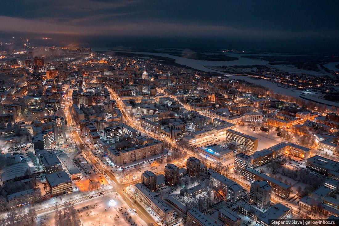
Tags: Komi Republic · Syktyvkar city
28
Abandoned Aniva Lighthouse on Sakhalin Island
1 Comment · Posted by Sergei Rzhevsky in Architecture, Regions, Travel
The Aniva Lighthouse is an amazingly picturesque abandoned lighthouse located on Cape Aniva in the very south of Sakhalin Island in the Far East of Russia. The height of the building is 31 meters, the height of light – 40 meters above sea level.
This mysterious place is an important tourist attraction of Sakhalin. Tourists usually come here on private boats. The lighthouse is gradually destroyed by water and wind. In the coming years, it is quite possible that repairs will be carried out to preserve this unique building. The Aniva Lighthouse on Google Maps. Photos by: Slava Stepanov.
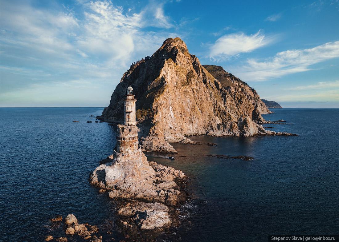
Tags: Abandoned · Sakhalin oblast
4
Putorana Plateau – the land of lakes and waterfalls
No comments · Posted by Sergei Rzhevsky in Nature, Regions, Travel
Putorana is a mountain range (plateau), located in the heart of Siberia, in the northern part of Krasnoyarsk Krai.
The maximum height of the plateau is 1,701 m. Its area is about 250,000 square km, which is about the same as the area of the UK (242,495 square km). The Putorana Plateau on Google Maps. Photos by: Slava Stepanov.

Tags: Krasnoyarsk krai
24
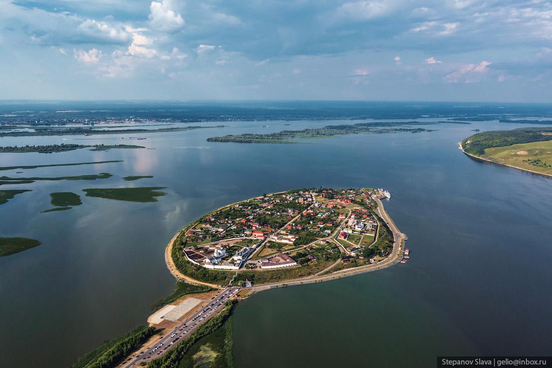
Sviyazhsk – a historical town-island in Tatarstan
No comments · Posted by Sergei Rzhevsky in Cities, Travel
Sviyazhsk is a very picturesque historical town-island located at the confluence of the Sviyaga River into the Volga, about 30 km west of Kazan, the capital of the Republic of Tatarstan. The Sviyazhsk fortress, founded in 1551, became the base of Russian troops during the siege of Kazan in 1552.
Initially, it stood on a hill, which was washed on both sides by the Sviyaga and Shchuka rivers. But in 1957, the Kuibyshev reservoir was built, the water level rose and Sviyazhsk ended up on an island. In 2008, an embankment and a road to Sviyazhsk were built. Sviyazhsk on Google Maps. Photos by: Slava Stepanov.
Tags: Kazan city · Tatarstan Republic
Khunzakh is a very picturesque village with a population of 4 thousand people located in the southern mountainous part of the Republic of Dagestan, 140 km southwest of the city of Makhachkala, at an altitude of about 1,700 meters above sea level.
The houses here are built on the very edge of the Khunzakh plateau, where the height of sheer cliffs reaches 100 meters. Khunzakh on Google Maps. Photos by: Slava Stepanov.
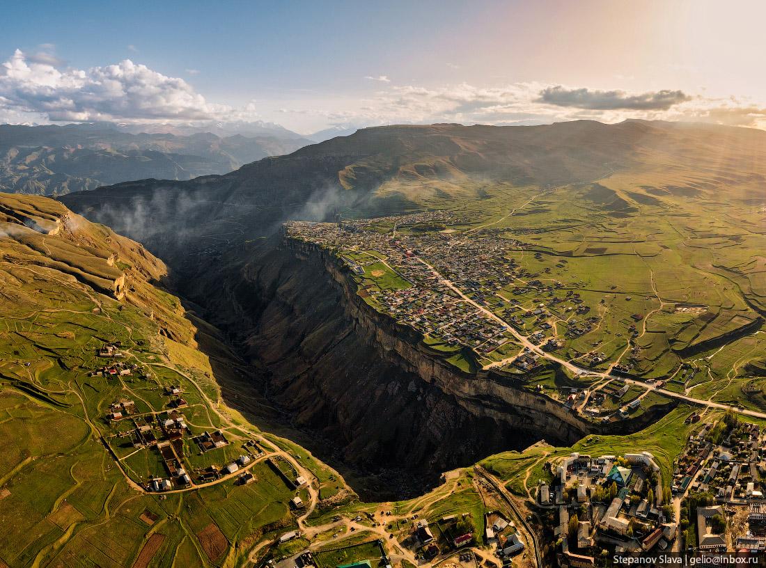
very picturesque mountain village
Tags: Dagestan Republic · Makhachkala city
20
Ekranoplan “Lun” – a unique military vehicle near Derbent
No comments · Posted by Sergei Rzhevsky in Technology, Travel
On December 30, 2021, a Project #903 Lun missile ekranoplan was towed ashore near the city of Derbent, in the Republic of Dagestan. This is the first exhibit of the future Patriot Park, which is planned to open here in 2023. Built in 1986, it became the only fully completed vehicle of this project out of eight planned due to financial problems and dubious military expediency.
An ekranoplan is a cross between a ship and an airplane. The principle of movement is similar to an air cushion, only it is created not by forcing air, but by an oncoming flow. When the flaps are lowered, the engines force air onto the wing and the ekranoplan rises out of the water. Ekranoplan “Lun” on Google Maps. Photos by: Slava Stepanov.

Tags: Dagestan Republic · Derbent city
23
Natural Spring Gremyachiy Klyuch in Moscow Oblast
No comments · Posted by Sergei Rzhevsky in Regions, Religion, Travel
Gremyachiy Klyuch is a natural spring located on the right bank of the Vondiga River, about 80 km northeast of Moscow, in the Sergiev Posad district of Moscow Oblast. The temperature of the water in the spring is constant all year round (6 degrees Celsius) and is considered curative.
According to legend, the spring appeared thanks to the prayer of Sergius of Radonezh (1314-1392), one of the most highly venerated saints of the Russian Orthodox Church. Today, the approaches to it have been landscaped, a church, a chapel, a refectory, a church shop with souvenirs, and baths have been built.
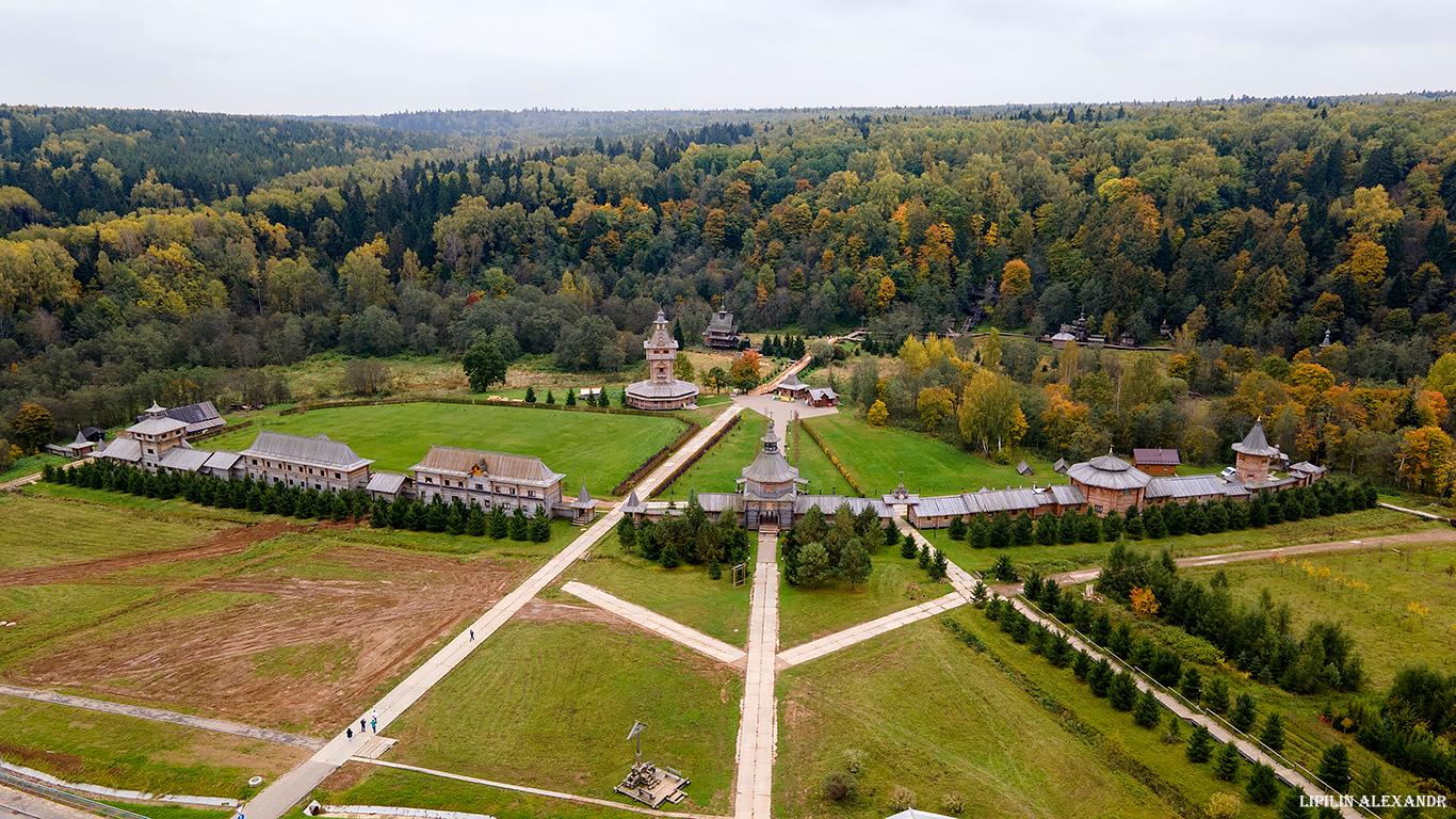
very picturesque tourist destination
Tags: Moscow city · Moskovskaya oblast
5
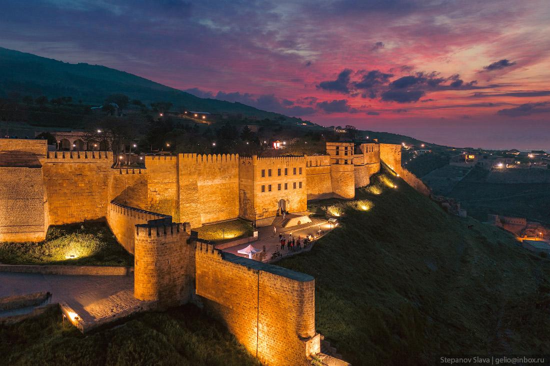
Derbent – the southernmost city in Russia
No comments · Posted by Sergei Rzhevsky in Cities, Travel
Derbent is a city with a population of about 126 thousand people located in the very south of European Russia in the Republic of Dagestan on the shores of the Caspian Sea, 127 kilometers southeast of Makhachkala.
The city stands in a narrow passage between the Caspian Sea and the Caucasus Mountains. This geographical position made Derbent one of the most important points of defense for many countries, since only this 3 km wide strip of land can be used to easily bypass the Caucasus Mountains. Photos by: Slava Stepanov.
Tags: Dagestan Republic · Derbent city