
25
St. Petersburg in the 1850s
No comments · Posted by Sergei Rzhevsky in Art, Cities, History
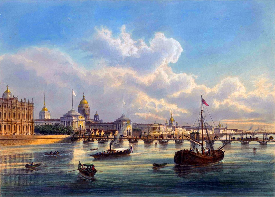
Joseph Daziaro (1806-1865) came to the Russian Empire from Italy in the early 1820s. He opened a publishing business and specialized in the sale of lithograph prints. His firm can be called the first private publishing house of printed artistic graphics in Russia.
By the beginning of the 1830s, he had 2 shops in Moscow. In 1849, he became the owner of a shop in St. Petersburg. Let’s look at his lithographs united under the title “Memories of St. Petersburg” (“Souvenir de St. Petersbourge”). They were mostly made from drawings by the Charlemagne brothers: Josif Charlemagne (1824-1870) and Adolf Charlemagne (1826-1901). Source: aldusku.
Dvortsovy (Palace) Bridge.

Tags: Russian Empire · Saint Petersburg city
10
Colorized photos of the Russian Imperial Fleet
No comments · Posted by Sergei Rzhevsky in Army, History, Photos
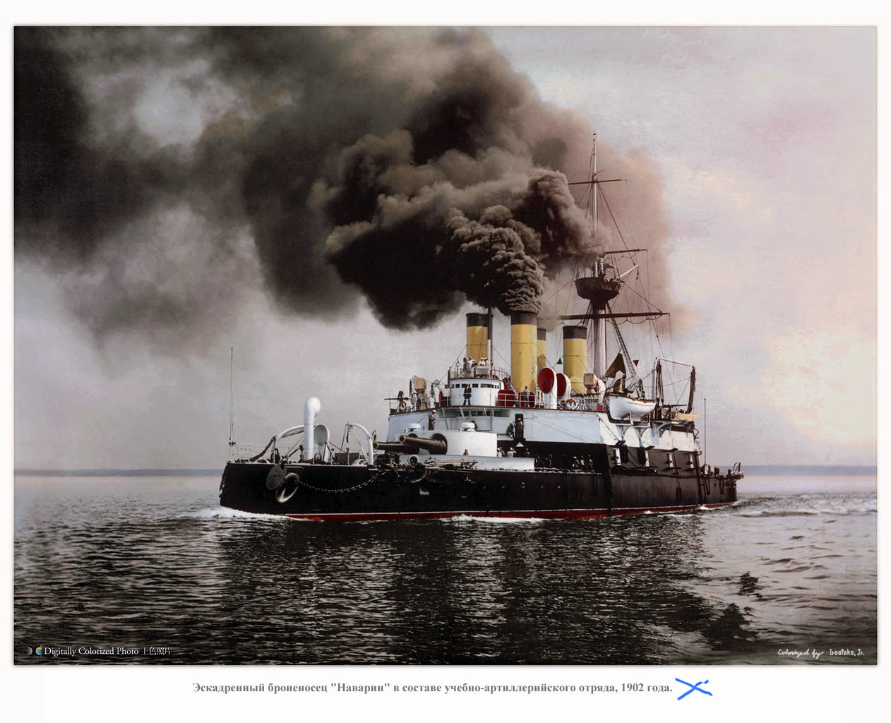
The period from 1853 to 1917 was the most interesting period in the development of the Russian Navy. After the Crimean War of 1853-1855, steam Navy began to develop rapidly. By the end of the 1850s, the Russian fleet started to operate in the oceans.
During the second half of the 19th century, the Russian Empire created a modern for that time armored fleet. In the early 20th century, the country had the third largest fleet in the world. On these photos made in this period you can see the battleships of this once mighty fleet.
historical photos of the Russian Imperial Fleet
Tags: Russian Empire
Totaling 11% of the landmass of the Earth’s surface – and with a larger surface area than Pluto – Russia is the largest country on the planet. Despite that, it is only home to approximately 144 million residents.
Russia is home to several locations of historic architecture, is known for its vodka production, and has been the birthplace of many incredible thinkers, artists, and musicians. Amongst these are writers like Leo Tolstoy and composers such as Pyotr Ilyich Tchaikovsky.
While the culture in the country is still deeply traditional, elements of the West have found their way into modern life. Amongst these elements is the entertaining pastime of gambling – which has led to some strict regulations.

Tags: No tags
2
Live casino: a comprehensive guide to live dealer games
No comments · Posted by Sergei Rzhevsky in Entertainment
By Cristina Possamai
For many questions, one answer: we have prepared a full guide to the world of live dealer games. The iGaming industry is rapidly changing, and for an online casino platform to succeed, it needs to satisfy its players’ demands by offering the best gaming content available. Live casino is a next-generation alternative to real offline casinos, with a lot of benefits for players – that’s why there’s so much buzz around live casinos today.
Live dealer games have become super popular among online casino operators, thanks to the growing demand from players worldwide. Offering a wide range of gaming content is key to attracting and keeping players happy. Different audiences have different preferences, but let’s be real, live dealer games are a hit across the globe!

Tags: No tags
15
Chirkey Reservoir – the largest in the North Caucasus
No comments · Posted by Sergei Rzhevsky in Nature, Regions, Travel
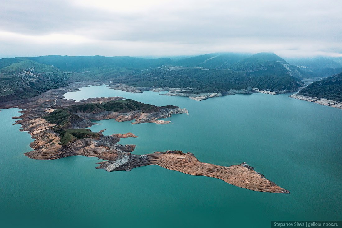
Chirkey Reservoir, the largest reservoir in the North Caucasus, is located in the central part of the Republic of Dagestan. It was formed on the Sulak River as a result of the construction of the Chirkey hydroelectric power station.
The reservoir is also used for fishing and water supply. Its height above sea level is 335 m. The water surface area is 42.4 square km, the volume – 2.78 cubic km. The greatest depth is 220 m. The width of the reservoir exceeds 5 km. Chirkey Reservoir on Google Maps. Photos by: Slava Stepanov.
Tags: Dagestan Republic · Makhachkala city
29
Russian Beauties in the Paintings of Konstantin Makovsky
2 Comments · Posted by Sergei Rzhevsky in Art, History, People
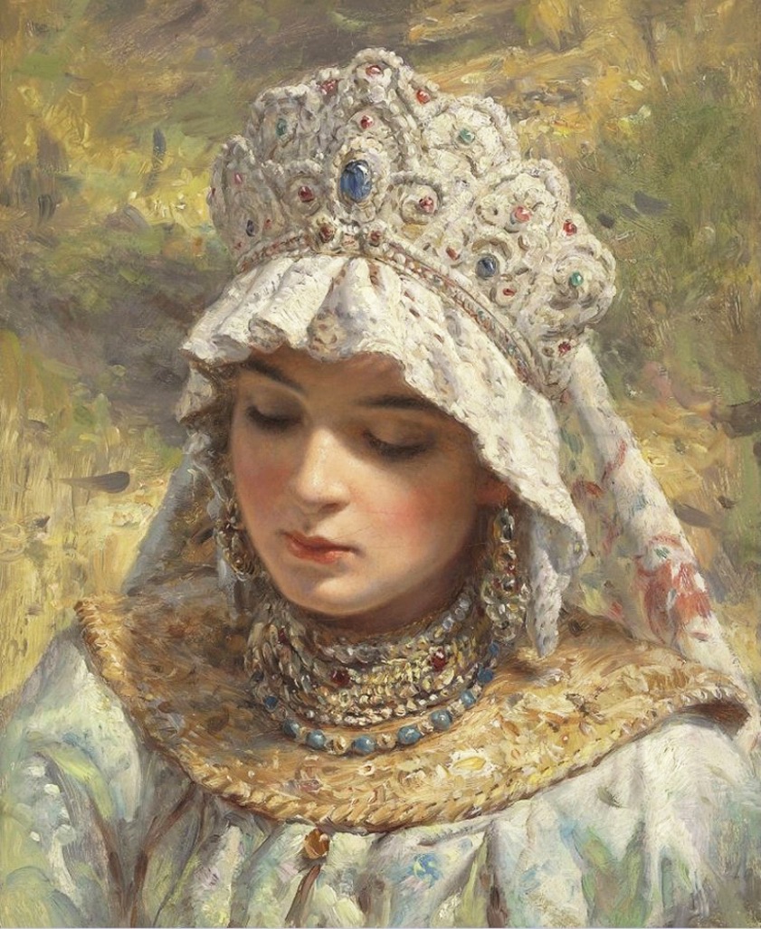
Konstantin Egorovich Makovsky (1839-1915) was one of the most popular and influential Russian artists at the end of the 19th century. A lot of his paintings show an idealized view of life in Russia in the past centuries.
The portrait genre occupied a special place in the artist’s work. Largely thanks to it, he achieved success. His paintings are known for beautifully painted furniture, clothes, expensive fabrics and furs. The artist tried to show the person being portrayed in the most favorable light, while maintaining an exact likeness.
Tags: Russian Empire
31
Gorokhovets – a picturesque historical town in Vladimir Oblast
No comments · Posted by Sergei Rzhevsky in Regions, Travel
Gorokhovets, founded in 1168, is a small town with a population of about 12 thousand people located in the eastern part of Vladimir Oblast in the center of European Russia, about 159 km east of Vladimir and 86 km west of Nizhny Novgorod.
One of the oldest towns in the region, Gorokhovets is included in the list of historical settlements of Russia. On the territory of the town and its environs, a lot of monuments of church and civil architecture from different eras have been preserved. Gorokhovets on Google Maps. Photos by: Yuliya Baturina.
Cathedral of the Annunciation (1700) in Gorokhovets.

beautiful architecture of provincial Russia
Tags: Vladimir oblast
6
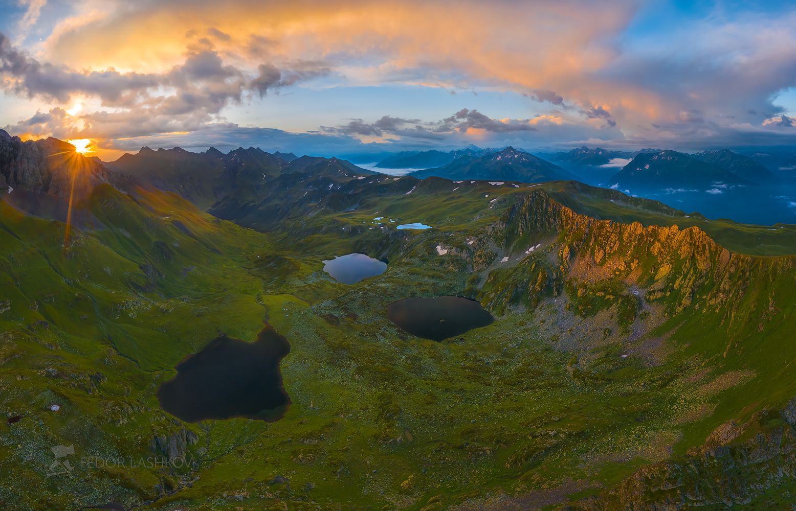
Atsgara Lakes in Karachay-Cherkessia
No comments · Posted by Sergei Rzhevsky in Nature, Regions, Travel
Atsgara lakes or the Pyatiozerye (“Five lakes”) valley are located at an altitude of about 2,500 meters above sea level in the Urupsky district of the Republic of Karachay-Cherkessia, about 26 km northwest of the village of Arkhyz and 7 km east of the village of Zagedan.
In total, there are more than 10 lakes here, but only 5 are large in size, their length is about 200-350 meters. The lakes are located on mountain terraces formed by an ancient glacier and at different heights relative to each other. In summer, these lakes warm up quite well and you can cool off in them. Atsgara Lakes in Karachay-Cherkessia on Google Maps. Photos by: Fedor Lashkov.
Tags: Cherkessk city · Karachay-Cherkessia Republic
19
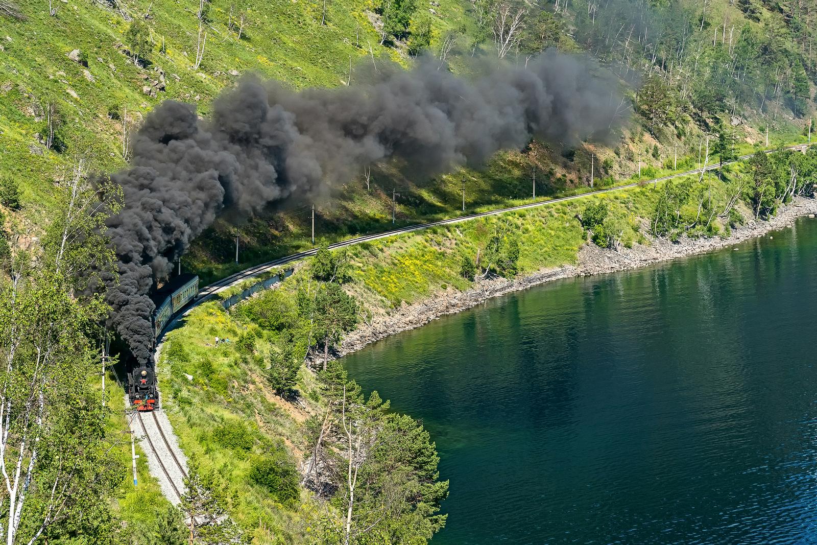
Steam Locomotive of the Circum-Baikal Railway
No comments · Posted by Sergei Rzhevsky in Entertainment, Regions, Travel
The Circum-Baikal Railway is the name used during the construction (1899-1905) and in the first years of operation of the 260 km section of the Trans-Baikal Railway. Today, this is a dead end section of Slyudyanka II – Baikal, 89 kilometers long. It is located about 70 km south of Irkutsk and runs along the shore of Lake Baikal.
This railroad has no equal in Russia by the number of engineering structures. Its tunnels and stone galleries are unique. Built according to non-standard projects, they were not rebuilt in subsequent years, retaining the original plan of architects and engineers of the early 20th century. Photos by: Mikhail Tilpunov.
Tags: Irkutsk oblast · Russian Empire
1
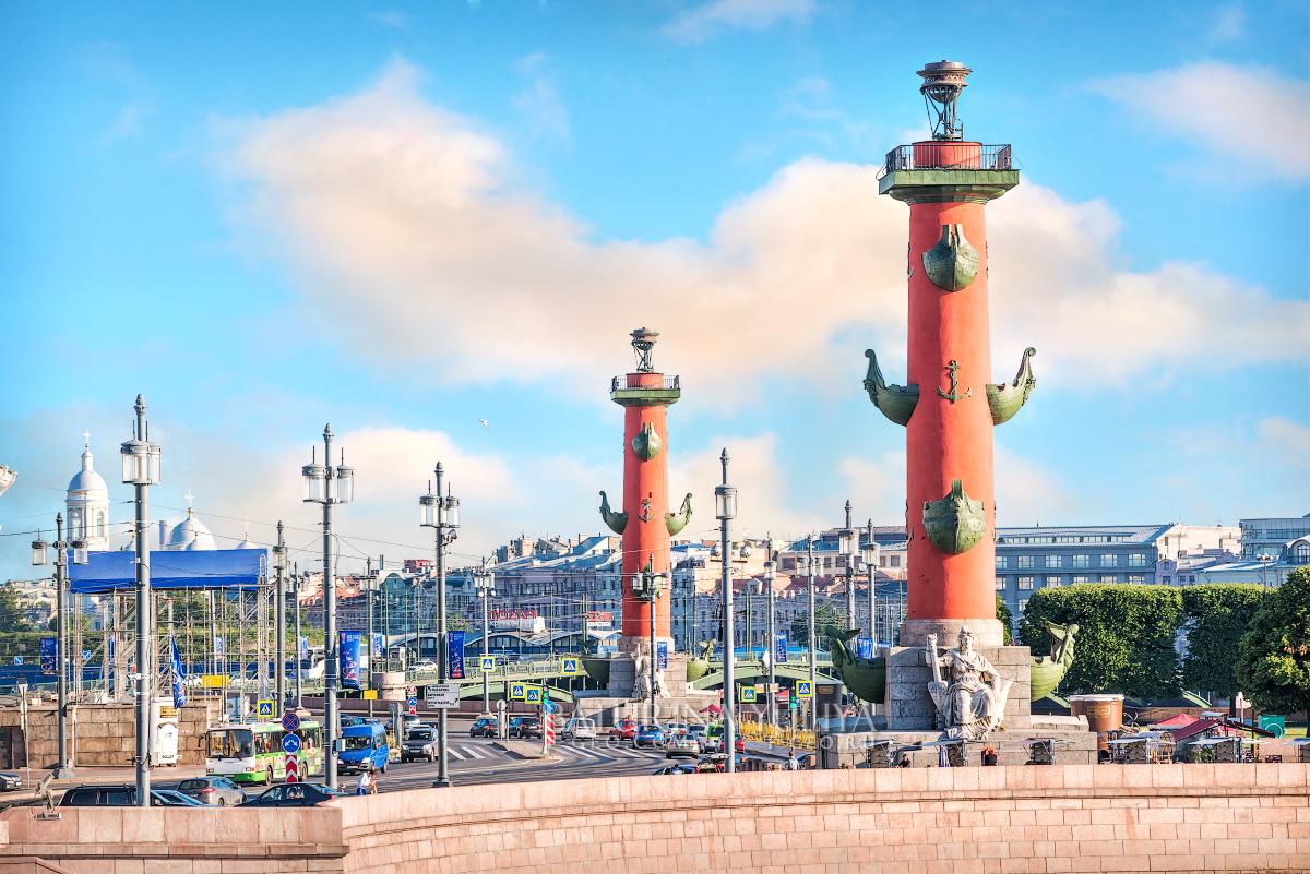
The Rostral Columns in Saint Petersburg
No comments · Posted by Sergei Rzhevsky in Architecture, History
The Rostral Columns are majestic architectural monuments located in the center of St. Petersburg, on the spit of Vasilyevsky Island, which in turn is one of the most famous architectural ensembles of the city. In the 19th century, these columns were used as lanterns to illuminate the port of the capital of the Russian Empire.
They were built according to the project of the French architect Jean-Francois Thomas de Thomon in 1805-1810 and were decorated with rostra of ships (in Latin, rostra is the plural of rostrum meaning the bow of a ship). Photos by: Yuliya Baturina.
Tags: Saint Petersburg city