History of Mari El
The Finno-Ugric tribes inhabited the current territory of the western, northern and central Russia since prehistoric times. The archaeological sites dating back to the first millennium B.C. are preserved on the territory of Mari El.
Due to the fact that Mari written language (tishte) was used only for recording economic information and Tatar written sources were destroyed, almost all of the written information on the history of the Middle Volga is in Russian language.
Between the 5th and the 8th centuries, the ancestors of Mari interrelated with the Goths and later with the Khazars, the state of Volga Bulgaria, which was located on the territory of present Tatarstan and was destroyed by the Mongols headed by Batu in 1236.
From the 9th century, Mari had contacts with the Slavic people of Kievan Rus who were moving eastwards and lived in the towns of Rostov, Galich, Yaroslavl, Suzdal, Vladimir, and Nizhny Novgorod. These towns were built on the lands of the Western Mari who converted to Christianity and were assimilated with the Slavs. Mari who refused to accept Christianity moved further east. Cheremis (the former name of Mari) were first mentioned in the 10th century.
More Historical Facts…
In the 13th-15th centuries, the territory inhabited by Mari was part of the Golden Horde and then the Kazan Khanate. In the 16th century, the area became a place of confrontation between the Russian state and the Kazan Khanate. In 1551, the territory of the highland Mari (on the right bank of the Volga River) came under the control of Moscow. In 1552, the Russian state captured Kazan and the Khazar Khanate ceased to exist. The lowland Mari began to pay tribute to Moscow too.
However, the entry into the Russian state was not peaceful and resulted in the so-called Cheremis wars, which lasted about 30 years. The wars ended after construction of towns-fortresses with military garrisons (Kozmodemyansk - in 1583, Tsarevokokshaisk (present Yoshkar-Ola) - in 1584, Yaransk and Sanchursk).
Forcible conversion to Christianity was the reason why a lot of Mari left their villages and went into the woods. During the reign of Peter the Great, Mari began to serve in the Russian army. At the same time, the research of this territory began, the first documents about the Mari language were created.
Mari lived under hard conditions and, in 1775, they joined Pugachev’s Rebellion. In 1872, a pedagogical school was opened in Kazan, which contributed to national revival of Mari. Prior to the revolutionary events of 1917, Mari had no autonomy and lived in Kazanskaya, Vyatskaya, Nizhegorodskaya, Ufimskaya, and Yekaterinburgskaya gubernias (provinces).
On November 4, 1920, Mari Autonomous Oblast was formed. In the 1920s, two equal literary language variants were established: lowland and highland Mari languages. These years were remarkable for rapid development of national culture. However, in the 1930s, when the mass repression began, this process slowed down. Mari population became the minority in the republic and the Mari language was replaced by Russian. On December 5, 1936, Mari Autonomous Oblast was reorganized into the Mari Autonomous Soviet Socialist Republic.
During the Second World War, more than 130 thousand people were drafted into the Soviet army. Only about 56 thousand people returned. At that time, a number of industrial enterprises were transferred from Moscow, Leningrad, Odessa, and others cities to Mari El.
In the postwar period, new large enterprises of machine-building and tool-making were opened. In 1972, the first university in the republic was opened - Mari State University.
On December 9, 1992, it became the Republic of Mari El. The name is derived from the ethnic name of indigenous population “Mari” (meaning “man, husband”) and “el” (meaning “country, region”).
In the 2000s, a lot of cultural facilities in Yoshkar-Ola (Tsarevokokshaisk Kremlin, embankment, Arkhangelskaya Sloboda, Sergei Chavain Boulevard, Victory Boulevard and others) were built and reconstructed.
Nature of the Mari El Republic

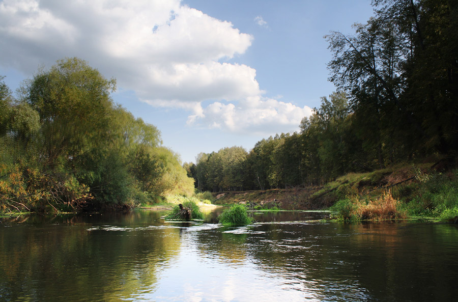
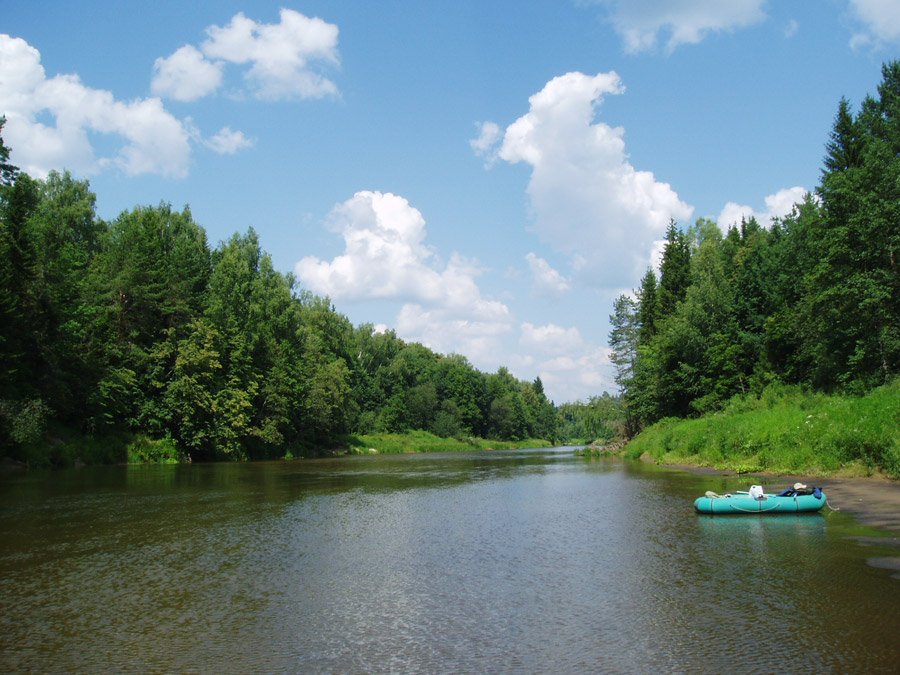
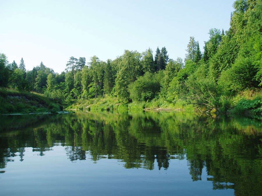
Small river in Mari El
Author: Alex Grachov

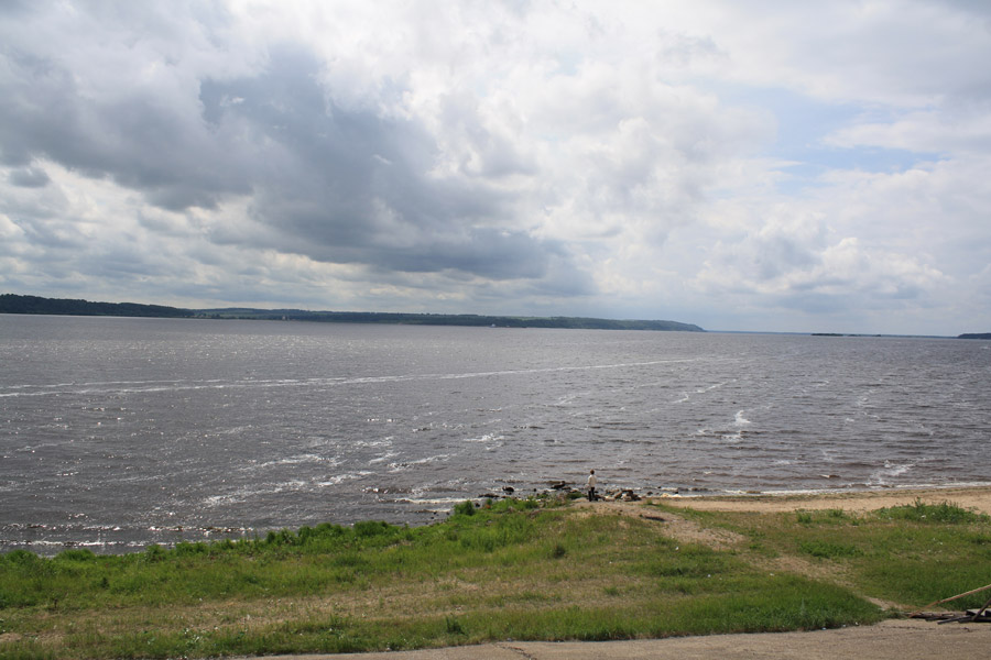
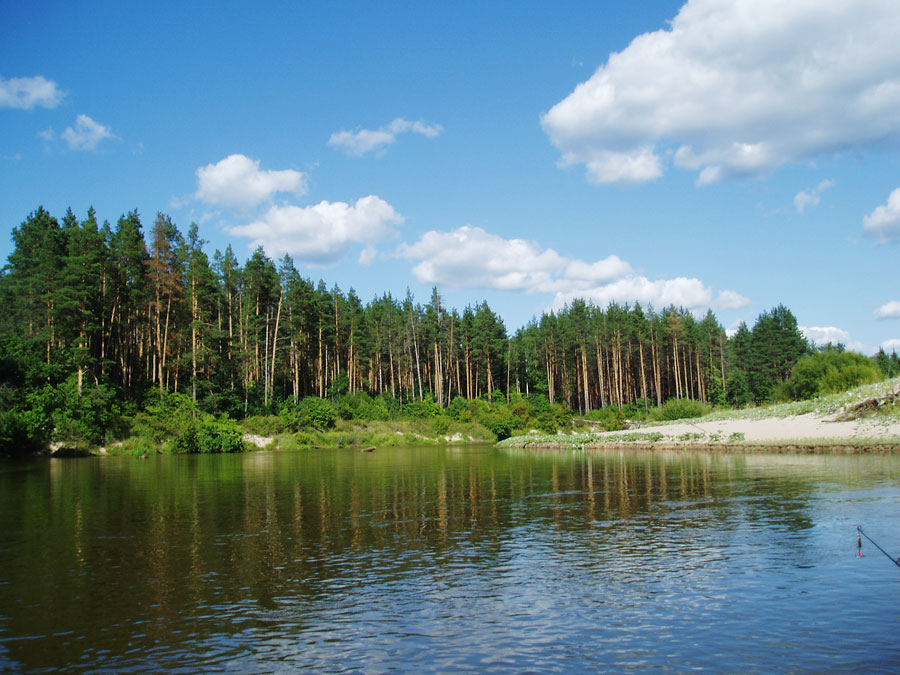
The Volga River in the Mari El Republic
Author: Alex Grachov

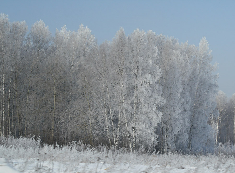
Winter in Mari El
Author: Alex Grachov
Mari El - Features
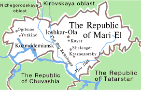
Mari El is located in the east of the East European Plain, in the middle reaches of the Volga River. Most of the territory of the republic is located on the left bank of the Volga. Gornomariysky district is situated on the right bank.
The climate is temperate continental with long cold winters and warm summers. The average temperature in summer is about plus 18-20 degrees Celsius, in winter - about minus 18-19 degrees Celsius.
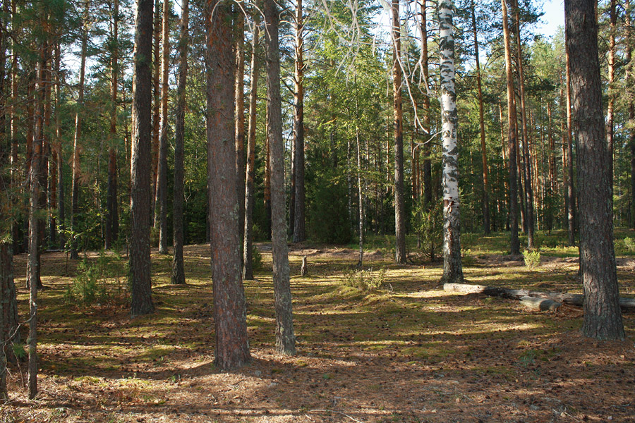
The main natural resources are peat, clay, building stone, limestone, glass, silicate sands, mineral springs. Mari El is rich in lakes and coniferous forests. The main industries are machine-building and metal working, timber, wood processing, paper and pulp, light and food industries. Agriculture is presented by meat and milk producing, sheep, goat and pig breeding, poultry farming. Such crops barley, oats, rye, wheat and vegetables are grown.
Yoshkar-Ola, with the population of about 279,400 people, is the largest city of the region. Also there are three towns: Volzhsk (51,900), Kozmodemyansk (19,700) and Zvenigovo (10,800). The national composition according to the 2010 Census: Russians (45.1%), Mari (41.8%), Tatars (5.5%).
Today, only about 320,000 of Mari out of 670,000 live in the Republic of Mari El. National culture of the Mari region is rich and diverse. Mari El is connected by cultural and economic ties with other Finno-Ugric peoples of Hungary, Finland and the Baltic countries.
The transport network of the republic is presented by all modes of transport: river (the Volga and Vetluga rivers with piers in Zvenigovo, Volzhsk, Kozmodemyansk, Yurino, Kokshaysk), air (the airport in Yoshkar-Ola offers regular flights to Moscow), rail (regular trains to Moscow), highways to Kazan and Cheboksary.
Attractions of Mari El
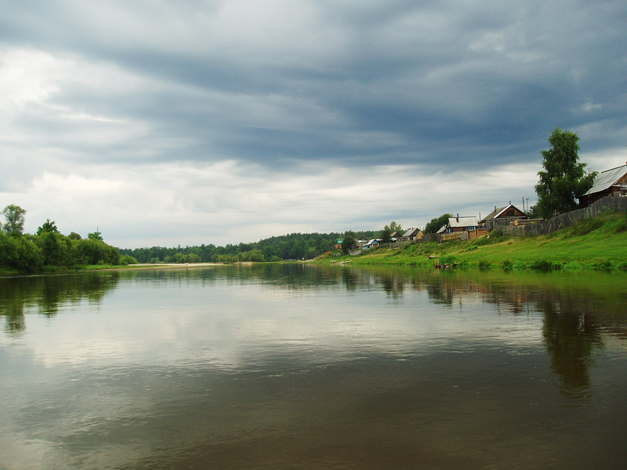
The Republic of Mari El is one of the most environmentally friendly regions in the European part of Russia. There are a lot of beautiful clean lakes, rivers and forests. It is a popular destination for travelers and tourists who enjoy nature.
The Volga, the longest river in Europe, flows for 155 kilometers through the territory of Mari El. Kozmodemyansk, one of the oldest towns in the territory of the republic, stands on its banks. Kozmodemyansk museum complex includes:
- Art and History Museum named after A.V. Grigoriev;
- Ethnographic Open-Air Museum - an exhibition showing the life and culture of the mountain Mari;
- Museum of Ostap Bender - installations and everyday objects one way or another related to the events of Ilf and Petrov’s novels “12 chairs” and “The Golden Calf”;
- Merchant Life Museum - the interior (furniture, household items) of a merchant’s house.
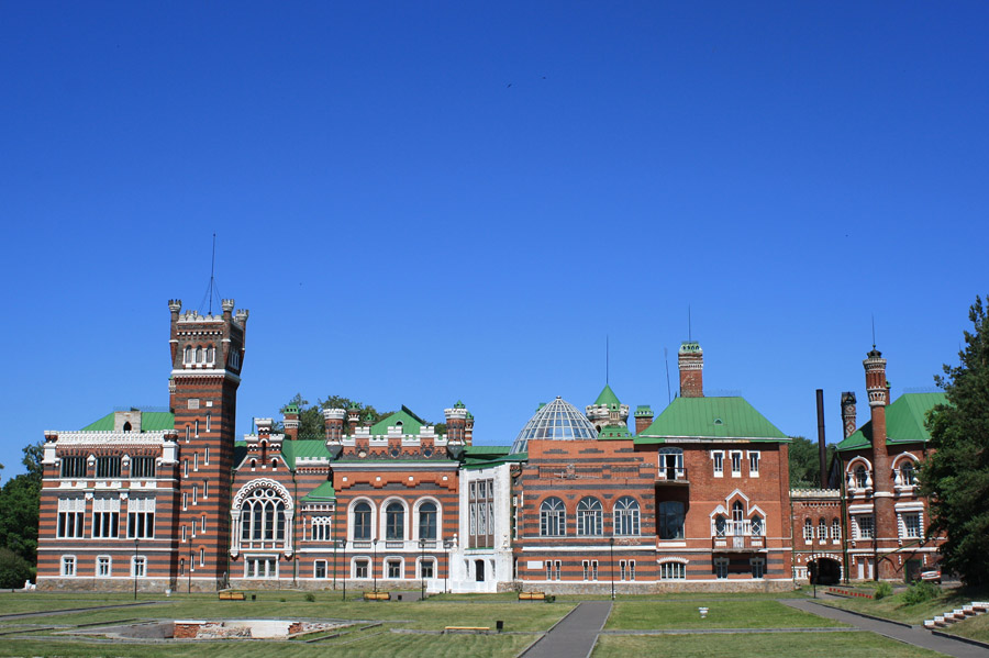
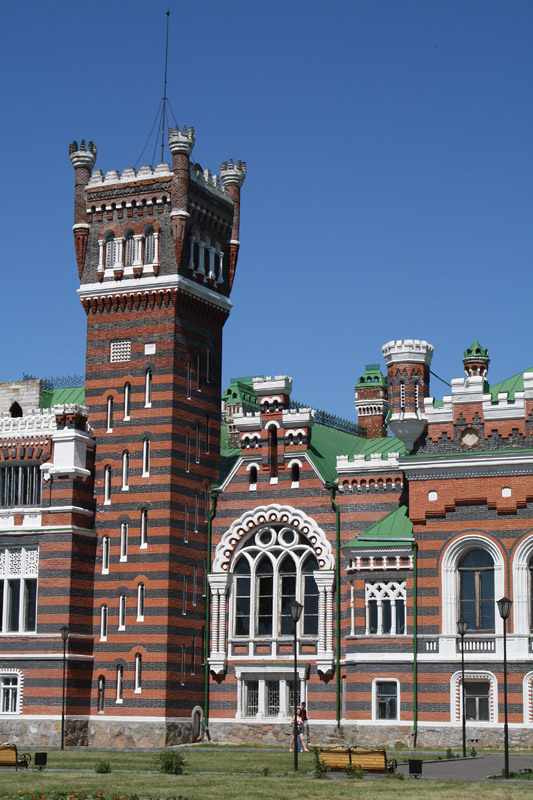
On the banks of the Volga you can also find the famous Sheremetev Castle (1874-1915). This palace and park ensemble, an architectural monument of federal importance, is located in the village of Yurino.
Numerous lakes are one of the main natural resources of the Republic of Mari El. Many of them are surrounded by forests and very picturesque. Tourist park, sports camps, rest homes, and sanatoriums are located on their shores. Bolshaya Kokshaga Nature Reserve is known for its virgin forests and wildlife.
The National Park “Mari Chodra”, located on Klenovaya (“Maple”) Mount, in the valley of the Ilet River, is an interesting natural complex offering various opportunities for boating, fishing, horseback riding, and mushrooming.
On its territory you can find “Klenovaya Mountain” sanatorium, such popular tourist places as Zelenyy Klyuch source, the lakes of Yalchik, Mashiner, Glukhoye, Konaner, the rivers of Ilet, Yushut, Petyalka. The oldest oak tree in the republic known as the Pugachev’s Oak is situated here too. According to legend, E.I. Pugachev with his troops stayed the night in its shadow.
Tours with recreational activities include water routes along the rivers of Malaya and Bolshaya Kokshaga, Bolshoy Kundysh, Ilet, Nemda, Volga; hiking and horseback riding in the south-western, southern and north-eastern parts of the republic; cycling and skiing throughout the entire region. Pilgrimage tours to holy places (monasteries, churches, sacred springs) and cult groves are also popular.


The comments of our visitors