
12
Taymyr – the Largest Peninsula in Russia
No comments · Posted by Sergei Rzhevsky in Uncategorized
Taymyr, the largest peninsula in Russia and the northernmost continental landmass of the Eurasian continent, is located between the Kara Sea and the Laptev Sea, on the coast of the Arctic Ocean, in the very north of Krasnoyarsk Krai.
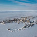
The total area of Taymyr is about 400 thousand square kilometers, which is larger than the area of such countries as Japan (373) and Germany (357). There are no cities on the peninsula, the nearest ones are Dudinka and Norilsk located to the south of the peninsula.
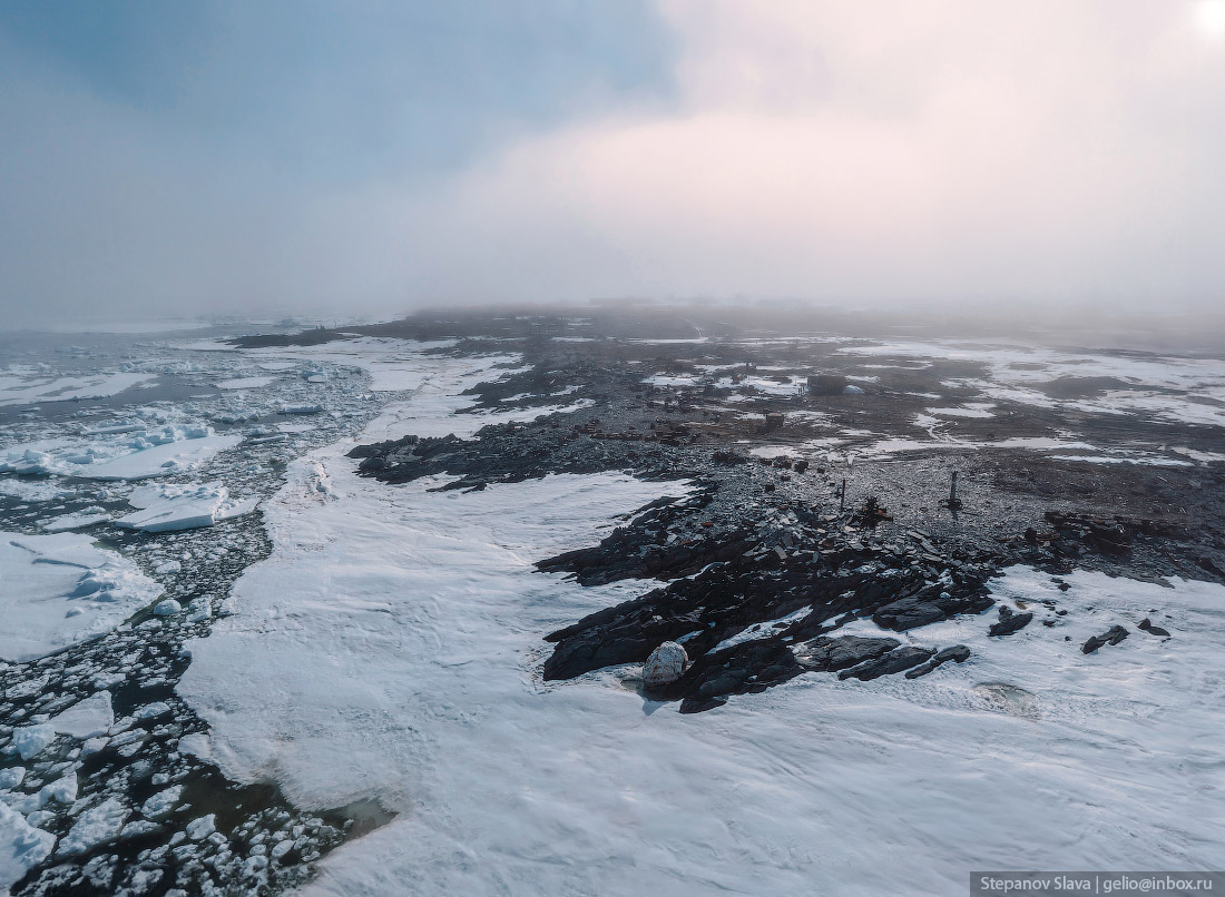
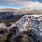
The Taymyr Peninsula is located in the Arctic and subarctic zones, which determines the extreme severity of its climate. Taymyr is characterized by long cold winters with temperatures down to -62 °C and short cool summers. Snowstorms are common, sometimes lasting up to several weeks. The local population is made up of peoples of the North who roam the territory. The Taymyr Peninsula on Google Maps. Photos by: Slava Stepanov.
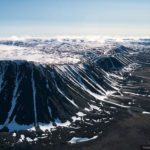
Byrranga are the northernmost mountains in the world. You can get here only by helicopter from Norilsk, Khatanga or Dikson. Weathering and permafrost have left their mark on the shape of these mountains – they have become flattened, without sharp outlines, and the peaks resemble a staircase with giant steps. The slopes and peaks are covered with “stone rivers” – fragments of rocks brought here by glaciers.
Cape Chelyuskin is the northernmost point of the continental landmass. The first to discover the northernmost point was Semyon Chelyuskin (1707-1764), a Russian polar explorer and naval officer, who got here with two Cossacks on a dog sled. The white boulder on the shore is a natural distinguishing mark of the northernmost point of the world. Nearby stands a border post and an old anti-aircraft installation.
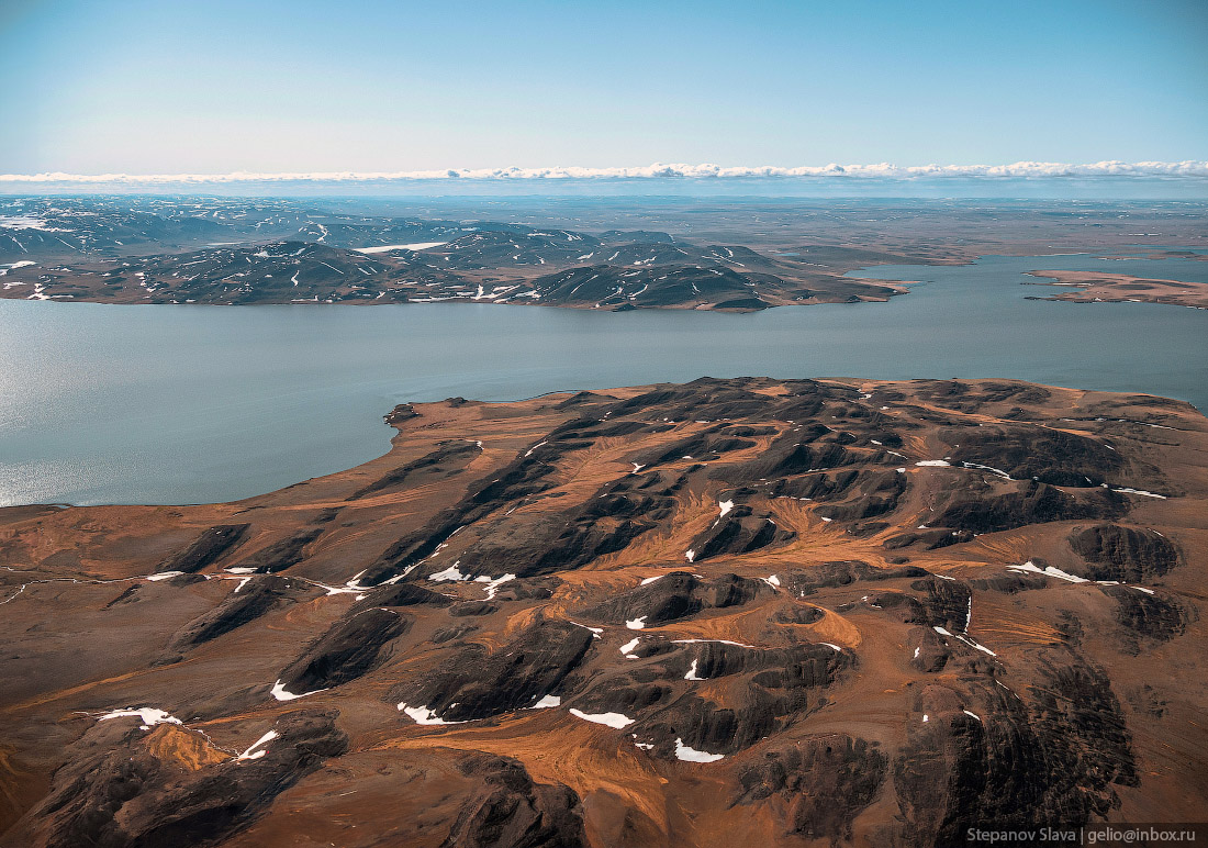
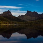
Lake Taymyr (4,560 square kilometers) is the fourth largest in Russia and the second largest in Siberia after Lake Baikal (31,722 square kilometers). Taymyr is a glacial lake formed tens of thousands of years ago, when the retreat of glaciers left depressions on the ground.
Lake Taymyr is quite shallow – the average depth is only 2.8 meters, but there are also areas with a depth of up to 26 meters.
Musk oxen disappeared as a species in Taymyr many years ago. It is believed that these animals were simply exterminated by hunters. In the 1970s, an experiment was launched to restore the population – Canadian musk oxen were brought to Taymyr. The experiment was a success – the musk oxen adapted well to the Taymyr climate.
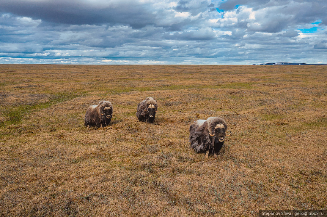
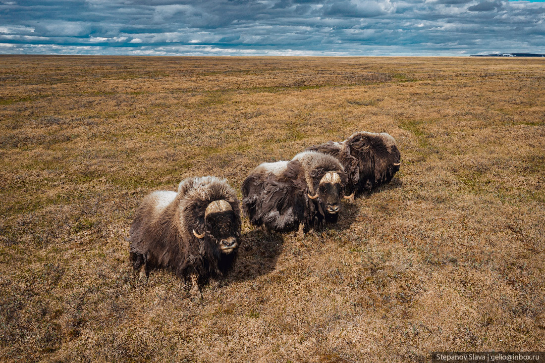
Musk oxen are better adapted to Arctic life than the reindeer that are widespread in Taymyr. They quickly spread and gradually displace the reindeer from the territory. By 1994, the number of musk oxen in Taimyr exceeded 1,000. In 2012, about 8,000 musk oxen lived in the Taymyr tundra.
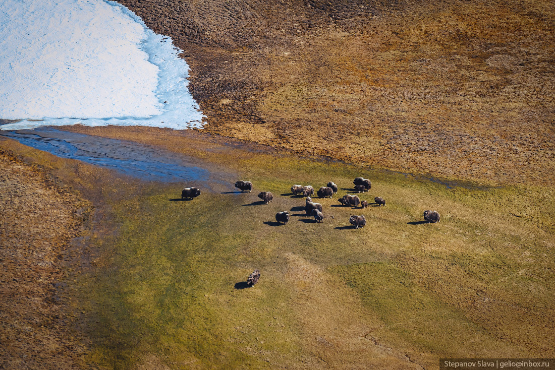
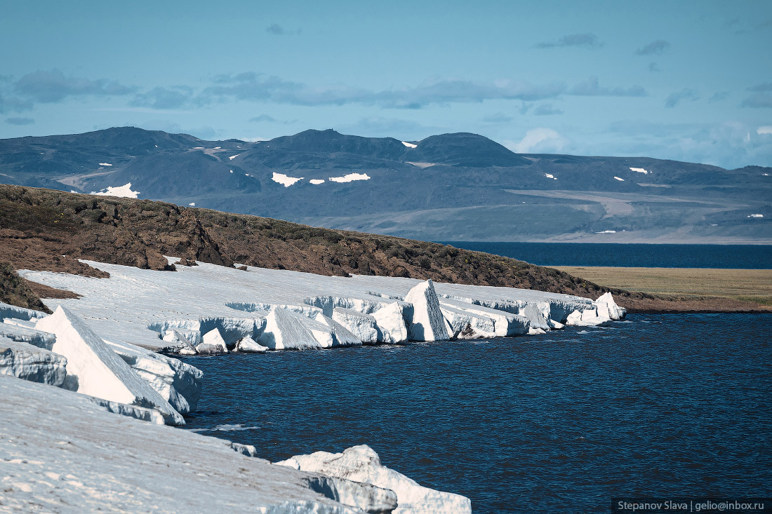
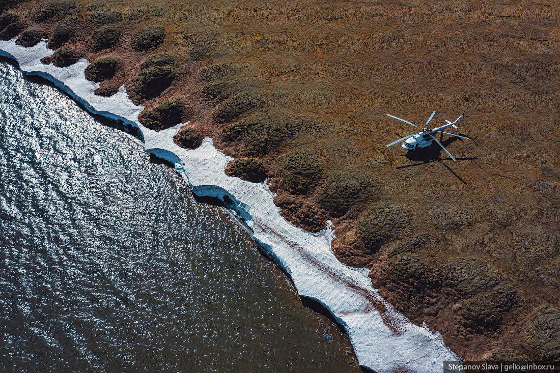
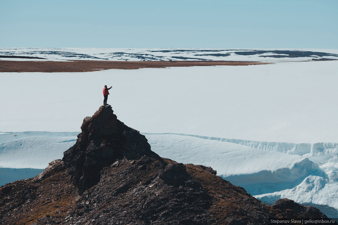
In some parts of the Taymyr Peninsula, ice remains on the surface all year round.
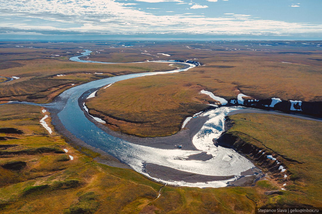
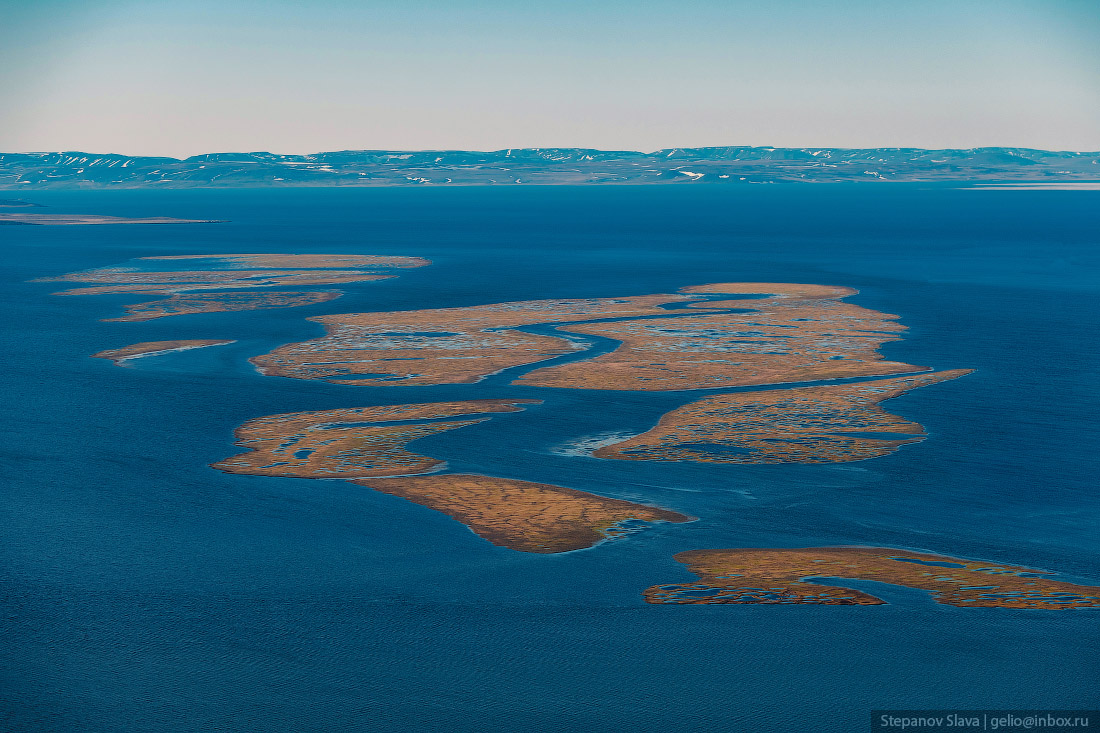
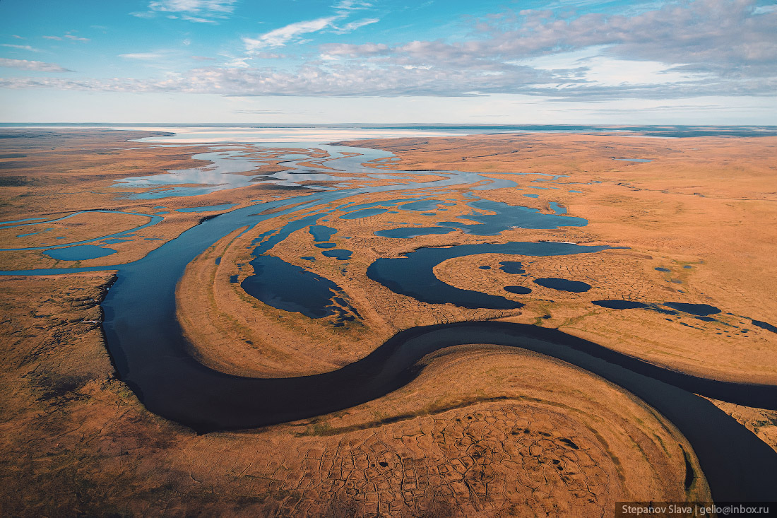
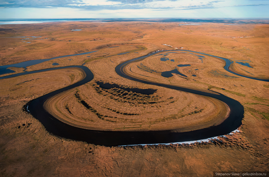
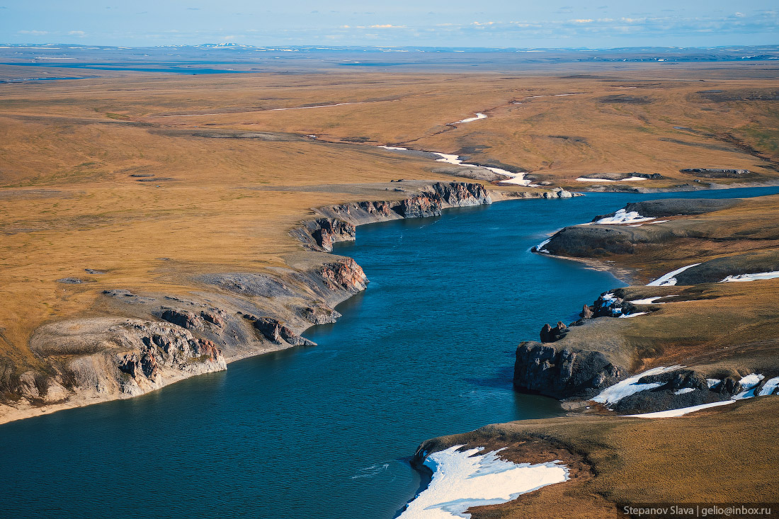
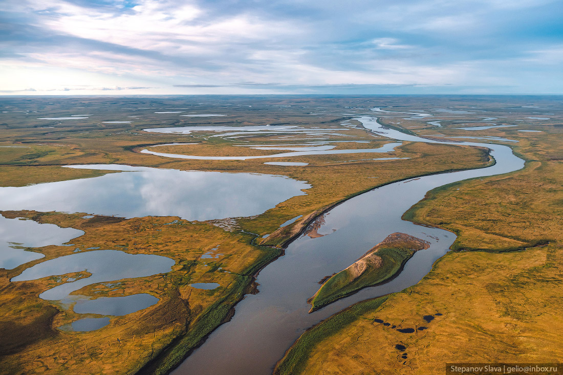
Winding rivers of Taymyr.
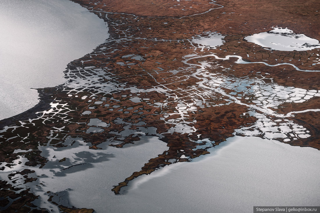
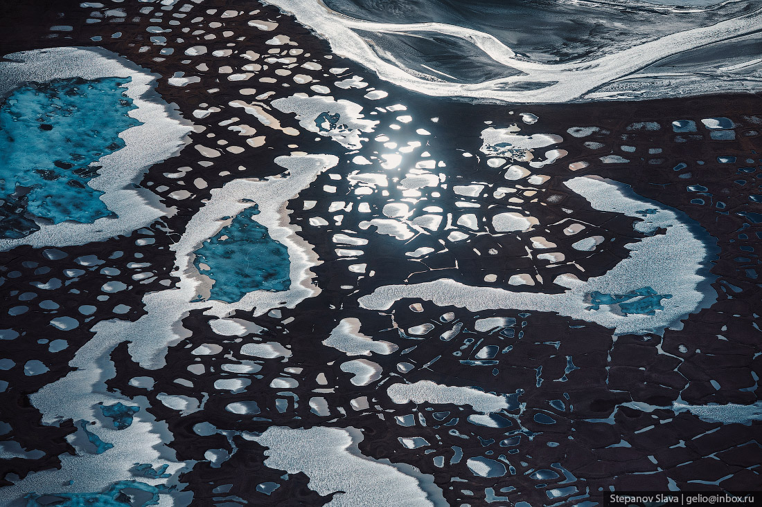
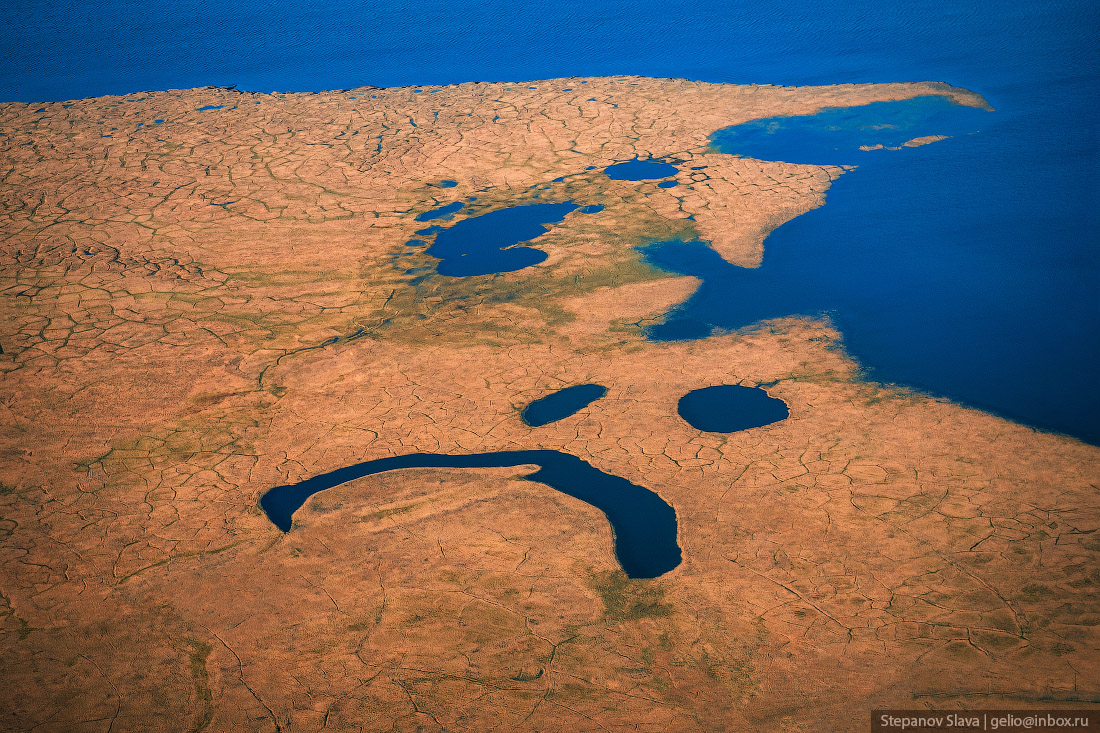
Polygonal swamps of Taymyr. Scientists believe that this bizarre shape is due to the constant alternation of melting and freezing cycles of the upper part of the permafrost – this causes erosion on the surface.
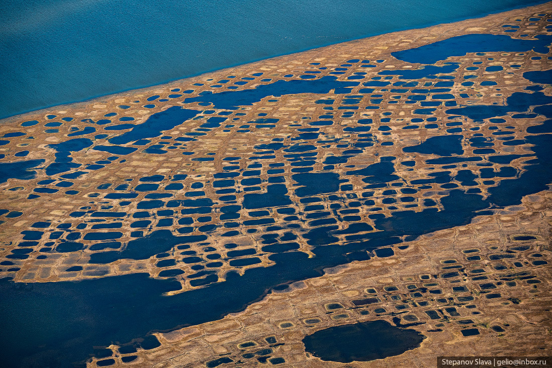
The soil from the cracks is pushed up and forms ridges, on which vegetation appears in the summer. And in the lowlands between the ridges, water accumulates. Thus, the surface is covered with polygons.
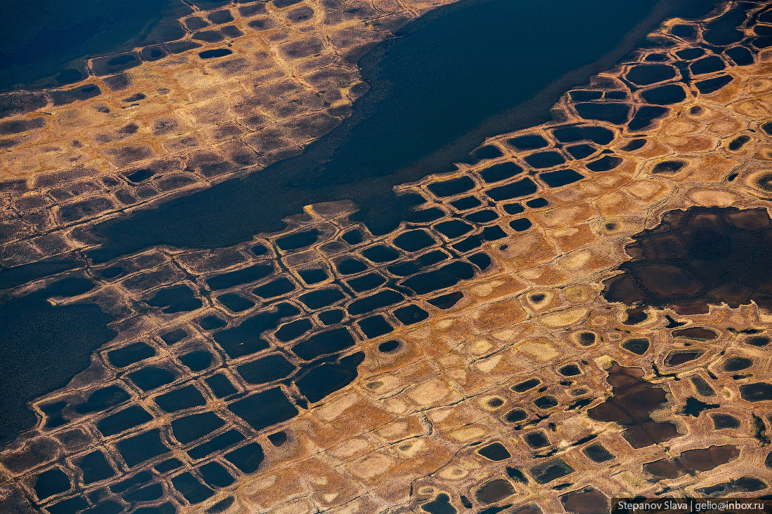
Reindeer trails are often found on the ridges – herds migrate along them, like along roads to the south and north.
Bird colony on the steep cliffs of the Unga River.
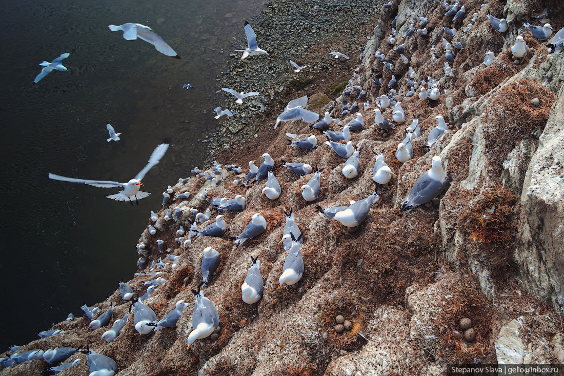
Bird colonies in the Arctic are a very common phenomenon. Thousands of birds flock here to nest. For the winter, the birds fly off to different countries – they travel thousands of kilometers every year to return and raise their offspring.
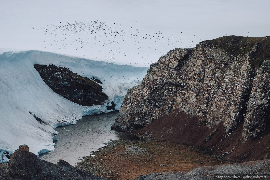
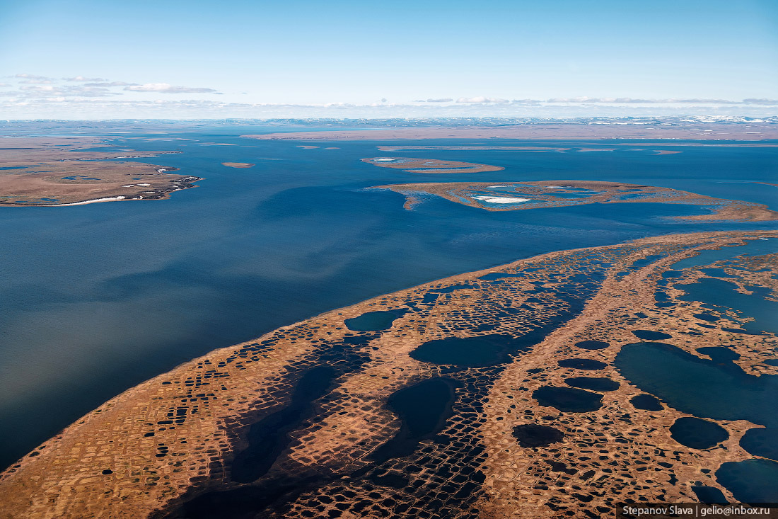
The Unga River flows through Taymyr in a winding channel and flows into the Laptev Sea.

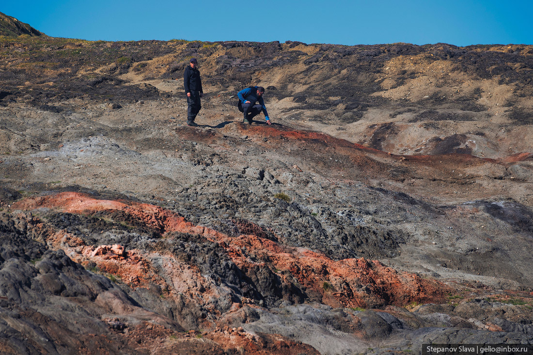
The burning coals on the Shrenk River are natural coal burning sites. This rare natural phenomenon was discovered not so long ago, although the coal burning, according to some estimates, has been going on for several centuries. The Shrenk River in its lower reaches cuts through powerful coal seams that stretch along the river in low hills.
Coal spontaneous combustion occurs due to interaction with elements that are part of the coal seams. Hundreds of years ago, coal spontaneously ignited from the interaction of these elements with air – and since then it has been smoldering and burning underground.
Most of the territory of Taymyr is in areas of excessive moisture. Filtration is almost absent here, water stagnates on the surface, forming numerous lakes and swamps.
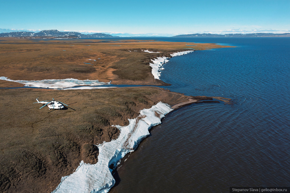
The only way to get to many points in Taymyr is by air.
Due to poor transport accessibility, tourists rarely come here. Usually groups come to Norilsk or Dudinka, sometimes they visit the Putorana Plateau, which borders Taymyr in the north, but almost no one gets to the peninsula itself.
There are several hypotheses about the origin of the toponym “Taymyr”. The most widespread version is about the Evenki origin from the ancient Tungus “tamura” (“valuable, expensive, rich”). This is what the Evenks initially called the Taymyr River, which was abundant in fish.
In the 19th century, through the geographer and traveler Alexander Fyodorovich Middendorf (1815-1894), this name spread to the entire peninsula.

Tags: No tags


<< Why Slot Games Continue to Be the Most Popular Casino Choice