History of Volgograd Oblast
Since the early 1240s, the Lower Volga region became part of the Golden Horde state founded by the Mongolian khan Batu. In the 13th-14th centuries, along the Volga and Akhtuba, there were numerous settlements and major urban centers, the population grew significantly, the local merchants established trade links with Russian principalities, the Italian republics, Egypt, Iran, Central Asia, India, and China.
In the first half of the 15th century, the Golden Horde broke up into a number of independent states including the Kazan and Astrakhan khanates. In the middle of the 16th century, they were conquered by the troops of the Russian Tsar Ivan the Terrible. From this time, colonization and economic development of this region by Russian settlers began.
From the second half of the 16th century, a system of fortress towns was created in the Volga region, built to protect the southeastern borders of the Russian state. The fortress of Tsaritsyn (Volgograd), founded in 1589, was one of these outposts.
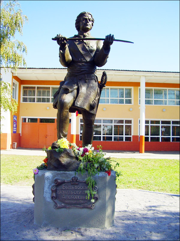
Peter the Great visited Tsaritsyn three times. According to his plan, in the 1730s, there was a reconstruction of the Tsaritsyn fortress and the construction of the Tsaritsyn sentry line, which contributed to the settlement of the lands along the rivers of Medveditsa, Ilovl, Volga, and Akhtuba.
More Historical Facts…
In 1765, as a result of two manifestoes of Catherine the Great, who invited people from abroad to settle in Russia, the first foreigners appeared in the region. They were granted a number of benefits, including exemption from recruitment and taxes for 30 years. After it, more than 100 German colonies appeared along the banks of the Volga River.
In the late 18th century, when the Crimea and the Kuban became parts of the Russian Empire, the borders of the state moved far to the south. The Tsaritsyn sentry line was abolished, the Volga Cossack army was liquidated, and the town lost its military-strategic importance. In 1798, Tsaritsyn became a district town of the Saratov province.
Until the second half of the 19th century, the economy of the region was represented exclusively by the agrarian sector (growing grain crops, melon growing), cattle breeding as well as fishing and hunting. In the 1860s-1870s, with the construction of railways, Tsaritsyn turned into the largest transit center of the southeast of the Russian Empire.
In the last quarter of the 19th - early 20th centuries, Tsaritsyn became one of the largest industrial centers of the Volga region. In 1880, the oil industrial town of Nobel was built, which later grew into the largest for the time oil industry complex. The merchants of Tsaritsyn called their town Russian Chicago.
In the late 1920s and throughout the 1930s, industry was the leading branch of the local economy. Old factories were modernized and new enterprises were opened. In April 1925, the city was renamed Stalingrad. Stalingrad oblast, formed in 1936, occupied one of the leading places in the economy of the USSR, and Stalingrad became a major industrial, scientific and cultural center, the southern capital of the country.
During the Second World War, the Stalingrad battle took place on the territory of the region, which played an important role in the defeat of Nazi Germany. As a result of fierce fighting, the city was turned into ruins.
Among the largest economic projects implemented on the territory of the region in the post-war period: the Volga-Don Shipping Canal, the Volzhskaya HPP, aluminum, metalworking and chemical plants, light and food industry enterprises.
In 1961, after the condemnation of Stalin’s cult of personality, Stalingrad was renamed to Volgograd, and the region, respectively, became Volgograd oblast.
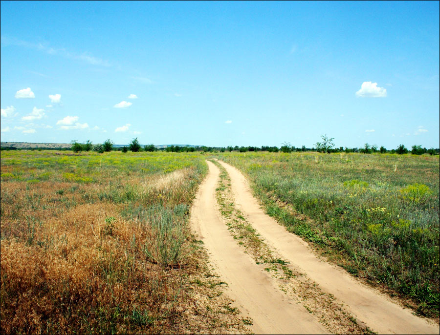
Volgograd Oblast scenery
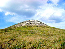
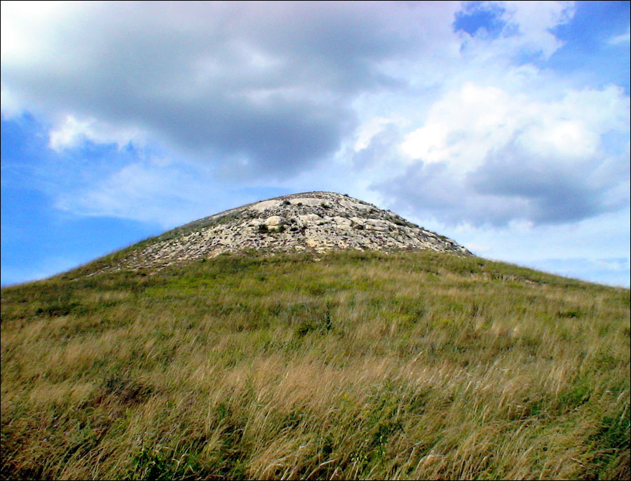
Cretaceous mountain in Volgograd Oblast
Author: A.S.Vasiliev
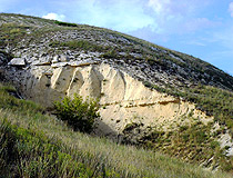
Nature of the Volgograd region
Author: A.S.Vasiliev
Volgograd Oblast scenery
Author: Nikolay Barabanshikov
Volgograd Oblast - Features
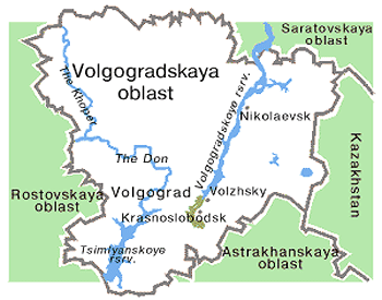
From north to south and from west to east, Volgograd Oblast stretches for more than 400 km. This region has an advantageous geographical position, being the main gateway to the south of Russia with access to Iran, the Caucasus, Ukraine, and Kazakhstan.
Also two main rivers of the European part of Russia, the Volga and the Don, are connected through the Volga-Don Canal here. With its help it is possible to reach the following seas: the Caspian Sea, the White Sea, the Baltic Sea, the Black Sea, and the Sea of Azov.
The climate of the Volgograd region is arid, with a pronounced continentality. The average temperature in January is about minus 8-12 degrees Celsius, in July - plus 22-25 degrees Celsius.
Volgograd Oblast has a high potential of natural resources: hydrocarbon raw materials (oil, condensate, natural gas), chemical (potash, magnesium, sodium salts, phosphorites), cement raw materials for the metallurgical industry, building materials, iron ores, non-ferrous, and rare metals.
The largest cities and towns of Volgograd Oblast are Volgograd (1,001,200), Volzhsky (321,400), Kamyshin (107,000), Mikhailovka (56,300), Uryupinsk (35,500), Frolovo (35,200).
Volgograd Oblast - Economy
The Volgograd region is one of the most economically developed regions of Russia with a balanced economic structure. Diversified agriculture is combined with a diverse industry, oil and natural gas reserves. Two largest navigable rivers flow along the territory of the region, connected by the Volga-Don Canal. Volzhskaya hydroelectric power station is located on the territory of the region.
The main industries are machine building and metalworking (tractors, ships, tower cranes, bearings, equipment for the oil industry, electrical and food industries, drilling, transport and storage, medical and commercial equipment), fuel (oil and gas production), oil refining, chemical industry, ferrous, and non-ferrous metallurgy.
The production of building materials is well developed, as well as textile, woodworking and food industries. Local agriculture is focused on the production of grain, corn, cereals, oilseeds, and vegetable oil, vegetables, fruits, melons.
Important railways, highways, water- and airways cross the territory of the region. The lower Volga and Don connected by the Volga-Don Canal favor freight carrying from the ports of European countries to Africa and the Middle East. The territory of the region is crossed by the federal highway M6 “Moscow - Astrakhan”.
Attractions of Volgograd Oblast
Volgograd Oblast is a relatively popular tourist destination in Russia, especially during a long and warm summer. Such small rivers of the region as the Khoper, Medveditsa, Ilovlya, Akhtuba are famous for their picturesque valleys.
There are seven natural parks in the region: the Volga-Akhtuba floodplain, the Donskoy, the Nizhnehopersky, the Ust-Medveditsky, the Tsimlyansk sands, the Shcherbakovsky, the Eltonsky.
The main places of interest located outside Volgograd:
- Volga-Akhtuba floodplain, which begins immediately behind the Volga hydroelectric power station, near which the Akhtuba separates from the Volga, a great place for fishing;
- Lake Elton - one of the most interesting natural sites on the territory of the Volgograd region, the largest salt lake in Europe (152 sq. km.). The name came from the Kazakh “Altyn-Nur”, which means “Golden Lake”;
- Floating islands on the lakes Bolshoye Babye and Maloye Babye near the village of Bolshoy Babinsky in Alekseevsky district;
- Archedin-Don Sands - a state botanical nature monument located on the territory of Serafimovichsky and Frolovsky districts, one of the largest sand massifs in the Volgograd region;
- Cretaceous mountains located on the right bank of the Ilovlya River, starting from the village of Kondrashi and ending in the area of Kamenniy brod;
- Sarpinsky Island - the largest river island in Europe located on the Volga River opposite Volgograd, the width - 18 km, the length - 20 km. This natural complex is the central part of the natural zone of Volgograd;
- Park-Museum of the Russian Fairy Tale named after A.S. Pushkin in the village of Kirovets in Sredneakhtubinsky district;
- Ethnographic Museum of Cossack Folk Architecture and Life located on the bank of the Ilovlya River, the 79th kilometer of the Volgograd-Moscow highway;
- Military-Memorial Cemetery of Rossoshka - a burial place of German and Soviet soldiers;
- Local History Museum in Kamyshin;
- Volga-Don Shipping Canal - an architectural ensemble included in the list of historical and cultural monuments of the Volgograd region;
- Monument to the Goat, Museum of Local Lore and Art in Uryupinsk.