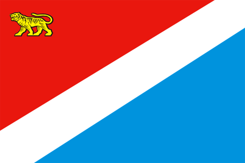
Primorsky Krai - Overview
Primorsky Krai (informally Primorye) is a federal subject of Russia located in the south-eastern part of the country, in the south of the Far East, part of the Far Eastern Federal District. Vladivostok is the capital city of the region.
According to the Federal State Statistics Service of Russia, the population of Primorsky Krai is about 1,799,600 (2025), the area - 164,673 sq. km.
History of Primorsky Krai
The first people settled in the region more than 30 thousand years ago. According to ancient legends, the coastal line was densely inhabited. In the Middle Ages, there were three empires on the territory of Primorye, which successively replaced each other: Bohai (698-926), Jin (1115-1234), Eastern Xia (1215-1233).
In the early 13th century, the territory of East Asia suffered the Mongol invasion. This led to the fall of the empire of Jin, but some provinces in the east preserved independence and formed an independent state known as Eastern Xia. In 1233, after another invasion this state ceased to exist too.
After that, the region was in ruins and attracted people persecuted in surrounding countries (bandits, adventurers, political dissidents). The first documented Russian presence in the region dates back to the summer of 1655, when the northern Primorye was visited by Russian Cossacks under the command of Onuphrius Stepanov.
In the middle of the 19th century, the Russian Empire began to strengthen its position in the north-west coast of the Pacific Ocean. In 1856, Primorskaya oblast was formed from the coastal parts of Eastern Siberia and Kamchatka. The territory of present Primorye was incorporated into the Russian state on the basis of Aigun (1858) and Beijing (1860) peace treaties that legalized the border between Russia and China.
More historical facts…
Since then, the southern part of Primorye took its current shape. In 1860, Vladivostok was founded as a military post. Russian migration in the region began. In 1899, the Oriental Institute was opened in Vladivostok - the first higher educational institution in Eastern Siberia and the Far East, and one of the oldest in East Asia.
Further strengthening of Russian positions in the Far East was limited by the small size of the Russian population and remoteness from populated parts of the empire. Regular communication between St. Petersburg and Vladivostok was established after the completion of the Trans-Siberian Railway in 1903.
From 1861 to 1917, about 250,000 peasants arrived in Primorye and founded 342 settlements. In 1917, the population of Primorye amounted to 307,000 people. By the mid-1920s, the local population reached 600,000 people. In the 1930s, forced industrialization and collectivization began which led to another wave of migration. The migration was both voluntary and forced (prisoners).
In 1937-1938, about 200,000 people of Korean and Chinese nationalities were forcibly deported from the region. Until the end of the 1980s, as a result of ethnic deportations, the Chinese and Koreans disappeared from the national composition of the population of Primorye.
In the summer of 1938, on the southern boundary of Primorye, in the area of Lake Khasan, there were military clashes between Manchukuo (a puppet state under Japanese control) and the Soviet Union. After two weeks of fighting, the USSR was able to repel the aggression. On October 20, 1938, Primorsky Krai with the capital in Vladivostok was formed.
After the end of the Second World War, Primorsky Krai continued to develop as a major industrial and agricultural region of the Far East also specializing in the extraction of natural resources. Rail and sea transport played a significant role in the local economy. Migration from the European part of Russia and Siberia continued, which led to an increase of population of the region from 1,381,000 people in 1959 to 1,978,000 in 1979.
With the collapse of the Soviet Union, the region’s economy went into decline, reverse migration in the European part of Russia began. At the beginning of the 21st century, the social and economic situation in Primorsky Krai improved.
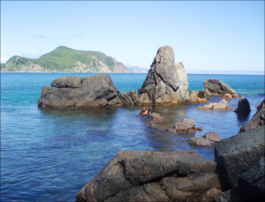
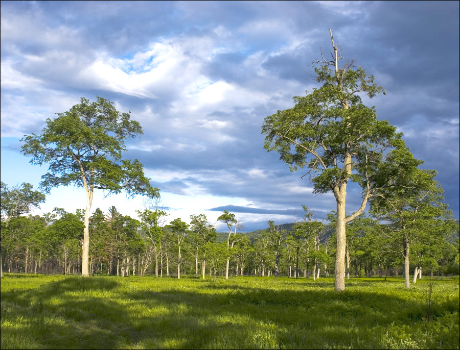
Beautiful nature of Primorsky Krai

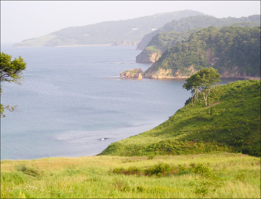
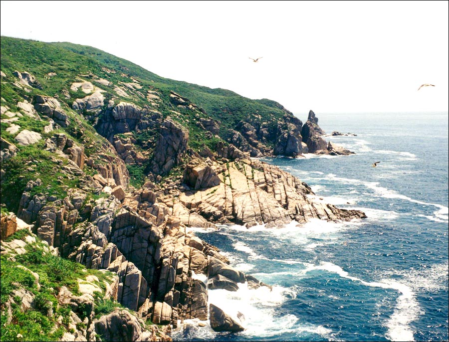
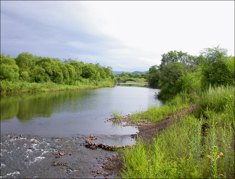
On the coast in Primorsky Krai
Author: Andrej Serbskij
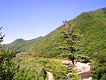
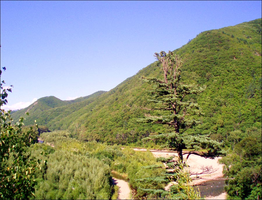
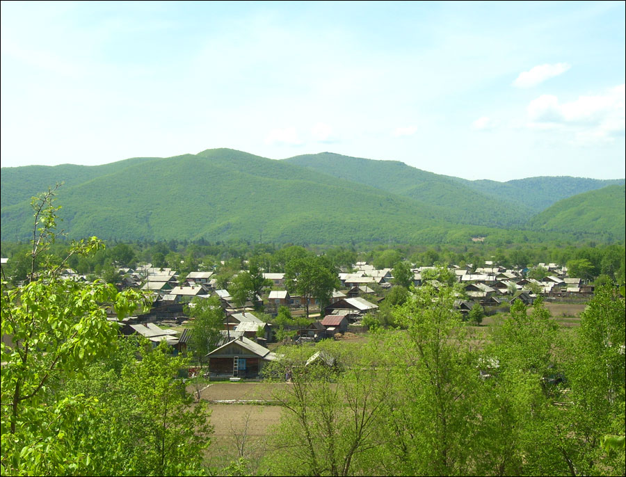
Hilly landscape of Primorsky Krai
Author: Kazakov Igor

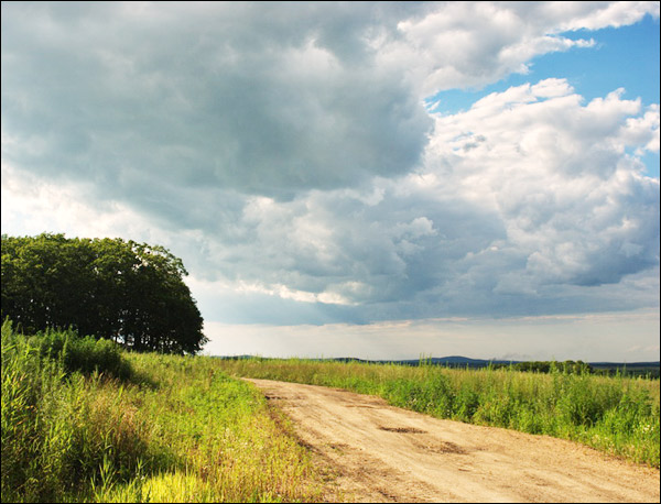
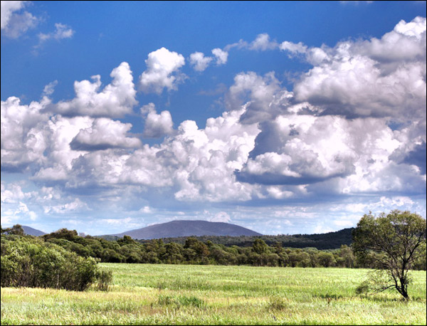
Primorye scenery
Author: Viktor Koblov
Primorsky Krai - Features
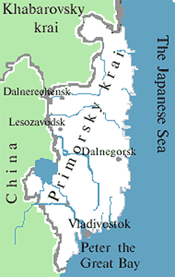
Primorsky Krai is located in the south of the Far East, in the south-eastern part of the Russian Federation. It is bordered by Khabarovsk Krai in the north, China in the west, North Korea in the south-west, and is washed by the Japan Sea in the south and east. The largest cities are Vladivostok (601,300), Ussuriysk (172,000), Nakhodka (140,200), Artyom (104,500).
The maximum length of Primorsky Krai (from the mouth of the Tumannaya River to the source of the Samarga River) is about 900 km, the maximum width (from the valley of the Ussuri River to the coast of the Sea of Japan) - about 280 km. The highest peak is Mount Anik (1,933 meters) located in the north-easton of the region, near the border with Khabarovsk krai.
The climate of Primorye is temperate monsoon. Winters are dry and cold with sunny weather; springs are long, cool, with frequent changes of temperature; summers are warm and humid; autumns as a rule are warm and dry.
The main peculiarity - lots of precipitation and fog in summer. Summer is the period of typhoons. The average temperature in July is about plus 17-21 degrees Celsius, in January - minus 8-23 degrees Celsius.
Primorsky Krai - Economy
A number of large and unique deposits of various minerals have been discovered in Primorye. This region has the most powerful mining industry in the Far East of Russia. There are about 100 coal deposits (2.4 billion tons), 30 deposits of tin, 15 deposits of complex ores containing zinc, lead, copper, and silver. Gold deposits are located both in the south of the region and in the north.
The largest in Russia deposit of boron is located near the town of Dalnegorsk. Several phosphorite deposits are discovered on the shelf of the Sea of Japan. There are also several small oil fields, large deposits of germanium. Mountain rivers have significant hydropower potential. Diverse forests cover about 80% of the territory.
Primorsky Krai is the most developed region in the Russian Far East due to its favorable geographic location and abundance of various natural resources. The local economy is based on such industries as mining, timber, fisheries, trade, shipbuilding and repairing.
Primorye has a relatively well-developed transportation network. The main traffic artery is the eastern section of the Trans-Siberian Railway. Due to its proximity to Japan and the Republic of Korea (imports of relatively cheap used cars), Primorsky Krai occupies the first place in Russia in the number of vehicles in the population.
The seaports of Primorsky Krai play an important role in the economy of Russia. The largest container terminals in the Russian Far East are located here. Regional and international air flights are carried out from Vladivostok International Airport.
Attractions of Primorsky Krai
Primorsky Krai is known for its rich flora and fauna, the variety of landscapes, the warm sea in the south, springs with healing water. All this creates favorable conditions for tourism development.
In Primorye, there are more than 500 unique natural sites (lakes, waterfalls, ancient extinct volcanoes, caves, bays). There are six nature reserves and three national parks:
- Far East Marine Reserve in the Gulf of Peter the Great,
- “Kedrovaya Pad” Reserve,
- Lazovsky Reserve,
- Sikhote-Alin Reserve included in the UNESCO World Heritage List,
- Ussuri Nature Reserve,
- Khanka Reserve,
- “The Call of the Tiger”,
- “Udege Legend”,
- “The Land of the Leopard”.
The following places of interest are also noteworthy:
- The Rope Park in Andreevka - a sports-tourist trail that includes elements of sports tourism and mountaineering,
- Shanduyskie lakes - mountain lakes located in the north of Primorye,
- “Black Sand” beach located near the village of Zarubino in Aleut Bay - an interesting beach with volcanic black sand, which is considered to be curative,
- The lighthouse on the southern tip of Gamov Peninsula. Gamov Peninsula is the pearl of Primorye and the Far East.


The comments of our visitors