
TAG | Ingushetia Republic
6
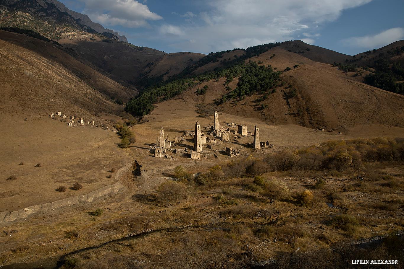
Tower Complex “Targim” in Ingushetia
No comments · Posted by Sergei Rzhevsky in Regions, Travel
Targim is an old abandoned settlement located in the southern part of the Republic of Ingushetia at an altitude of 1,080 meters above sea level.
On its territory there is an architectural complex “Targim” with a number of historical objects: tower-type dwellings, 4 battle towers up to 30 meters high, 4 semi-battle towers, and 16 dilapidated residential towers, as well as 19 crypt burial grounds, 2 mausoleums, and 5 sanctuaries. The tower complex “Targim” on Google Maps. Photos by: Alexandr Lipilin.

Tags: Ingushetia Republic
6
Amazing landscapes of mountainous Ingushetia
2 Comments · Posted by Sergei Rzhevsky in Nature, Regions, Travel
The Republic of Ingushetia is located on the northern slopes of the foothills of the Greater Caucasus Range (in its central part) and on the adjoining small ranges of Tersky, Sunzhensky and Skalisty.
The length of this region from north to south is 144 km, from west to east – 72 km. In the northern districts the relief is steppe, in the south – it is mountainous consisting of ridges separated by valleys and gorges. Photos by: Alexandr Lipilin.

Tags: Ingushetia Republic
18
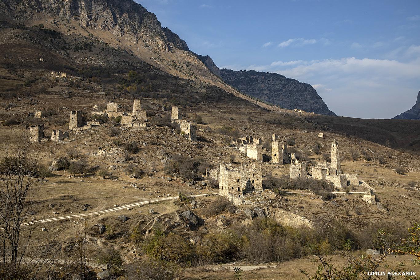
Medieval Tower Complex Egikal in Ingushetia
No comments · Posted by Sergei Rzhevsky in Regions, Travel
In the 11th-12th centuries, Egikal was one of the largest settlements of medieval Ingushetia located on the northern slopes of the foothills of the Greater Caucasus Mountain Range.
Today, on this territory there is a picturesque architectural complex “Egikal”, which includes, in addition to military and watchtowers, residential towers that belonged to old clans, as well as structures of a religious cult. Egikal on Google Maps. Photos by: Alexandr Lipilin.
Tags: Ingushetia Republic
18
The Most Interesting Ancient Towers of Ingushetia
No comments · Posted by Alex Smirnov in Architecture, Regions, Video
The Republic of Ingushetia is located on the northern slopes of the foothills of the Caucasus Mountains. This region is also sometimes called “the land of towers.”
The towers of Ingushetia are unique in its architecture and occupy an important place in the history of the Caucasus. Also they are remarkably scenic as you can see in this video.
Tags: Ingushetia Republic
2
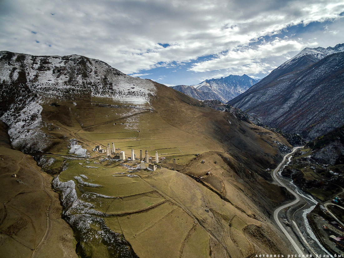
Tower Complex Erzi – the view from above
No comments · Posted by Sergei Rzhevsky in Architecture, Culture, Travel
Erzi translated from the Ingush means “eagle.” “In bad weather, when the entire lower part of the Armkhi valley is covered by clouds, the towers of Erzi resemble an eagle nest” writes in his book “In the country of towers and legends” the historian and ethnographer Batyr Malsagov.
The medieval tower complex Erzi, one of the largest tower complexes in Ingushetia, is located in the south of the republic, in Dzheyrakhsky district, opposite the village of Olgeti. Photos by: Vadim Razumov.
Tags: Ingushetia Republic
28
Stunning nature of the Caucasus – climbing Stolovaya Mountain
No comments · Posted by Sergei Rzhevsky in Nature, Regions, Travel
Stolovaya is a flat mountain (3,003 meters) located on the border of the Republic of Ingushetia and the Republic of North Ossetia in the North Caucasus. In Russian the word “stol” means “table”.
This mountain, depicted on the state emblem of Ingushetia, is visible from Magas, the capital of Ingushetia, and Vladikavkaz, the capital of North Ossetia (also depicted on the emblem of Vladikavkaz). Stolovaya Mountain on Google Maps. Photos by: Timur Agirov.
climb to the top of Stolovaya Mountain
Tags: Ingushetia Republic · North Ossetia Republic
30
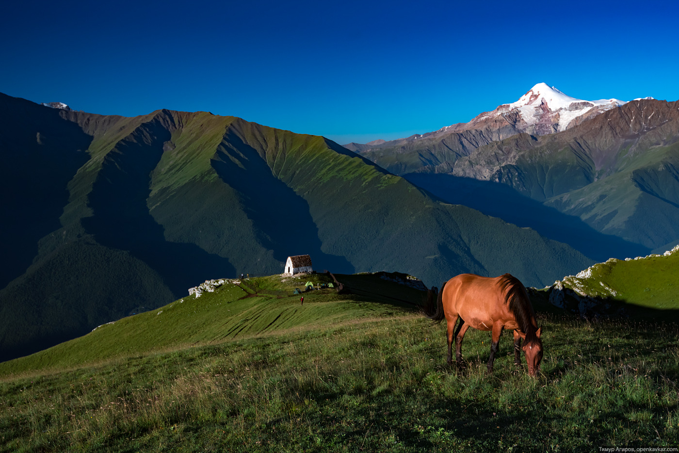
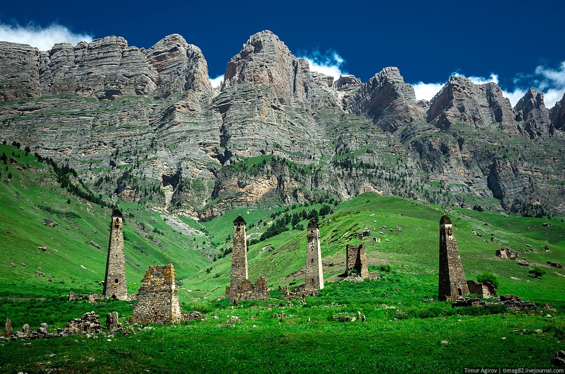
Majestic landscapes of the mountain Ingushetia
No comments · Posted by Sergei Rzhevsky in Nature, Regions, Travel
An exciting walk to the far corners of the mountainous Ingushetia. You can see the unique symbiosis of majestic nature and ancient watchtowers.
Unfortunately, the North Caucasus region remains unsafe because of high level of terrorist activity, that’s why tourist trips there are very risky. Luckily, there are still people who can visit these beautiful places and take some pictures. Photos by Timur Agirov
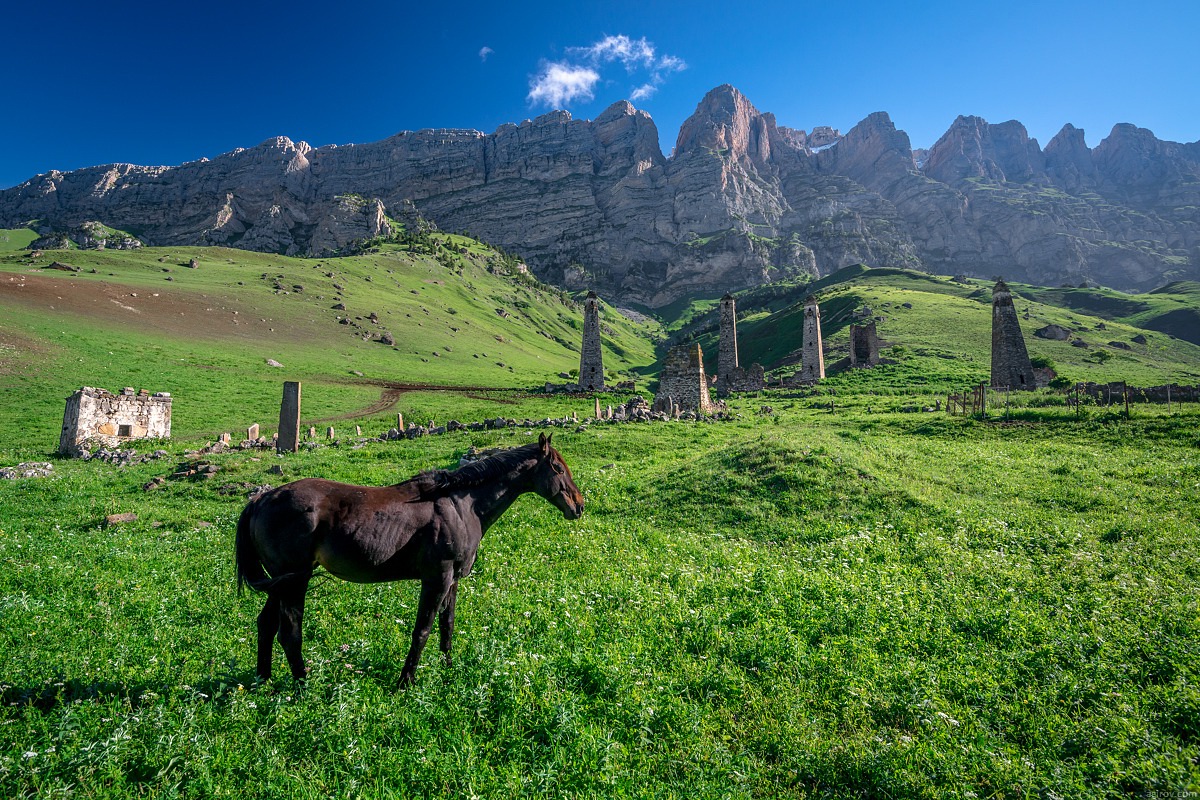
Tags: Ingushetia Republic · landscapes
17
The beautiful scenery of the mountain Ingushetia
3 Comments · Posted by Sergei Rzhevsky in Nature, Regions, Travel
Ingushetia is located on the northern slopes of the foothills of the Caucasus Mountains. The length of the republic territory from north to south is 144 km, from west to east – 72 km.
Northern part of the republic has steppe relief, in the south – the terrain is mountainous, consisting of ridges separated by valleys and gorges. The highest point is Mount Shan (4500 meters).
Tags: Ingushetia Republic · landscapes
14
Beautiful views of the mountainous Ingushetia
1 Comment · Posted by Sergei Rzhevsky in Nature, Photos, Regions
Ingushetia Republic is located in the northern part of Big Caucasus range, part of North Caucasus Federal District. The length of the region from north to south is 144 km, from west to east – 72 km.
The northern part of the region has steppe terrain, the southern – the mountainous terrain, which consists of ridges separated by valleys and gorges (the Caucasus Mountains). The highest point of the region is Mount Shan (4500 meters). Ingushetia is known for its tower buildings – historical and architectural monuments. Photos by timag82

Tags: Ingushetia Republic