
10
Yoshkar-Ola – the view from above
No comments · Posted by Sergei Rzhevsky in Cities, Photos, Travel
Yoshkar-Ola is a city in Russia with a population of about 265 thousand people, the capital of the Republic of Mari El. The city’s name translated from the Mari language means “red city”.
It was founded as a military fortification in the center of the Volga-Vyatka region in 1584. Until 1919, the town was called Tsarevokokshaisk, in 1919-1927 – Krasnokokshaisk. Photos by: Slava Stepanov.

fly over the center of Yoshkar-Ola
Tags: Mari El Republic · Yoshkar-Ola city
6
Church of St. John Chrysostom in Saunino
No comments · Posted by Sergei Rzhevsky in Architecture, Regions, Travel
Kiprovo (formerly Saunino) is a small village with a population of about 200 people located in the Kargopol district of the Arkhangelsk region, 5 km from the town of Kargopol.
The village is known for its beautiful wooden church of St. John Chrysostom (1665) with a bell tower. The pictures of this architectural ensemble show how diverse wooden architecture can be depending on the view angle. Church of St. John Chrysostom in Saunino on Google Maps. Photos by: Alexandr Lipilin.
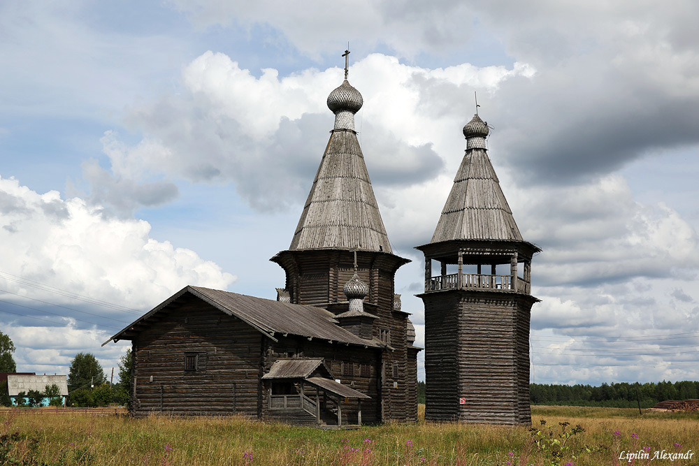
wooden beauty of the Russian North
Tags: Arkhangelsk oblast · churches
2
Hiking in the Ergaki Nature Park
No comments · Posted by Sergei Rzhevsky in Nature, Regions, Travel
The Ergaki Nature Park is located in Ermakovsky and Karatuzsky districts in the south of Krasnoyarsk krai. It is a real natural “pearl” of the region.
This amazingly beautiful place is a mountain range with a variety of bizarre peaks, lakes and waterfalls.
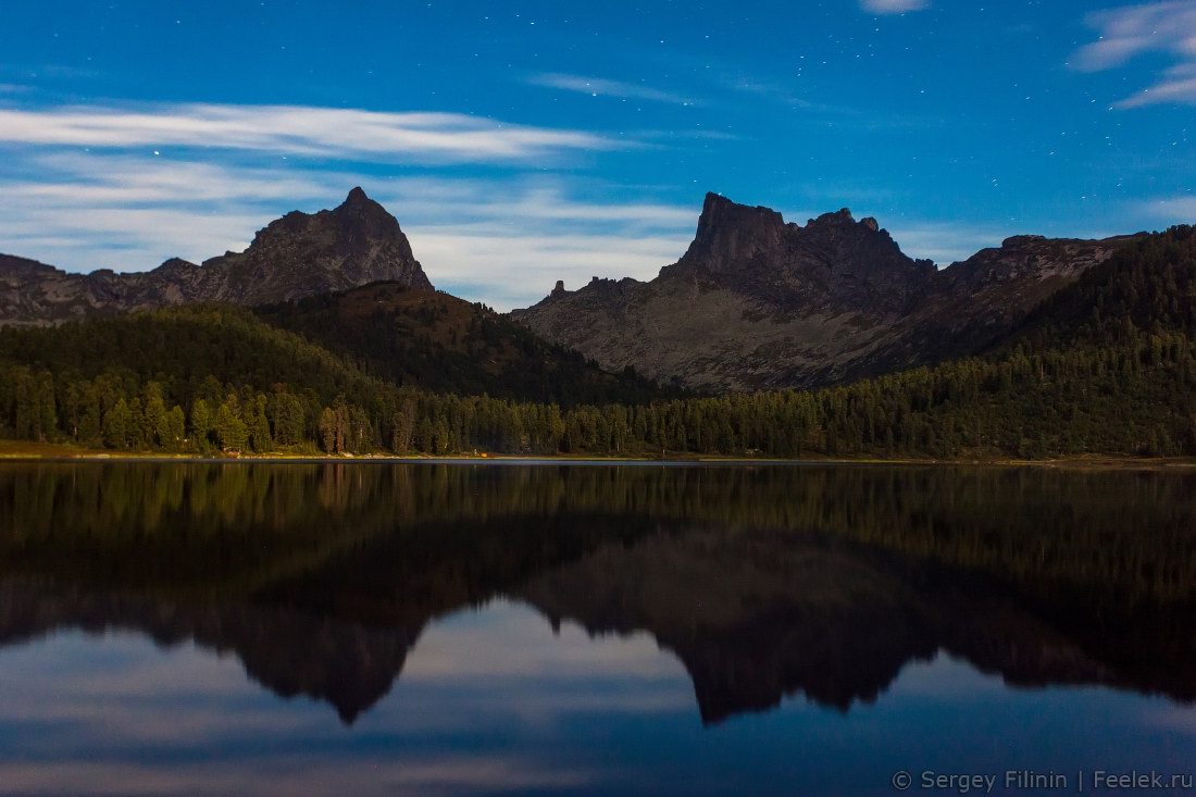
Tags: Krasnoyarsk krai
29
Krasnodar – the view from above
No comments · Posted by Sergei Rzhevsky in Cities, Photos, Travel
Krasnodar is a city with a population of more than 800 thousand people located in the south of Russia, on the banks of the Kuban River, about 120-150 kilometers from the Black and Azov Seas.
This city, the administrative center of the Krasnodar region, is often called the capital of southern Russia. Krasnodar is located on the so-called “golden line” – the 45th parallel, between the North Pole and the equator. The climate in the area is considered to be the most suitable for life. Photos by: Slava Stepanov.
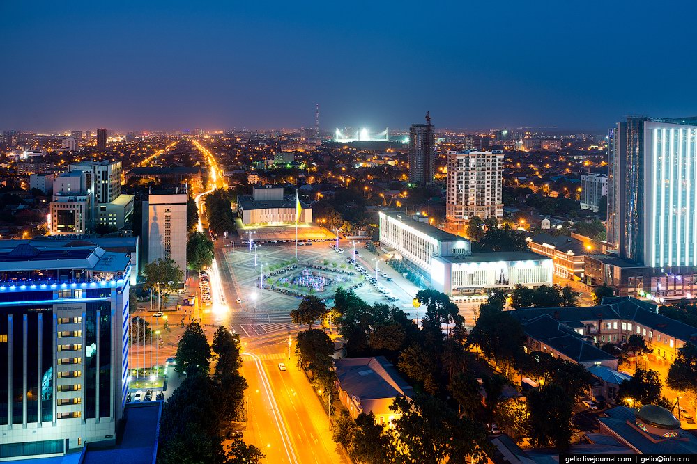
Tags: Krasnodar city
25
Beautiful Vvedenskiy Tolga Convent in Yaroslavl
No comments · Posted by Sergei Rzhevsky in Religion, Travel
Vvedenskiy Tolga Convent is located on the outskirts of Yaroslavl, on the left bank of the Volga River. You can easily get here by water-bus from the city center.
Founded as a monastery in 1314, it was named after the Tolga River flowing nearby. In 1987, after nearly sixty years of closure, it was reopened as a convent. Tolga Convent on Google Maps. Photos by: Vasiliy Nikitinskiy.
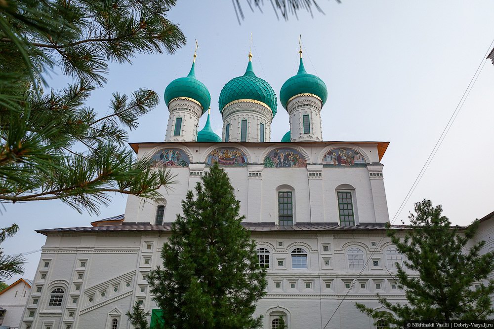
Tags: churches · Yaroslavl city
22
Ruskeala marble quarry – a tourist complex in Karelia
No comments · Posted by Sergei Rzhevsky in Nature, Regions, Travel
The mountain park “Ruskeala” is a unique man-caused and natural landscape and tourist attraction, tourist complex located in Sortavala district of the Republic of Karelia, near the village of Ruskeala, 30 km north of the city of Sortavala, on the banks of the Tohmajoki River.
The basis of the complex is a former marble quarry filled with groundwater – the object of cultural heritage, the monument of history. The length of the quarry from north to south is 460 meters, the width – up to 100 meters.
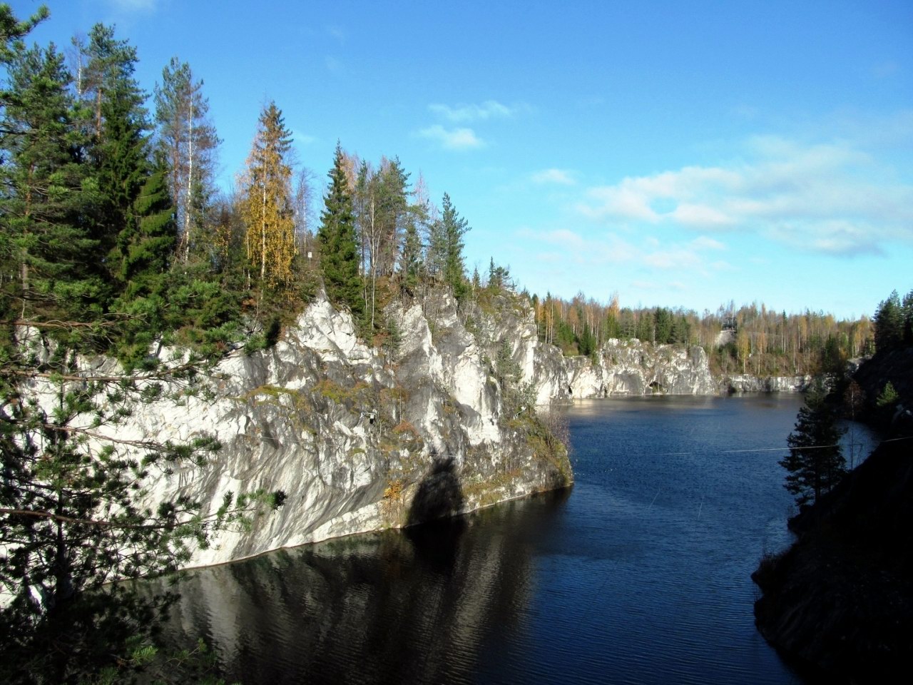
Tags: Karelia Republic
18
Church of the Transfiguration in Posad (Turchasovo)
No comments · Posted by Sergei Rzhevsky in Architecture, Photos, Regions
This beautiful wooden church, Church of the Transfiguration, was built in 1786. It is located in a small village of Posad (the central part of the village of Turchasovo) in the Onega district of the Arkhangelsk region.
To get to this village with a population of only about 100 people, you can either go by boat or over the ice in winter. Transfiguration Church in Posad on Google Maps. Photos by: Alexandr Lipilin.

Tags: Arkhangelsk oblast · churches
15
Tsakhur – the place of the first madrasa in the Caucasus
No comments · Posted by Sergei Rzhevsky in Photos, Regions, Travel
Tsakhur is a small village with a population of about 500 people located in a picturesque place in the south of Dagestan, in the Rutulsky district, a few kilometers from the border with Azerbaijan.
The village is situated in the valley of the Samur River, Dagestan’s second largest river. From the 7th to the 16th centuries, it was the capital of the Tsakhur Khanate that avoided the Mongol conquest. Tsakhur on Google Maps. Photos by: Petr Ushanov.
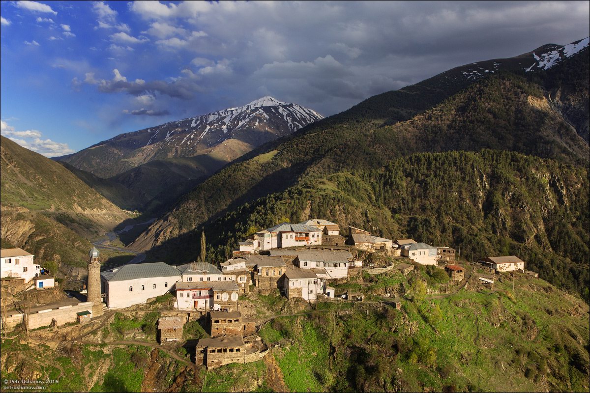
Tags: Dagestan Republic
12
Transfiguration Church in Krasnoye village
No comments · Posted by Sergei Rzhevsky in Architecture, Photos, Regions
Krasnoye (meaning “red”) is a village with a population of about 400 people located in Staritsa district of the Tver region, 20 kilometers north-west of the town of Staritsa.
In the second half of the 18th century, M.F. Poltoratsky, the owner of the manor in Krasnoye, decided to replace the old wooden church and built a new one.
Tags: churches · Tver oblast
Kenozersky National Park is a natural and historical-cultural complex located in the south-western part of the Arkhangelsk region, at the junction of the Plesetsk and Kargopol districts.
In 2004, the park received the status of a biosphere reserve and was included in the UNESCO list of biosphere reserves.
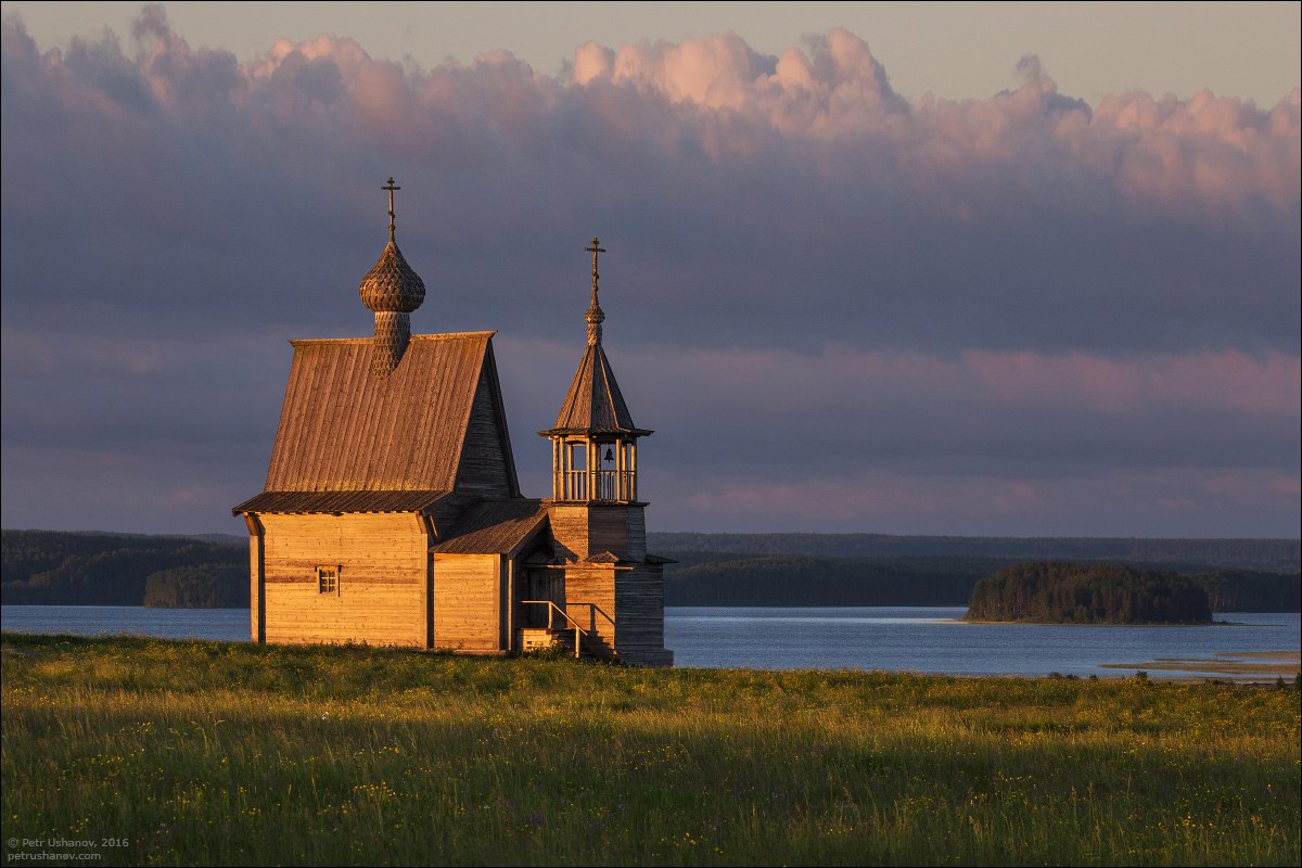
preserved corner of ancient Russia
Tags: Arkhangelsk oblast