
CAT | Travel
22
Ruskeala marble quarry – a tourist complex in Karelia
No comments · Posted by Sergei Rzhevsky in Nature, Regions, Travel
The mountain park “Ruskeala” is a unique man-caused and natural landscape and tourist attraction, tourist complex located in Sortavala district of the Republic of Karelia, near the village of Ruskeala, 30 km north of the city of Sortavala, on the banks of the Tohmajoki River.
The basis of the complex is a former marble quarry filled with groundwater – the object of cultural heritage, the monument of history. The length of the quarry from north to south is 460 meters, the width – up to 100 meters.
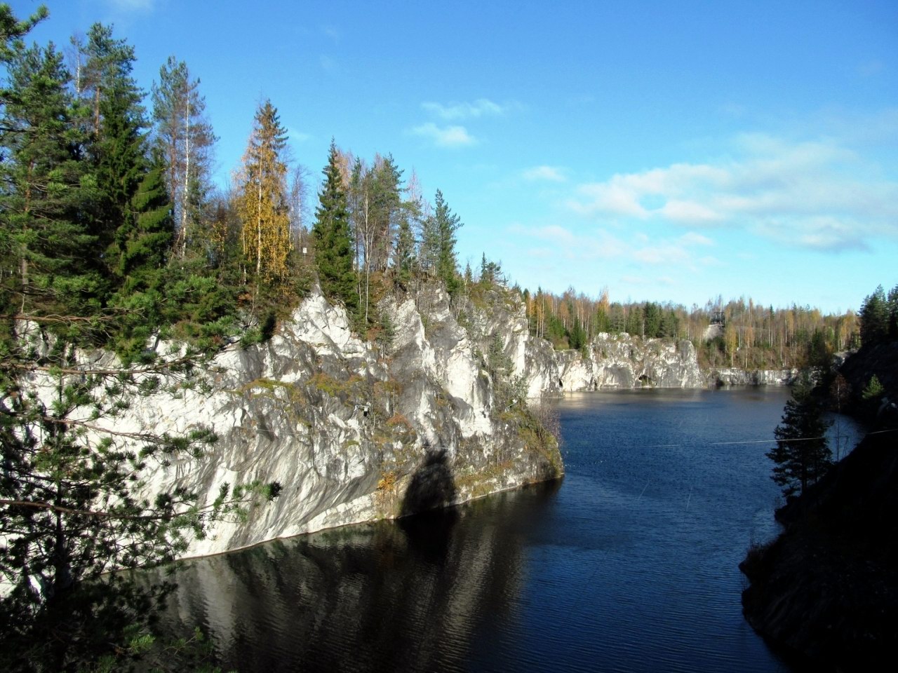

Tags: Karelia Republic
15
Tsakhur – the place of the first madrasa in the Caucasus
No comments · Posted by Sergei Rzhevsky in Photos, Regions, Travel
Tsakhur is a small village with a population of about 500 people located in a picturesque place in the south of Dagestan, in the Rutulsky district, a few kilometers from the border with Azerbaijan.
The village is situated in the valley of the Samur River, Dagestan’s second largest river. From the 7th to the 16th centuries, it was the capital of the Tsakhur Khanate that avoided the Mongol conquest. Tsakhur on Google Maps. Photos by: Petr Ushanov.
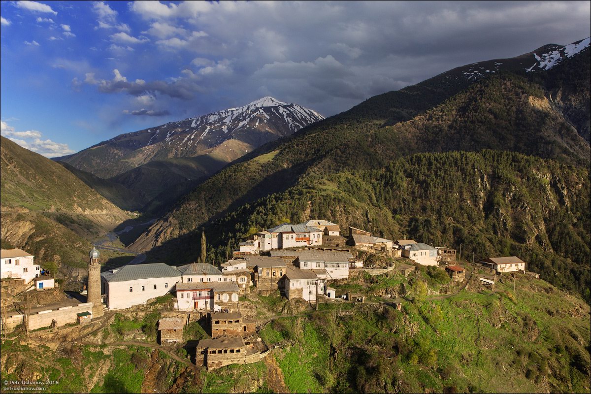
Tags: Dagestan Republic
Kenozersky National Park is a natural and historical-cultural complex located in the south-western part of the Arkhangelsk region, at the junction of the Plesetsk and Kargopol districts.
In 2004, the park received the status of a biosphere reserve and was included in the UNESCO list of biosphere reserves.
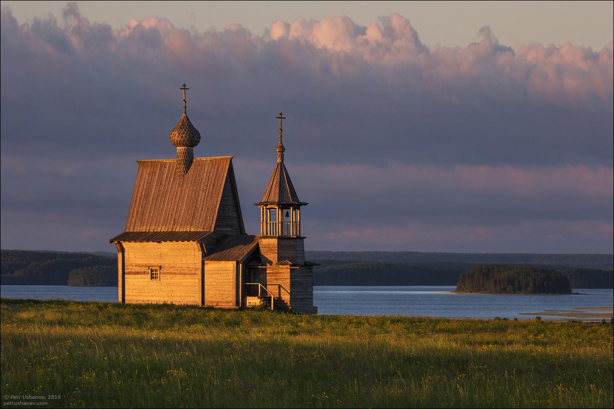
preserved corner of ancient Russia
Tags: Arkhangelsk oblast
2
Volgograd – the view from above
1 Comment · Posted by Sergei Rzhevsky in Cities, Photos, Travel
Volgograd is a city with a population of over 1 million people located in the southeast of the European part of Russia. Volgograd has the title of Hero City because the Battle of Stalingrad took place here during the Second World War.
The city’s uniqueness is in its length. Volgograd stretches along the banks of the Volga for about 120 km. This is one of the longest cities in the world. Photos by: Slava Stepanov.
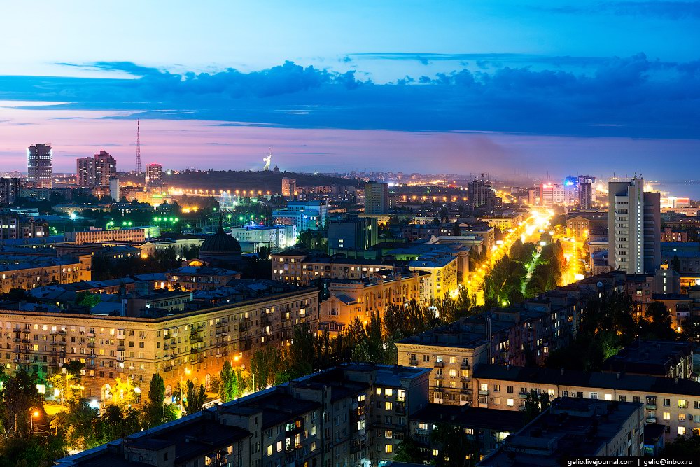
Tags: Volgograd city
28
The State Nature Reserve “Stolby”
No comments · Posted by Sergei Rzhevsky in Nature, Regions, Travel
The state nature reserve “Stolby” (“Pillars”) is located in the north-western spurs of the Eastern Sayan – a mountain range in southern Siberia. From the north-east it is adjacent to the city of Krasnoyarsk, a city bus ( “Turbaza” stop) goes to the border of the reserve.
This is a unique corner of Siberian nature with diverse landscapes, one of the main natural attractions of the Krasnoyarsk region. Photos by: Sergey Filinin.
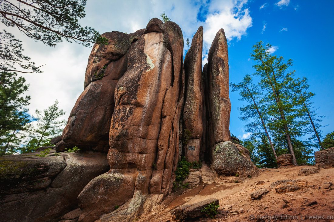
Tags: Krasnoyarsk krai
This little-known cave is located on the ridge Azish-Tau in the north-eastern part of the plateau Lago-Naki in the Republic of Adygeya, near the hotel named after this ridge and the ski lift.
The cave is relatively small, but has an unusually large concentration of speleothems commonly known as cave formations.
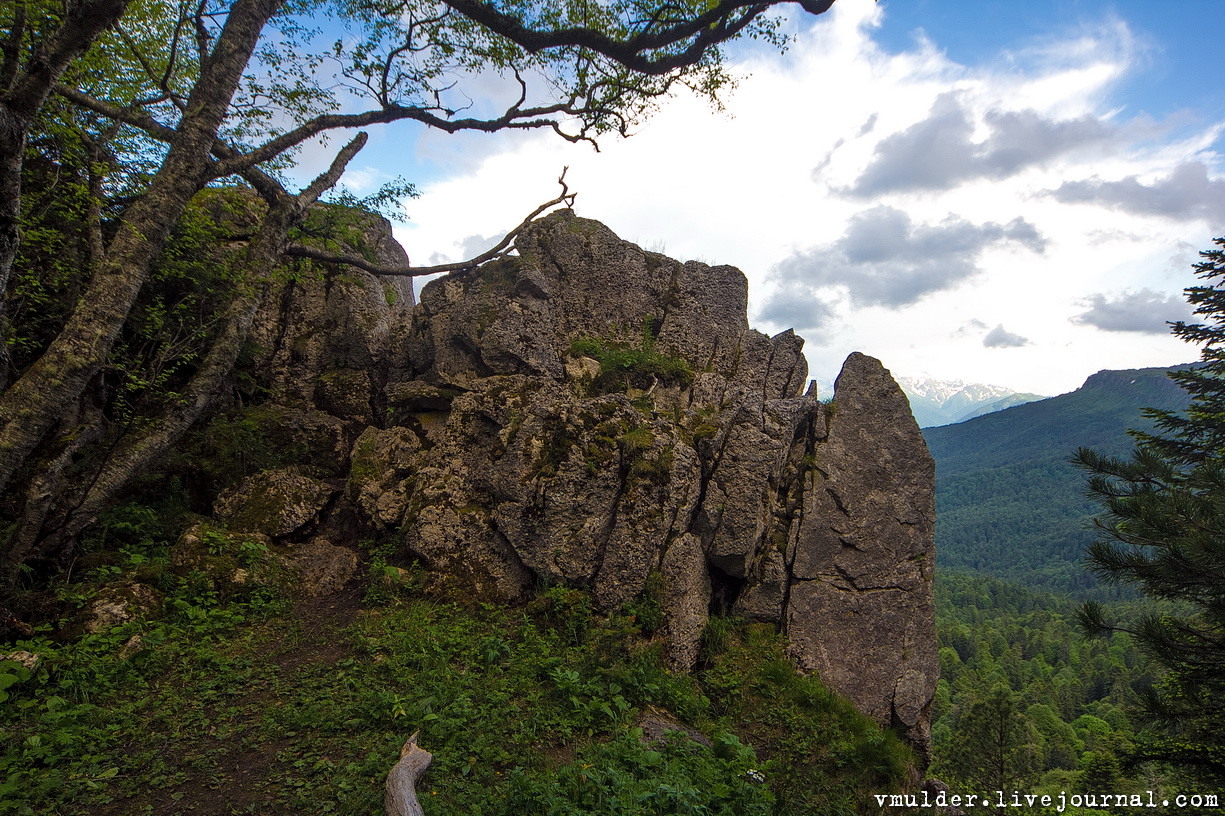
Tags: Adygeya Republic
22
The train ride along the shore of Lake Baikal
1 Comment · Posted by Sergei Rzhevsky in Entertainment, Regions, Travel
If you are going to visit Lake Baikal in the Irkutsk region, you should definitely take part in the following trip – a train ride along the shore of Baikal on the historical part of the Trans-Siberian Railway.
The Circum-Baikal Railway was the most complex and expensive part of the Trans-Siberian Railway of the Russian Empire. Today, it has become a place for a unique guided tour. Photos by: Alexander Belenkiy.
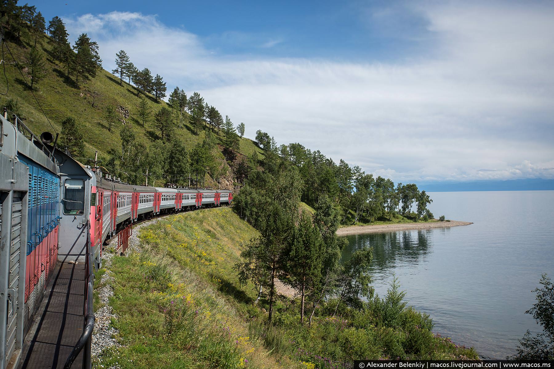
Tags: Irkutsk oblast
18
Anadyr – the view from above
No comments · Posted by Sergei Rzhevsky in Cities, Photos, Travel
Anadyr is a port city in the extreme north-east of Russia, an administrative center of Chukotka autonomous okrug. The city is located in the permafrost zone, on the shore of Anadyr Bay in the Bering Sea.
Multicolored buildings of Anadyr make a strong impression against the background of gray tundra of Chukotka. Photos by: Sergey Dolya.
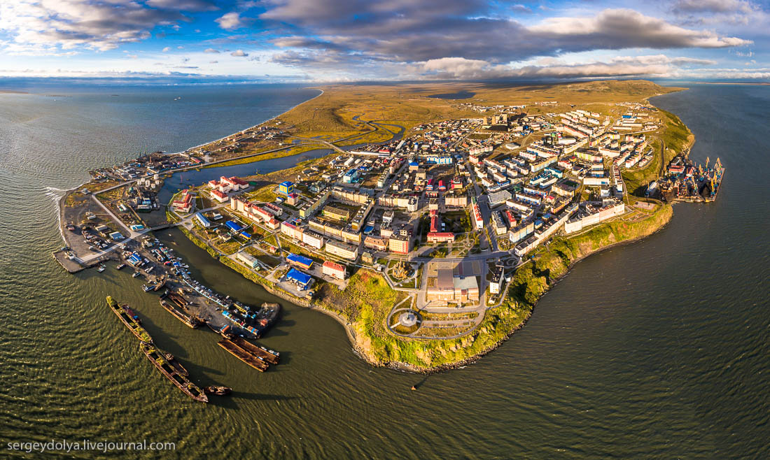
Tags: Anadyr city · Chukotka okrug
14
The white waterfalls of the southern Kamchatka
No comments · Posted by Sergei Rzhevsky in Nature, Regions, Travel
Kamchatka, a peninsula stretching from north to south for 1,200 km, is located in the north-eastern part of Eurasia, in Russia. This is one of the most beautiful regions in the country known mainly for its volcanoes.
One of the interesting places can be found at a distance of one-day walk from Pauzhetka village, on the outer slope of Koshelev volcano. The water in the local rivers and waterfalls has a distinct white color due to the concentrated alumina. Photos by: lusika33.
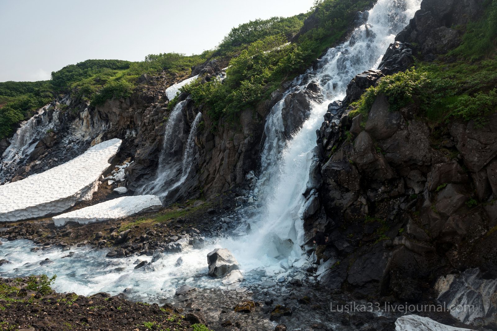
Tags: Kamchatka krai
9
The lava fields and dead forest of Tolbachik
1 Comment · Posted by Sergei Rzhevsky in Nature, Regions, Travel
Tolbachik is a volcanic massif located in the east of Kamchatka. It consists of two major volcanoes – Ostry Tolbachik (extinct) (3,682 m) and Plosky Tolbachik (active) (3,140 m). Around them there are dozens of smaller ridges and cones.
The lava fields of Tolbachik, a huge river of lava emerged only a few years ago, look like landscapes of Mordor. Tolbachik on Google Maps. Photos by: Anton Petrus.
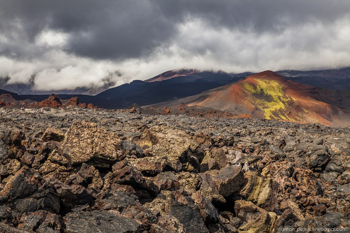
Tags: Kamchatka krai