
CAT | Regions
14
Parus (Sail) Rock – a natural monument near Gelendzhik
No comments · Posted by Sergei Rzhevsky in Nature, Regions, Travel
Parus (Sail) Rock is a natural monument located on the Black Sea coast, 17 km southeast of the resort town of Gelendzhik in the Krasnodar region.
The rock is a sandstone monolith standing vertically on the beach, separated from the main rock mass by a gap. The shape of the rock resembles the shape of a quadrangular sail, hence its name. Parus (Sail) Rock on Google Maps. Photos by: Andrei Kireev.
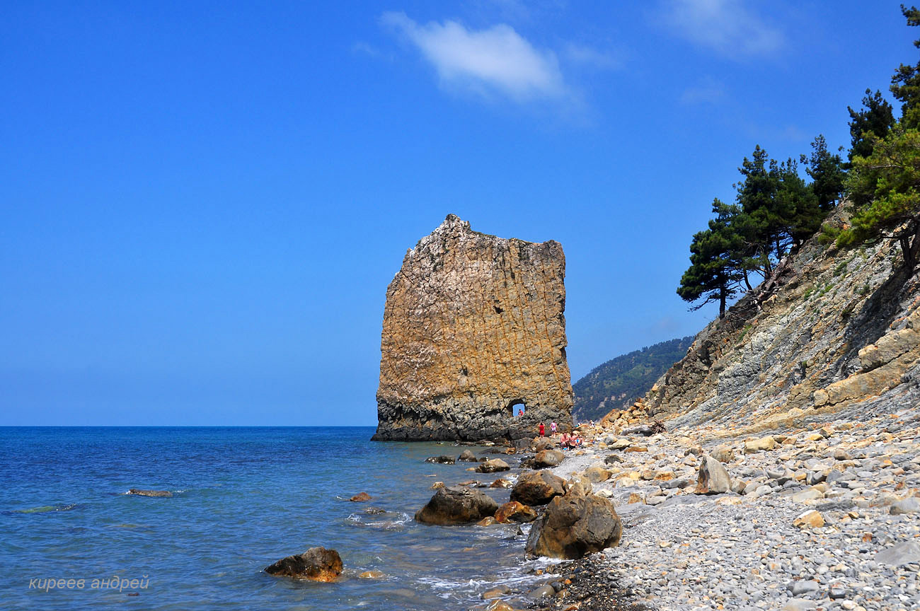
magnificent monument of nature

Tags: Gelendzhik city · Krasnodar krai
10
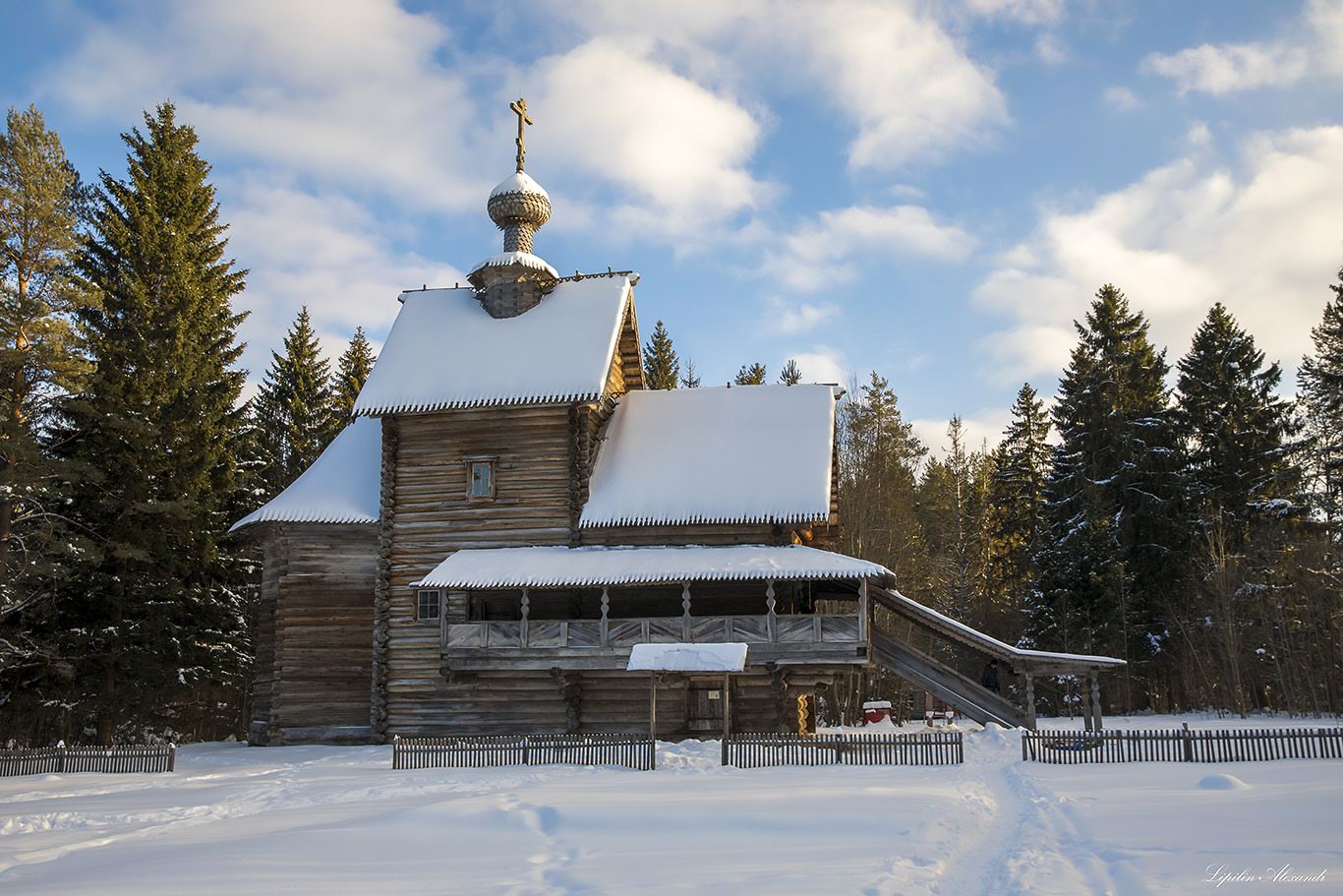
Museum of Wooden Architecture Vasilevo
No comments · Posted by Sergei Rzhevsky in Architecture, Regions, Travel
Vasilevo open-air architectural and ethnographic museum is located in the village of Vasilevo in the Tver region, 76 km north-west of Tver.
The museum was opened on the basis of the former nobleman’s estate in 1976. Masterpieces of wooden architecture from different parts of the Tver region were brought here. Vasilevo Museum on Google Maps. Photos by: Alexander Lipilin.
Ascension Church (1732).
Tags: museum · Tver oblast
25
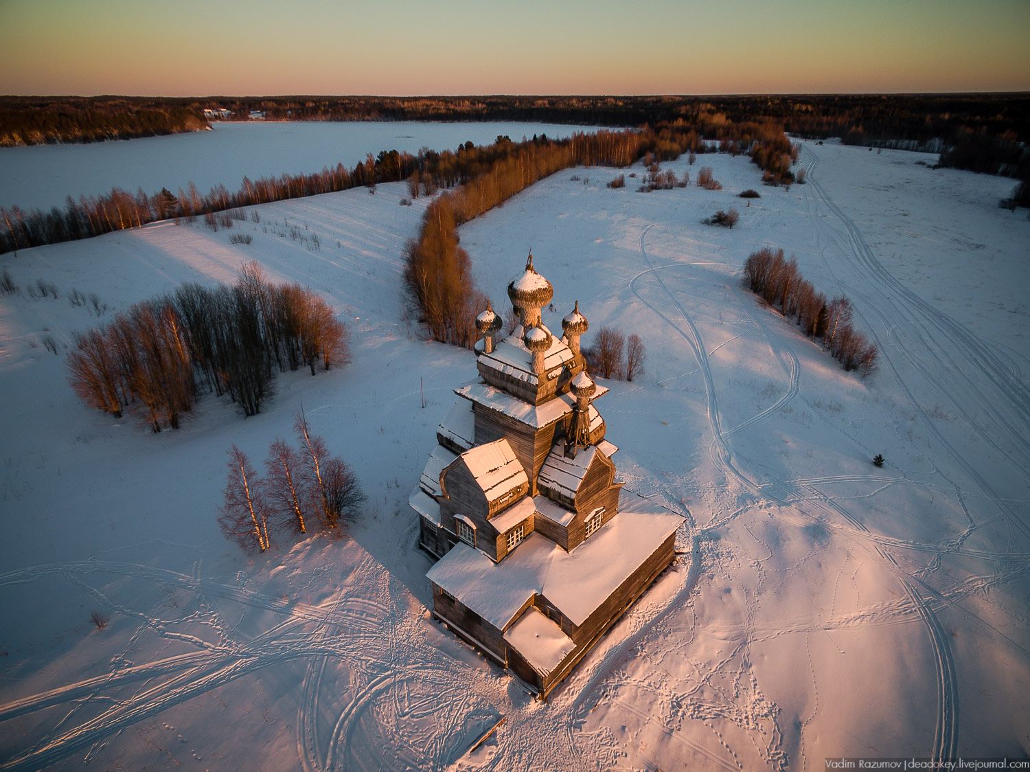
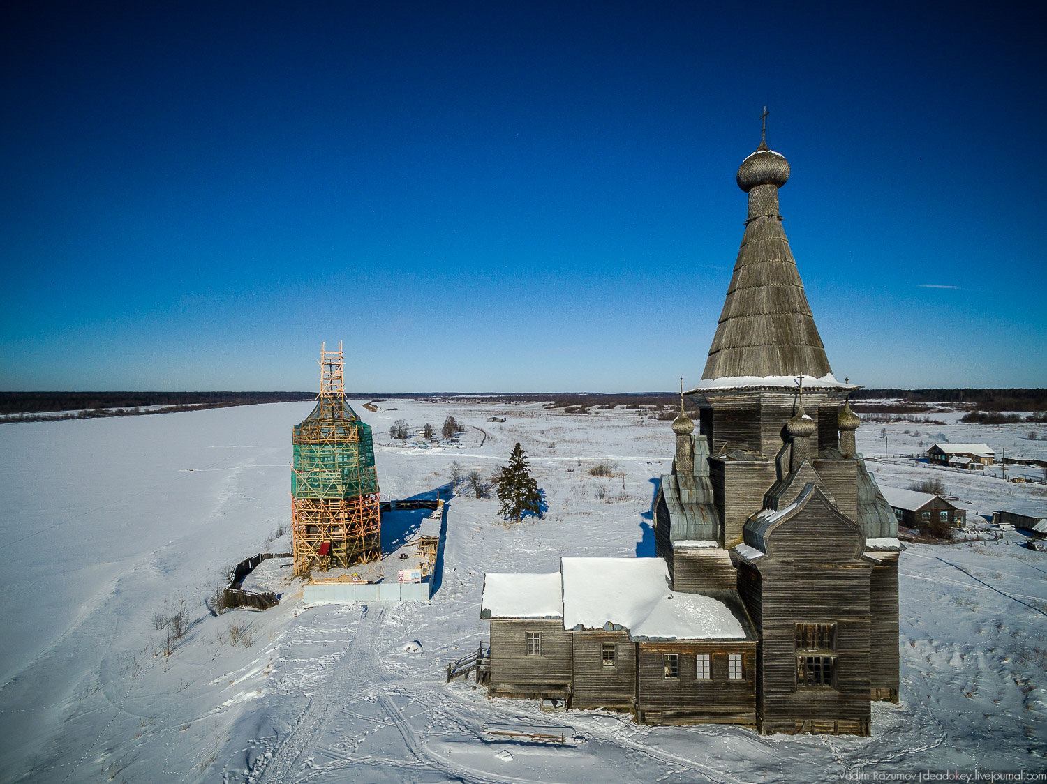
Church of Our Lady of Vladimir in Podporozhye
No comments · Posted by Sergei Rzhevsky in Architecture, Culture, Regions
Podporozhye is an abandoned village located on the bank of the Onega River in the west of the Arkhangelsk region. Some time ago there was a whole church complex in the village. But only the Church of Our Lady of Vladimir, built in 1757, has survived.
This huge and majestic wooden building is one of the landmark monuments in the development of the architecture of the Russian North. Podporozhye on Google Maps. Photos by: Vadim Razumov.
Tags: Arkhangelsk oblast · churches
11
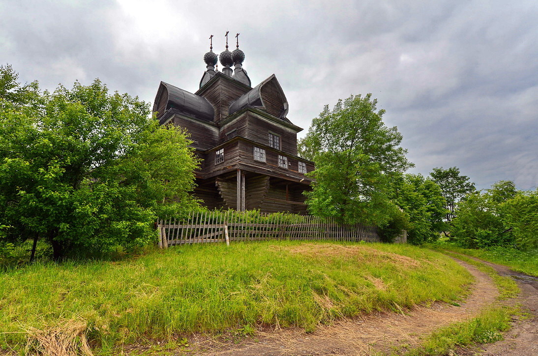
Wooden Church of the Ascension in Piyala
No comments · Posted by Sergei Rzhevsky in Architecture, Culture, Regions
The Russian North is a collective name for the northern regions of the European part of Russia, where a lot of folk traditions have been preserved since the times of Kievan Rus.
In the 16th-17th centuries, a peculiar northern culture developed here with its northern “schools” of painting, bone and wood carving, wooden architecture.
Tags: Arkhangelsk oblast · churches
9
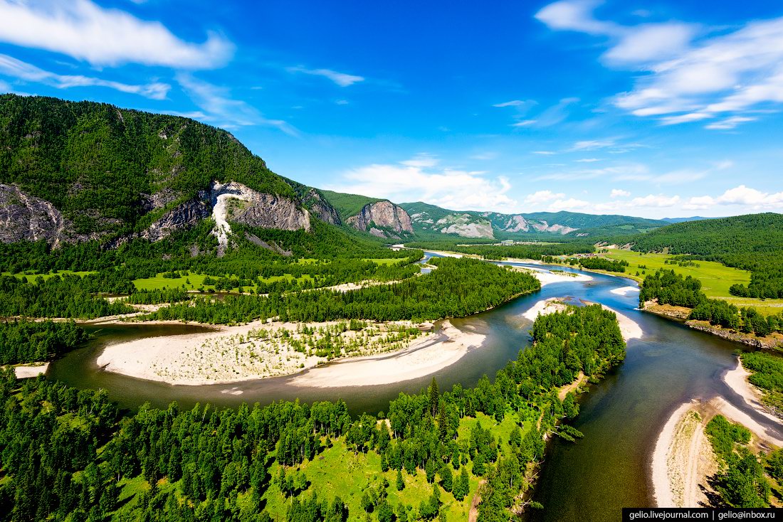
Lake Valdai – the view from above
No comments · Posted by Sergei Rzhevsky in Nature, Regions, Travel
Valdai is a picturesque lake located in the territory of the Valdai National Park in the Novgorod region. The area of the lake is about 20 square kilometers, the average depth is 12 meters (the maximum depth – 60 meters).
On an island in the center of the lake, there is a historical and architectural monument of the 17th-18th centuries – an ensemble of buildings of the Iversky Monastery. On the western shore of the lake the town of Valdai is located. Lake Valdai on Google Maps. Photos by: Konstantin Antipin.

Tags: Novgorod oblast
29
Majestic Church of the Holy Trinity in Novotroitskoye
No comments · Posted by Sergei Rzhevsky in Architecture, Regions, Religion
Novotroitskoye is a small village with a population of about 150 people located in the Dolgorukovskiy district of the Lipetsk region.
The main attraction of the village is the ensemble of the Church of the Holy Life-Giving Trinity built on the means of Major-General Petr Andrianovich Pozdnyakov, the owner of the village, in 1809-1819. Novotroitskoye on Google Maps. Photos by: Vadim Razumov.
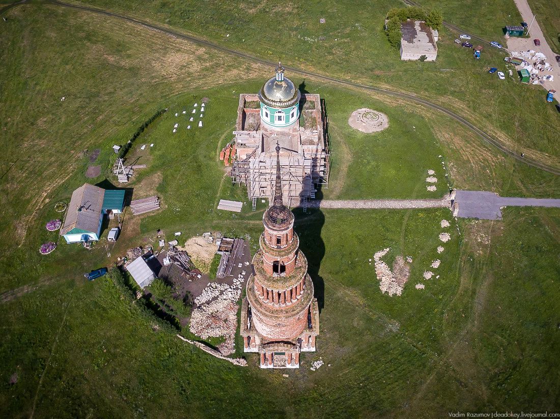
Tags: Abandoned · Lipetsk oblast
16
The Lost World of Tofalaria
2 Comments · Posted by Sergei Rzhevsky in Nature, Regions, Travel
Today, in the world there are only about 800 representatives of the indigenous Siberian nation of the Tofalars. Once nomads, most of them live compactly in three villages in the Nizhneudinsky district of the Irkutsk region.
This very beautiful and isolated mountainous region located in the Eastern Sayan mountain system in the south of Siberia is called Tofalaria. You can get to it only by air. Tofalaria on Google Maps. Photos by: Slava Stepanov.
Tags: Irkutsk oblast
3
Unique Beauty of Geyzernoye Lake in Siberia
1 Comment · Posted by Sergei Rzhevsky in Nature, Regions, Travel
Geyzernoye Lake, also known as Blue Lake, is a unique body of water in Siberia located in the Ulagan district of the Altai Republic, near the village of Aktach.
The main feature of this clean and ice-free lake is thermal springs that bring the blue silt to the bottom forming colorful and bizarre pictures – various concentric circles. Geyzernoye Lake on Google Maps. Photos by: Andrei Kireev.
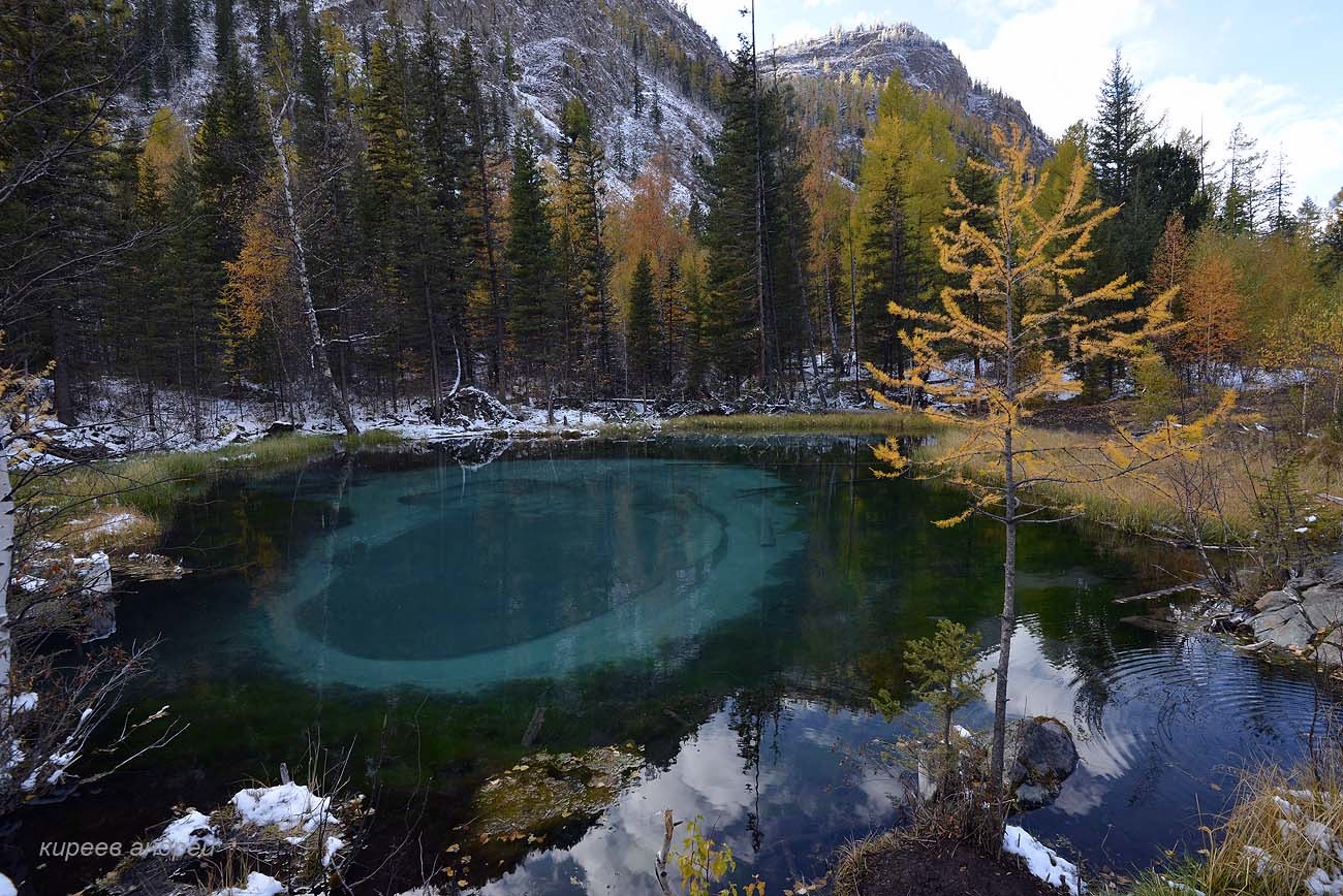
lake with geysers at the bottom
Tags: Altay Republic
12
Northern Urals: Manpupuner Plateau and Dyatlov Pass
No comments · Posted by Sergei Rzhevsky in Nature, Regions, Travel
The Northern Urals is one of the most hard-to-reach areas of the Urals, but it gradually becomes more popular among tourists primarily thanks to two main attractions: the rock formations on the Manpupuner Plateau and the Dyatlov Pass.
Both of these places are covered with legends. Although one of them was created by nature, and the second – by human tragedy that is still an unsolved mystery. Photos by: Slava Stepanov.

Tags: Komi Republic · Perm krai · Sverdlovsk oblast
7
Church of the Assumption of Our Lady in Nelazskoye
No comments · Posted by Sergei Rzhevsky in Architecture, Regions, Travel
Nelazskoye is a small village with a population of about 200 people located in the Cherepovets district of the Vologda region, about 30 km north-west of Cherepovets.
The main attraction of the village is the Church of the Assumption of Our Lady – a wooden church of unique shape built in 1694. Nelazskoye on Google Maps. Photos by: Denis Spirin.
beautiful monument of wooden architecture
Tags: Cherepovets city · churches · Vologda oblast